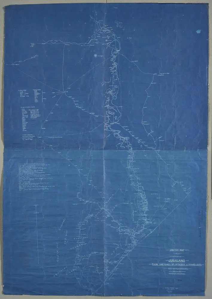
'Sketch Map of a Portion of Jubaland from Sketches of Officers and Travellers'.'(sd:) R.E. Salkeld Capt. 3rd. King's Africa Rifles Kismayu 5.12.02'
Identifier
WOMAT_AFR_BEA_91
Collection
womat
Description
Shows a region in East Africa, indicating roads, settlements, some relief with form lines, tribal regions, vegetation and hydrology, with descriptions of topography. Also provides a list of locations and descriptions of water availablility, and a list of stages and journey times to points west.
Publication date
1903
Creator
Salkeld, Robert Edward, 1867-1927, army officer, Author.