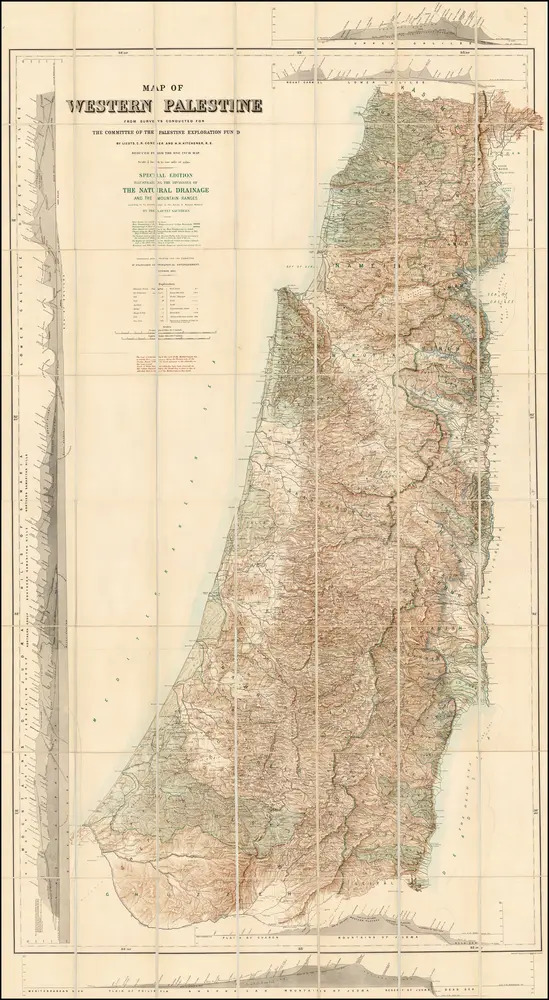
Map of Western Palestine from surveys conducted for The Committee of the Palestine Exploration Fund. By Lieuts. C. R. Conder and H. H. Kitchener, R. E. Reduced from the one inch map in twenty six sheets. Special Edition Illustrating The Divisions of The Natural Drainage And the Mountain Ranges...
ℹ You will be redirected to OldMapsOnline.org to finish the export.