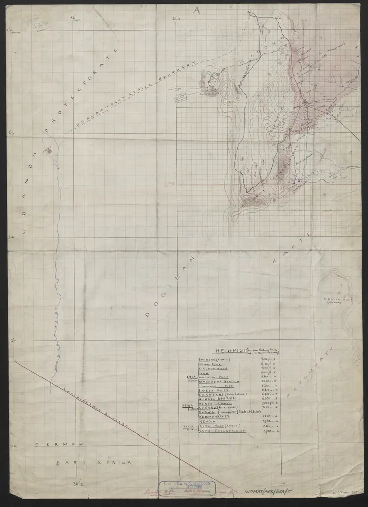
East Africa Protectorate. Map of part of the Ukamba Province North of 2°.30' Latitude South shewing the Districts of (part of) Kenia, Ulu and part of Kitui.'By 'John. Ainsworth. H.M.s. Sub-Commissioner&Vice-Consul. F.R.G.S.'
ℹ You will be redirected to OldMapsOnline.org to finish the export.