ℹ You will be redirected to OldMapsOnline.org to finish the export.
Sign in to access WMTS endpoints.
Sign in to download GeoTIFF.
Sign in to export as IIIF.
Compare
Website
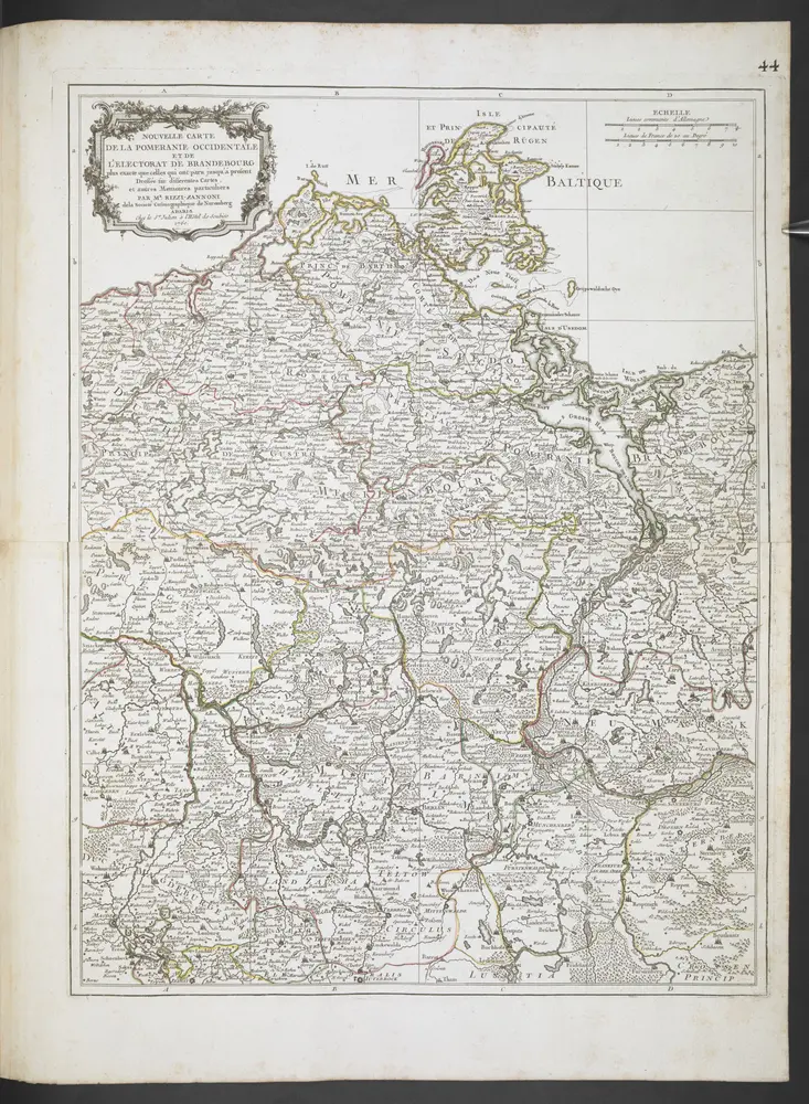
ATLAS TOPOGRAPHIQUE ET MILITAIRE, Qui comprend Les Etats de la Couronne de Boheme & La Saxe Electorale avec leur Frontiers. /
mapsu1utabu38u44
ktop2
1 map on 52 pages
1758
Julien, R. J.
che ́s l'Auteur a l'ho^tel de Soubise