Gecatalogiseerde kaart
Plan du chasteau d'Algoire


Volledige titel:Plan du chasteau d'Algoire
Jaar illustratie:1665 - 1680
Uitgever:s.n.
Plan of the country and camps of Almanar, the one under Charles III and the other of the Enemy under the D. of Anjou (July 27, 1710) / for Mr. Tindal's continuation of Mr. Rapin's History of England ; I. Basire sculp.
1740
Tindal ; Rapin ; Basire, J.
Carte du gouuernement d'Algoire
1680
s.n.
Carte du gouuernement de Balaguier
1680
s.n.
Carte du gouuernement de Lerida
1680
s.n.
Carte du gouuernement d'Ager en Catalogne
1680
s.n.
Episcopatus Balbastrensis et comitatus Ribagorcæ
1690
Valck; Schenk
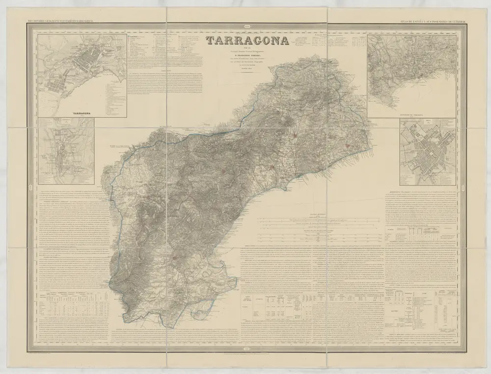
Tarragona
1858
Coello, Francisco
1:200k
n/a
1791
n/a
1791
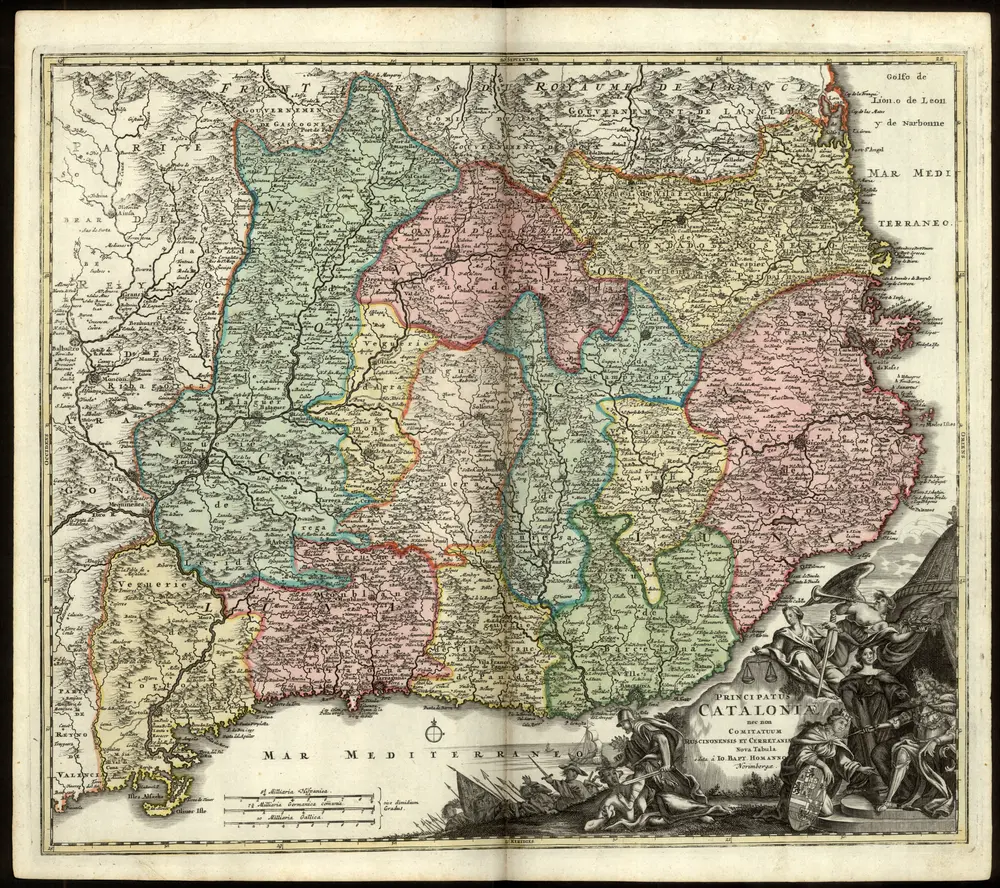
Neuer Atlas Uber die Gantze Welt, mapa ze strany: [93]
1714
Homann Johann Baptist