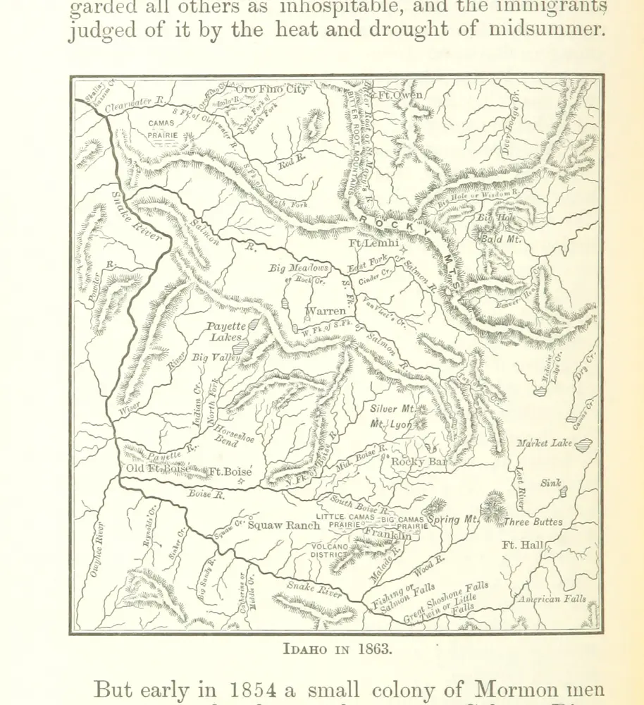
1882
Bancroft, Hubert Howe.
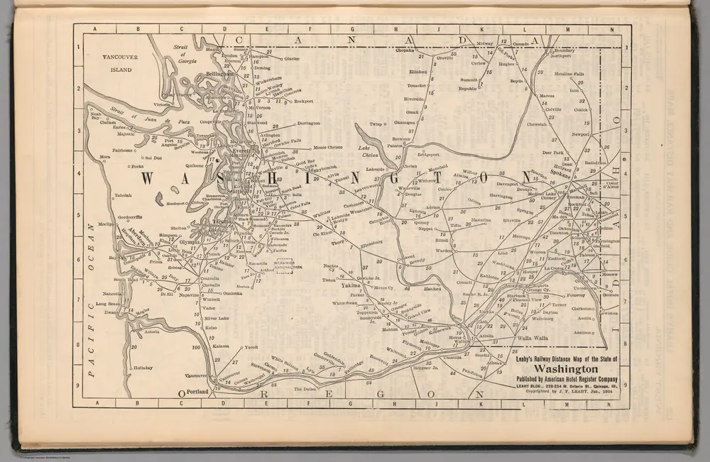
1934
Leahy, J.F.
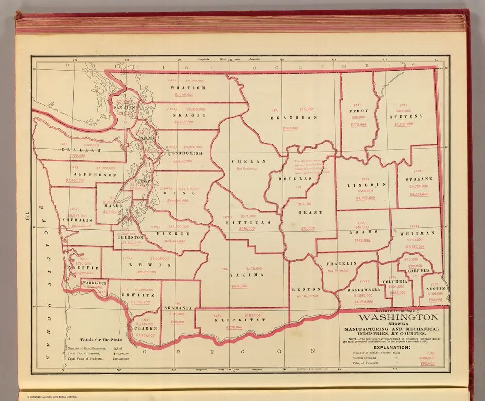
1909
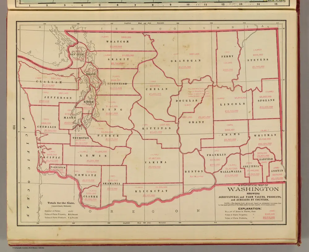
Cram, George Franklin; Davis, Ellis Arthur
1:2m
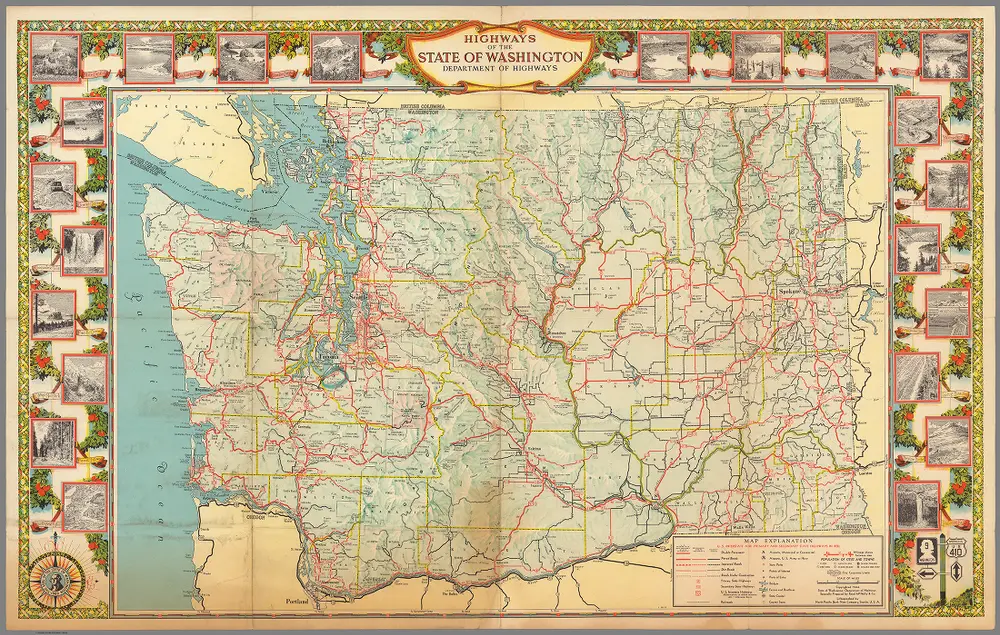
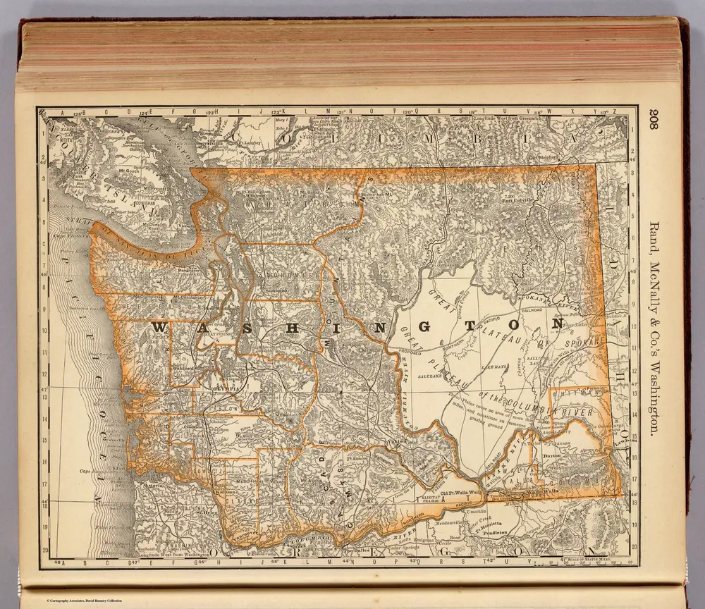
1944
Rand McNally & Co.
1:895k
Cram, George Franklin
1924
Rand McNally and Company
1:950k
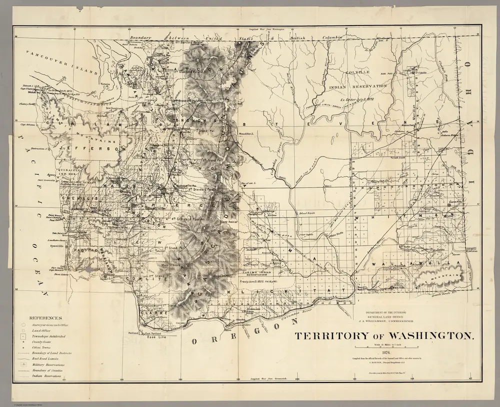
1876
U.S. General Land Office
1:760k
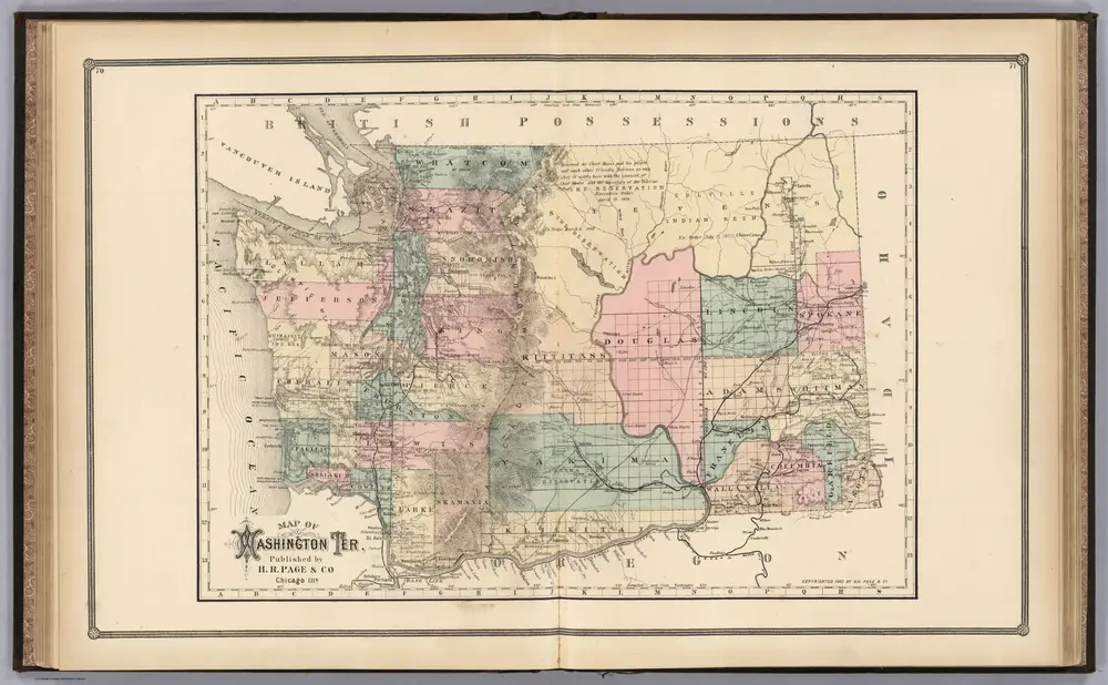
1885
Page, H.R. & Co.
1:1m
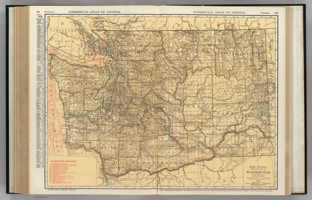
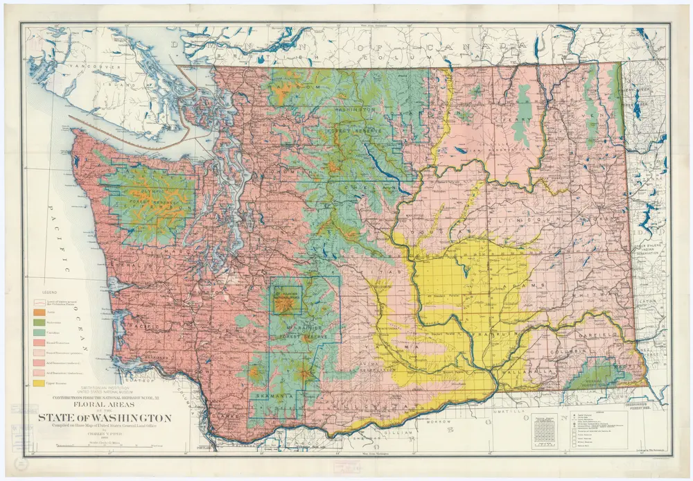
1906
Piper, Charles V.
1:890k
1879