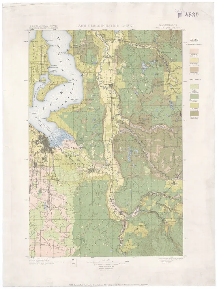
Washington
1900
U.S. Geological Survey
1:125k
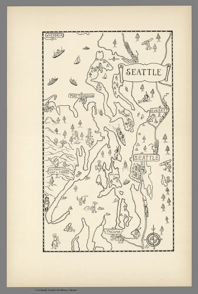
Seattle.
1934
Mora, Jo (1876-1947)
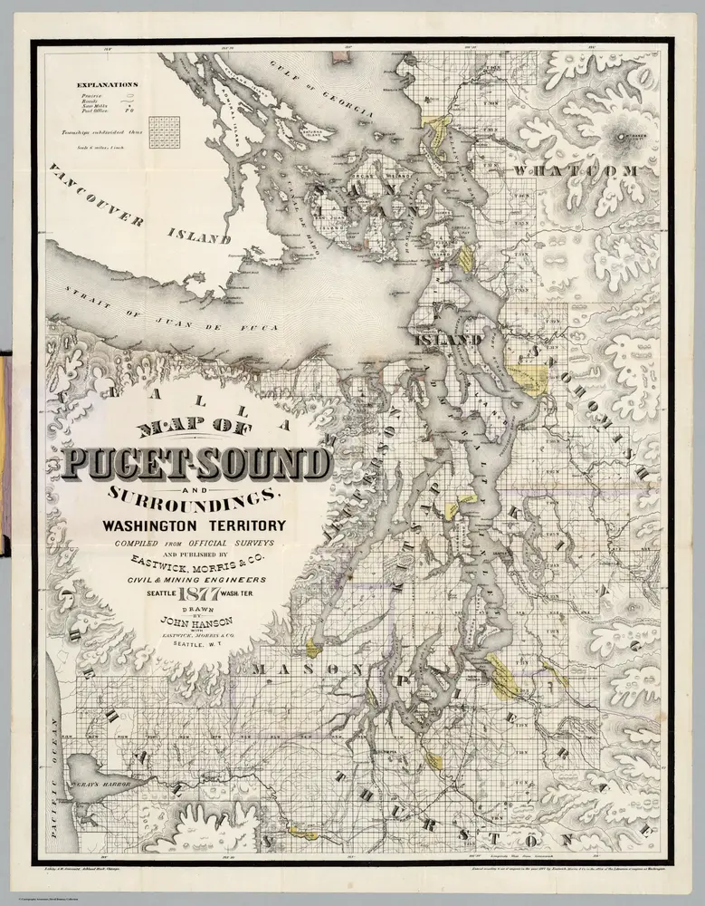
Map Of Puget Sound And Surroundings, Washington Territory.
1877
Hanson, John
1:380k
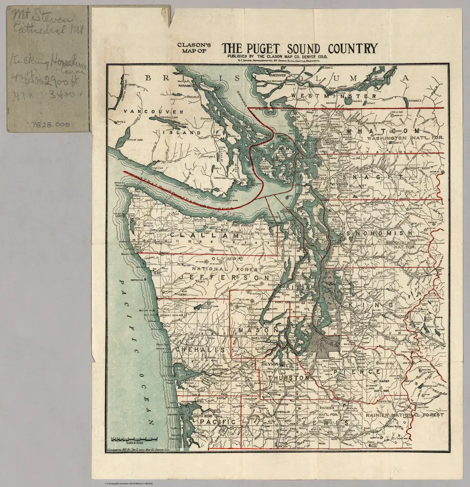
Clason's Map of The Puget Sound Country.
1910
Clason
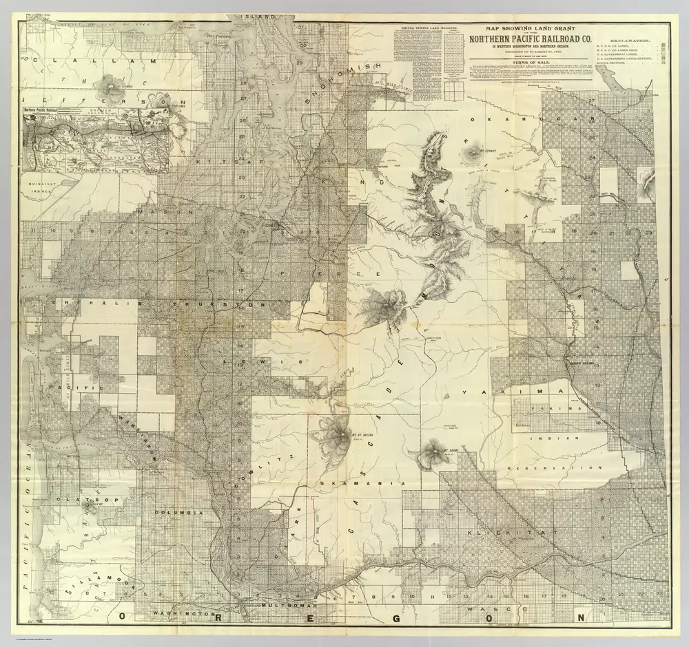
Land grant W. Wash. & N. Oregon.
1888
Northern Pacific Railroad Company
1:380k
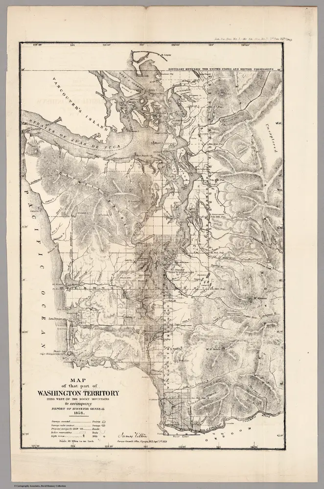
Washington Territory Lying West of the Rocky Mountains,1858
1858
U.S. General Land Office
1:1m
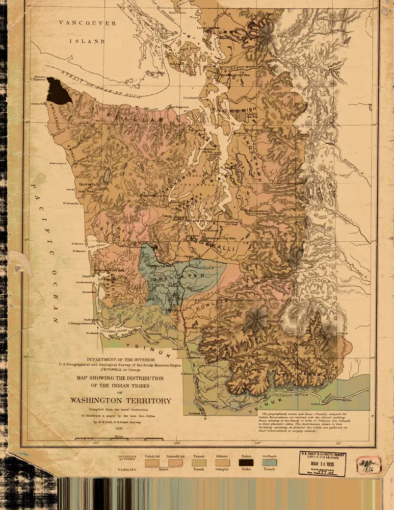
the Distribution of the Indian Tribes of Washington Territory
1876
1:634k
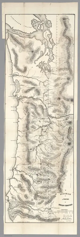
Diagram of a Portion of Oregon Territory, 1852
1852
U.S. General Land Office
1:634k
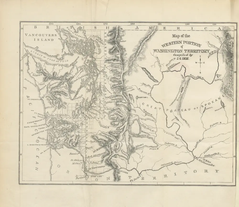
The North-West Coast; or, three years' residence in Washington Territory. ... With ... illustrations
1857
SWAN, James Gilchrist.
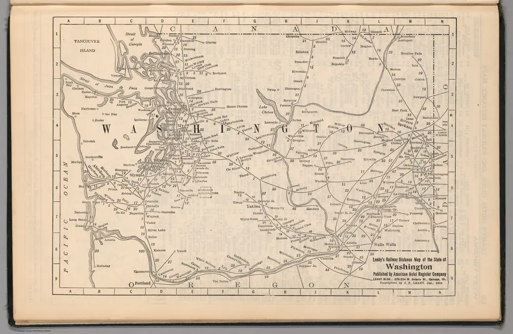
Railway Distance Map of the State of Washington
1934
Leahy, J.F.
ケント (ワシントン州)の古地図
歴史的な地図でケント (ワシントン州)の過去を発見する
ケント (ワシントン州)の古地図
歴史的な地図でケント (ワシントン州)の過去を発見する
を探している Google Maps APIの代替?