Progetto
Comunità
Notizie
La mia app
Le mie mappe
Margate, Kent
1801
Margate (Kent)
1797
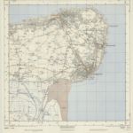
TR36 & Parts of TR37 & TR46 - OS 1:25,000 Provisional Series Map
1948
Ordnance Survey
1:25k
Kent XXV - OS Six-Inch Map
1872
Ordnance Survey
1:11k
Bishopsbourne, Kent
1797
Kent XXXVII - OS Six-Inch Map
1872
Ordnance Survey
1:11k
Kent XXV.SE - OS Six-Inch Map
1948
Ordnance Survey
1:11k
Kent XXV.SE - OS Six-Inch Map
1938
Ordnance Survey
1:11k
Kent XXV.SE - OS Six-Inch Map
1931
Ordnance Survey
1:11k
Kent XXV.SE - OS Six-Inch Map
1931
Ordnance Survey
1:11k
History
Vecchie mappe di Thanet District
Scoprite il passato di Thanet District sulle mappe storiche
Vecchie mappe di Thanet District
Scoprite il passato di Thanet District sulle mappe storiche
Esplorare le mappe
Scoprire la storia
Regione madre
Inghilterra
Luoghi correlati