Mappe di Madelia, Minnesota
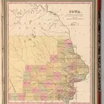 1849|Mitchell, Samuel Augustus1:1 400 000
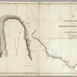 1835|Featherstonhaugh, G.W.1:506 880
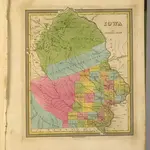 1845|Tanner, Henry S.1:1 700 000
 1854|Colton, G. Woolworth1:887 000
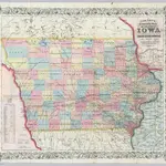 1855|Colton, G. Woolworth1:887 000
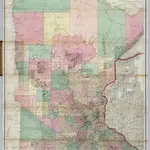 1866|Sewall, Joseph S.1:760 320
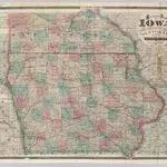 1871|Cram, George Franklin1:740 000
Vecchie mappe di Madelia, Minnesota
Scoprite il passato di Madelia, Minnesota sulle mappe storiche
Vecchie mappe di Madelia, Minnesota
Scoprite il passato di Madelia, Minnesota sulle mappe storiche
Alla ricerca di un Alternativa all'API di Google Maps?