Progetto
Comunità
Notizie
La mia app
Le mie mappe
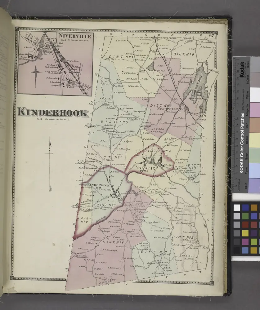
Niverville [Village]; Kinderhook [Township]
1873
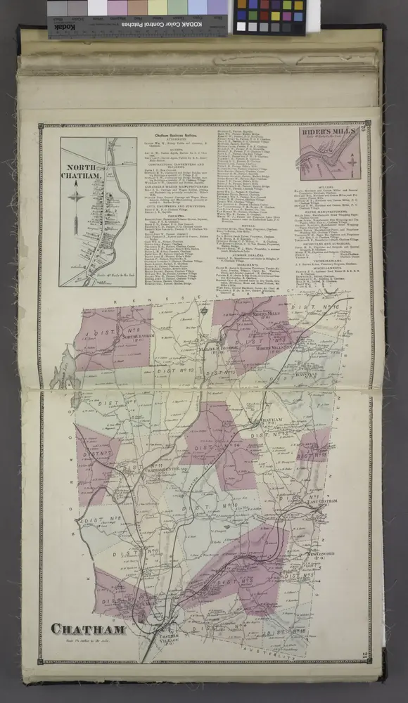
North Chatham. [Village]; Chatham Business Notices.; Ridder's Mills [Village]; Chatham [Township]
1873
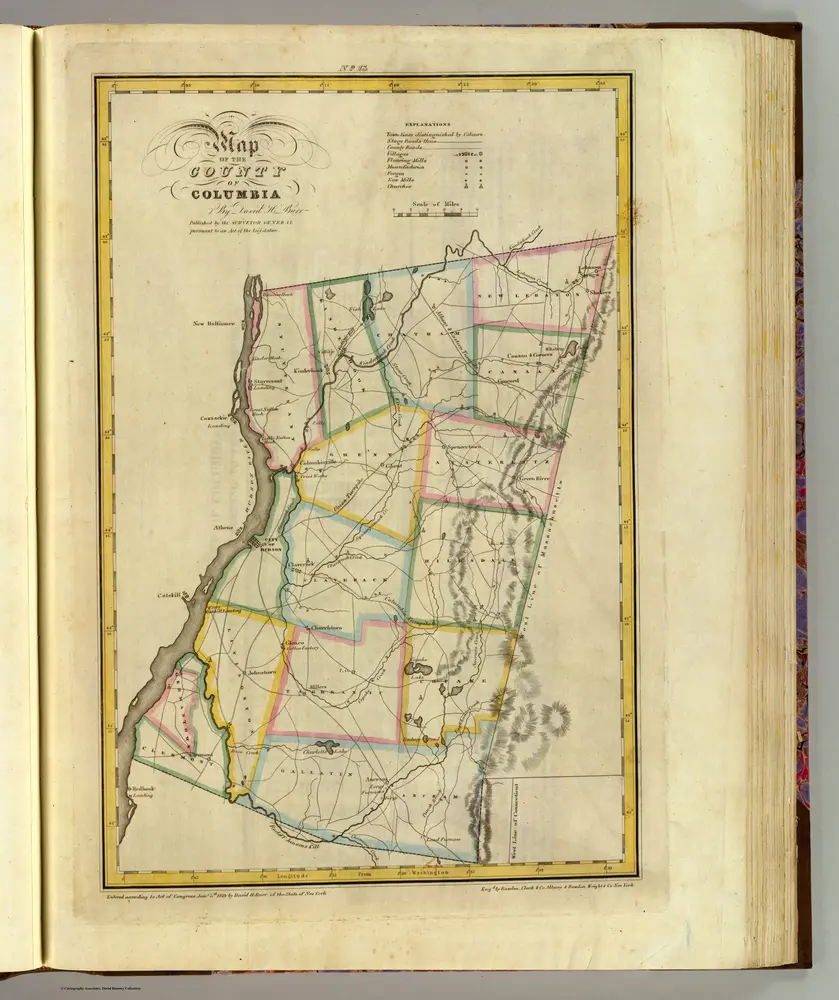
Columbia County.
1829
Burr, David H., 1803-1875
1:151k
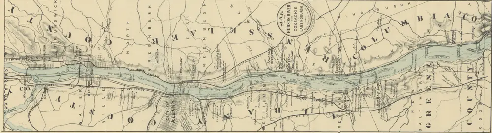
The Hudson ... Illustrated by Alfred Fredericks, etc. [A guide book. With maps.]
1894
BRUCE, Wallace.
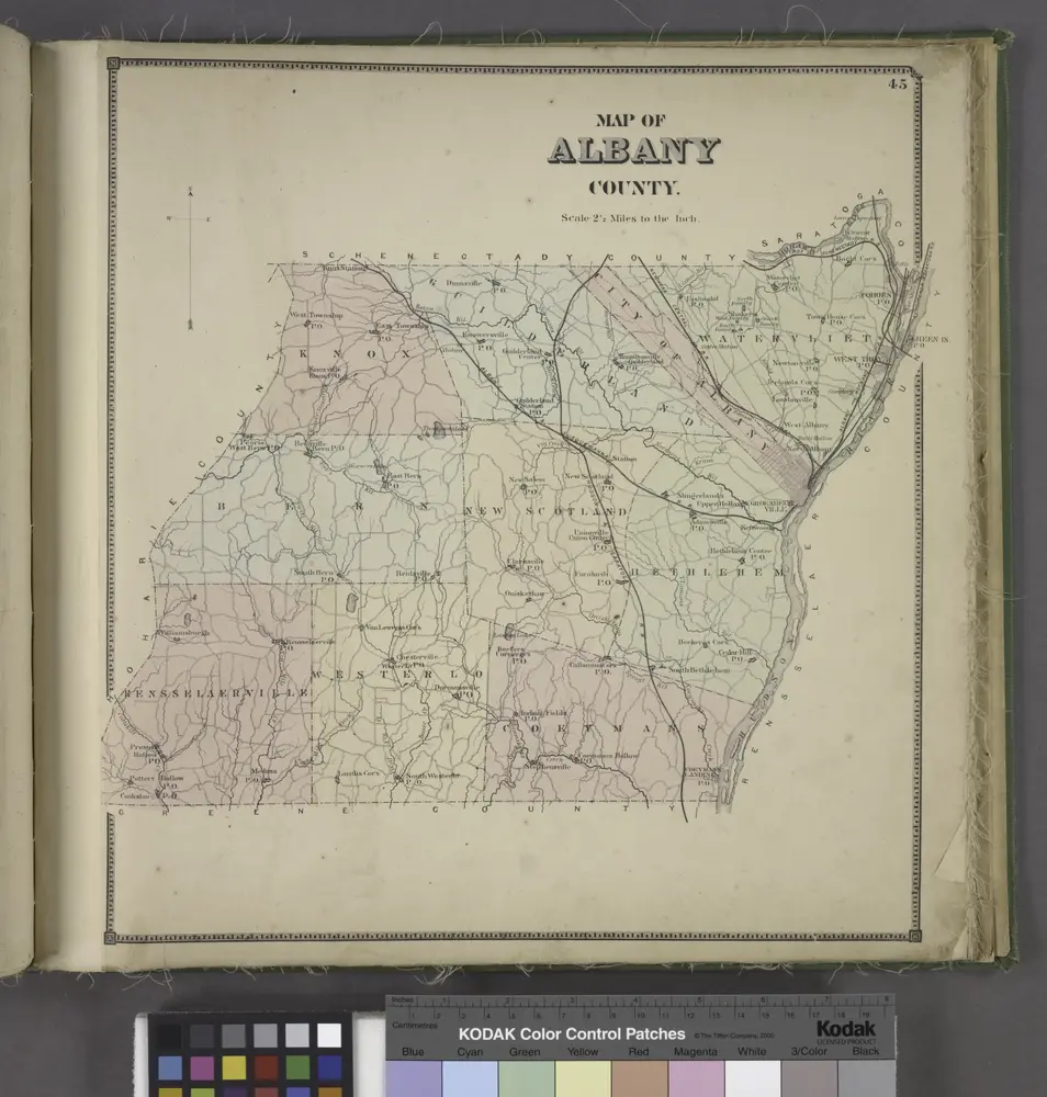
Map of Albany County.
1866
Map of the county of Columbia / by David H. Burr ; engd. by Rawdon, Clark & Co., Albany, & Rawdon, Wright & Co., New York.
1829
Map of the counties of Albany and Schenectady / by David H. Burr ; engd. by Rawdon, Clark & Co., Albany, & Rawdon, Wright & Co., N.Y.
1829
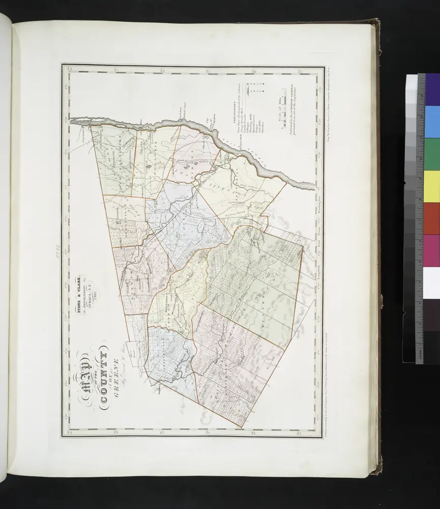
Map of the county of Greene / by David H. Burr ; engd. by Rawdon, Clark & Co., Albany, & Rawdon, Wright & Co., New York.
1841
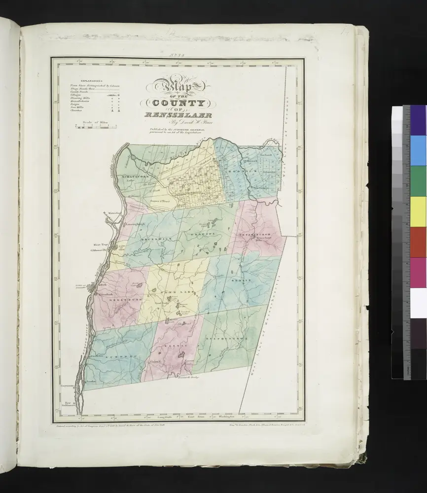
Map of the County of Rensselaer / by David H. Burr ; engd. by Rawdon, Clark & Co., Albany, & Rawdon, Wright & Co., New York.
1829
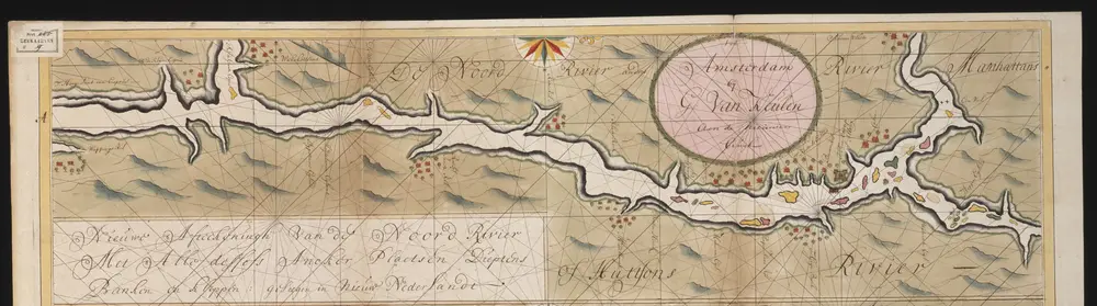
Nieuwe afteekeningh van de Noord Rivier met alle desselfs ancker plaetsen dieptens banken en klippen, geleegen in Nieuw Nederlandt [south part]
1720
Gerard van Keulen
Geschiedenis
Vecchie mappe di Ghent, New York
Scoprite il passato di Ghent, New York sulle mappe storiche
Vecchie mappe di Ghent, New York
Scoprite il passato di Ghent, New York sulle mappe storiche
Esplorare le mappe
Scoprire la storia
Regione madre
Contea di Columbia (New York)
Luoghi correlati