Progetto
Comunità
Notizie
La mia app
Le mie mappe
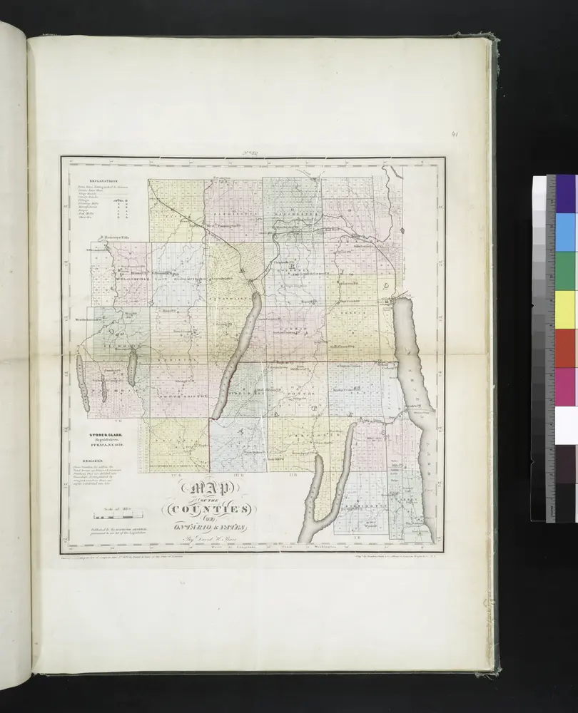
Map of the counties of Ontario & Yates / by David H. Burr ; engd. by Rawdon, Clark & Co., Albany, & Rawdon, Wright & Co., N.Y.
1829
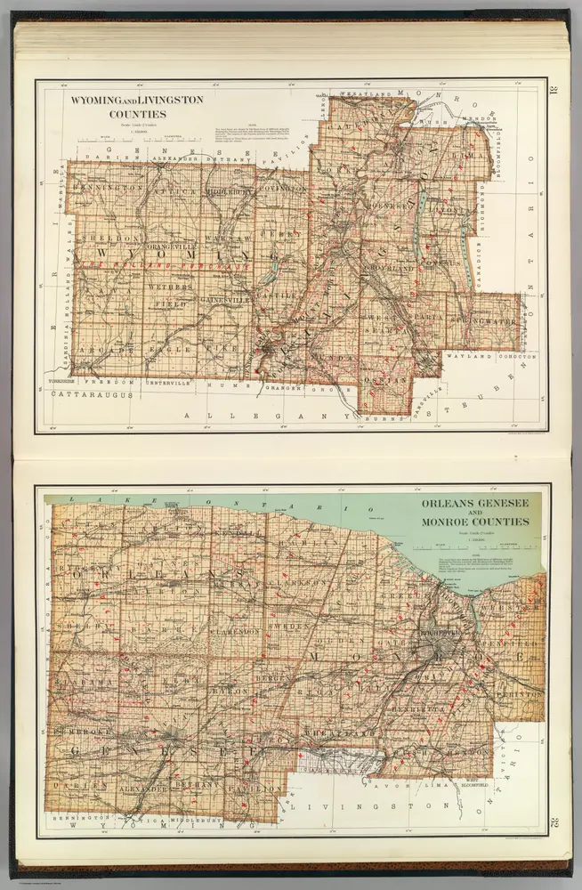
Wyoming, Livingston, Orleans, Genesee, Monroe counties.
1895
Bien, Joseph Rudolf
1:158k
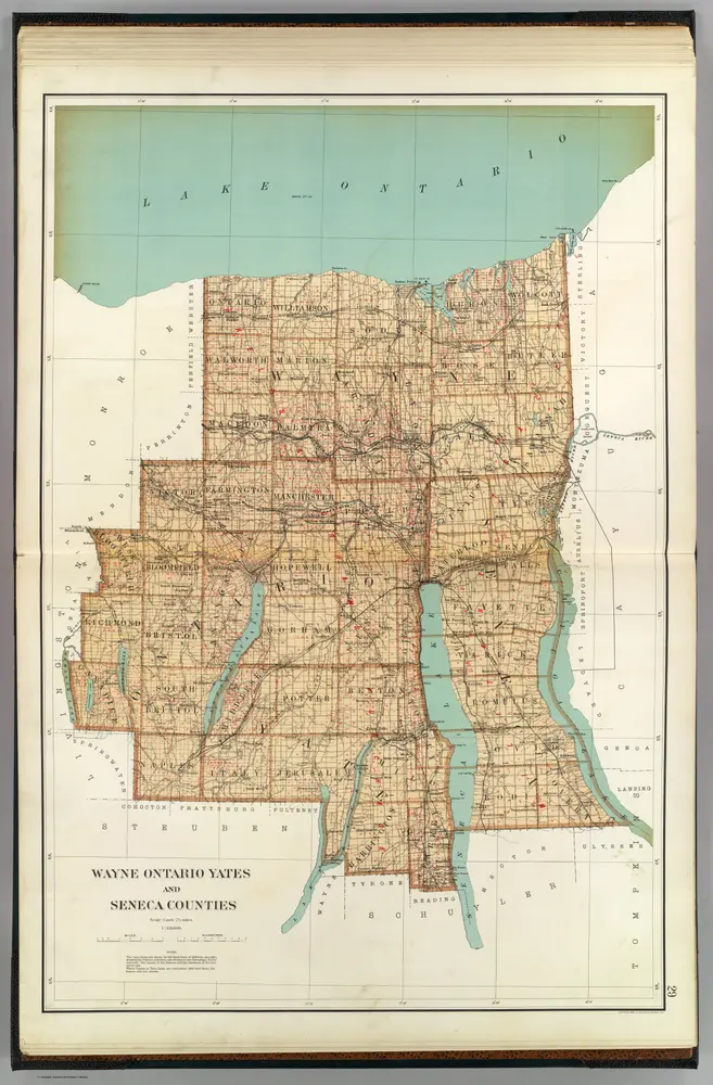
Wayne, Ontario, Yates, Seneca counties.
1895
Bien, Joseph Rudolf
1:158k
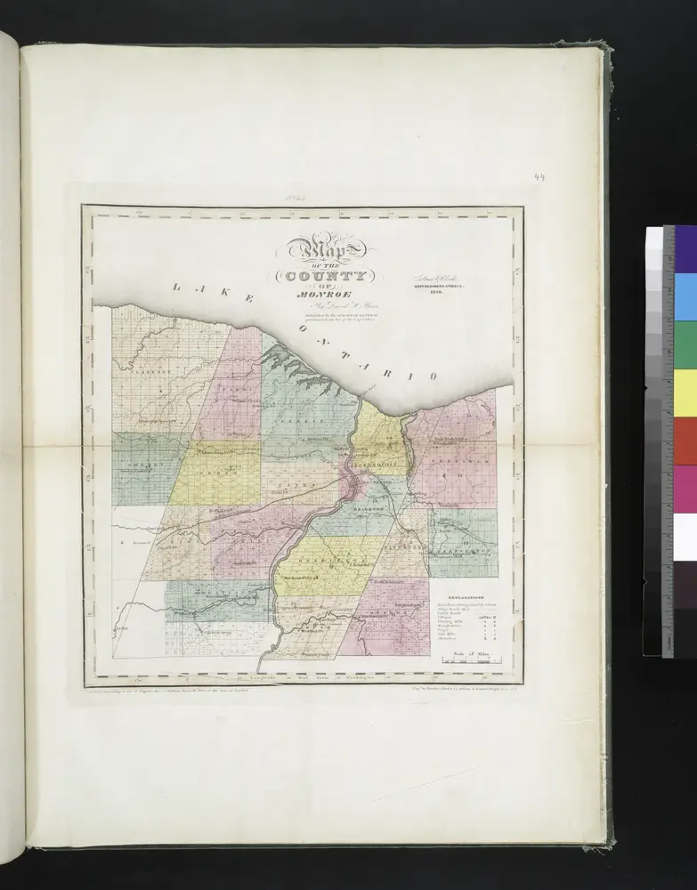
Map of the county of Monroe / by David H. Burr ; engd. by Rawdon, Clark & Co., Albany, & Rawdon, Wright & Co., N.Y.
1829
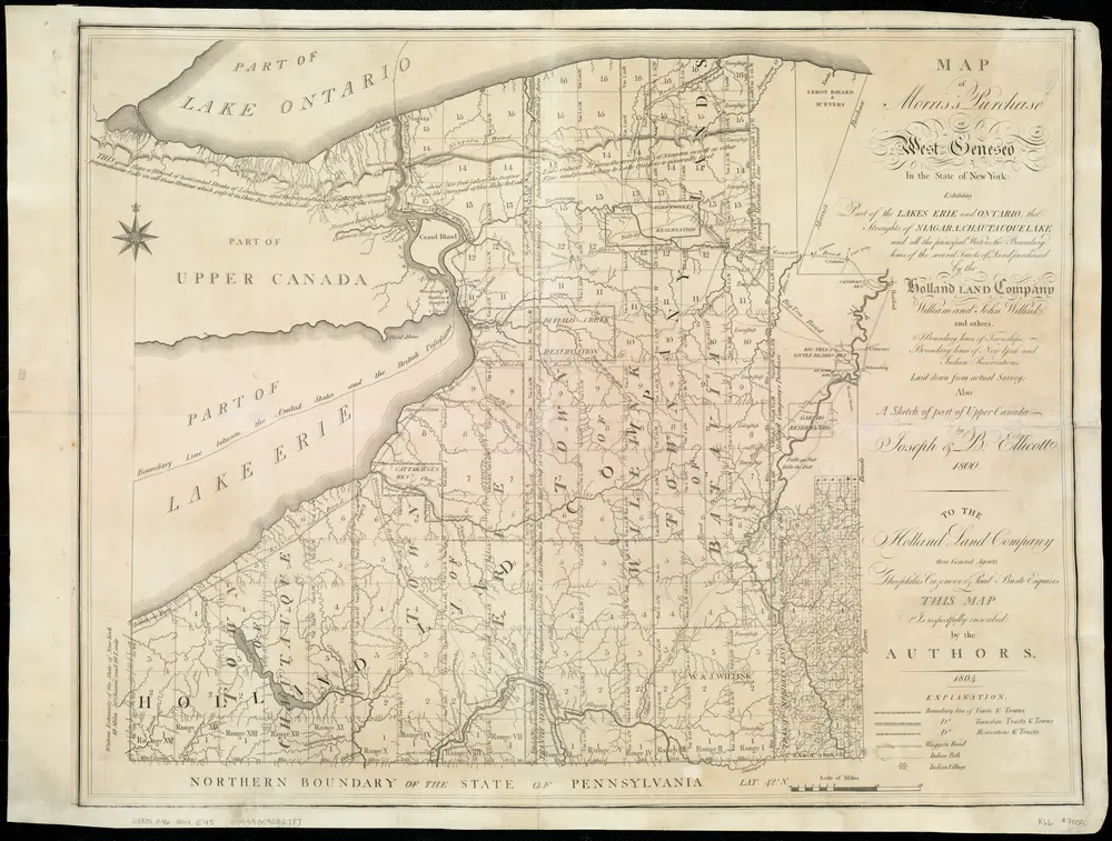
Map of Morris's Purchase or West Geneseo in the state of New York : exhibiting part of the Lakes Erie and Ontario, the Straights of Niagara ...
1804
Ellicott, Joseph
1:336k
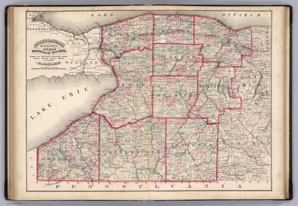
Niagara, Erie, Chautaugua, Cattaraugus, Orleans, Genesee, Wyoming, Allegheny, Monroe, and Livingston Counties, New York.
1870
Asher & Adams
1:400k
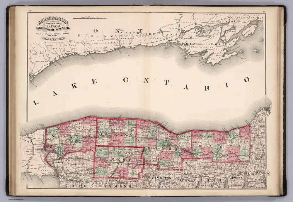
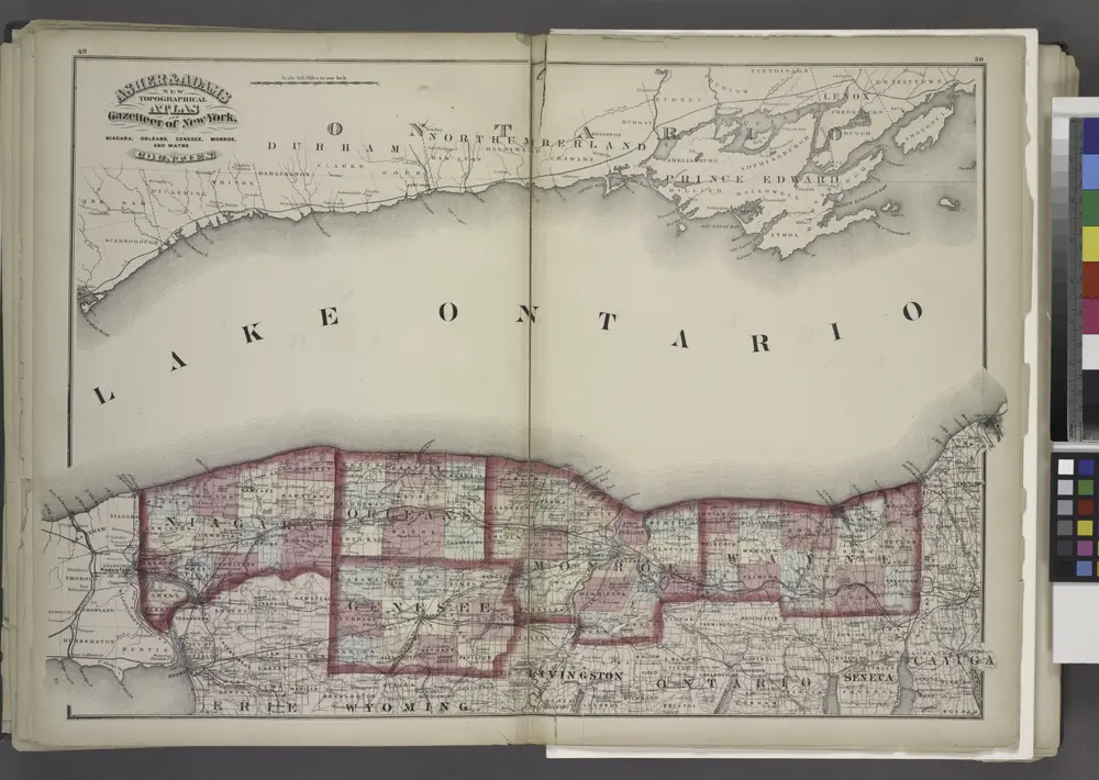
Niagara, Orleans, Genese, Monroe, and Wayne Counties, New York.
1870
Asher & Adams
1:400k
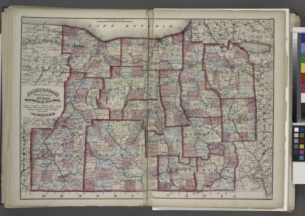
"Monroe, Livingston, Allegany, Wayne, Ontario, Steuben, Yates, Schuyler, Chemung, Seneca, Cayuga, Tompkins, Tioga, Onondaga, and Cortland Counties "
1871
"Niagara, Orleans, Genesee, Monroe, and Wayne counties"
1871
"Niagara, Erie, Chautauqua, Cattaraugus, Orleans, Genesee, Wyoming, Allegany, Monroe, and Livingston Counties"
1871
History
Vecchie mappe di East Bloomfield
Scoprite il passato di East Bloomfield sulle mappe storiche
Vecchie mappe di East Bloomfield
Scoprite il passato di East Bloomfield sulle mappe storiche
Esplorare le mappe
Scoprire la storia
Regione madre
Contea di Ontario (New York)
Luoghi correlati