Cataloged map

11B - N.Y. City (Aerial Set).
1924
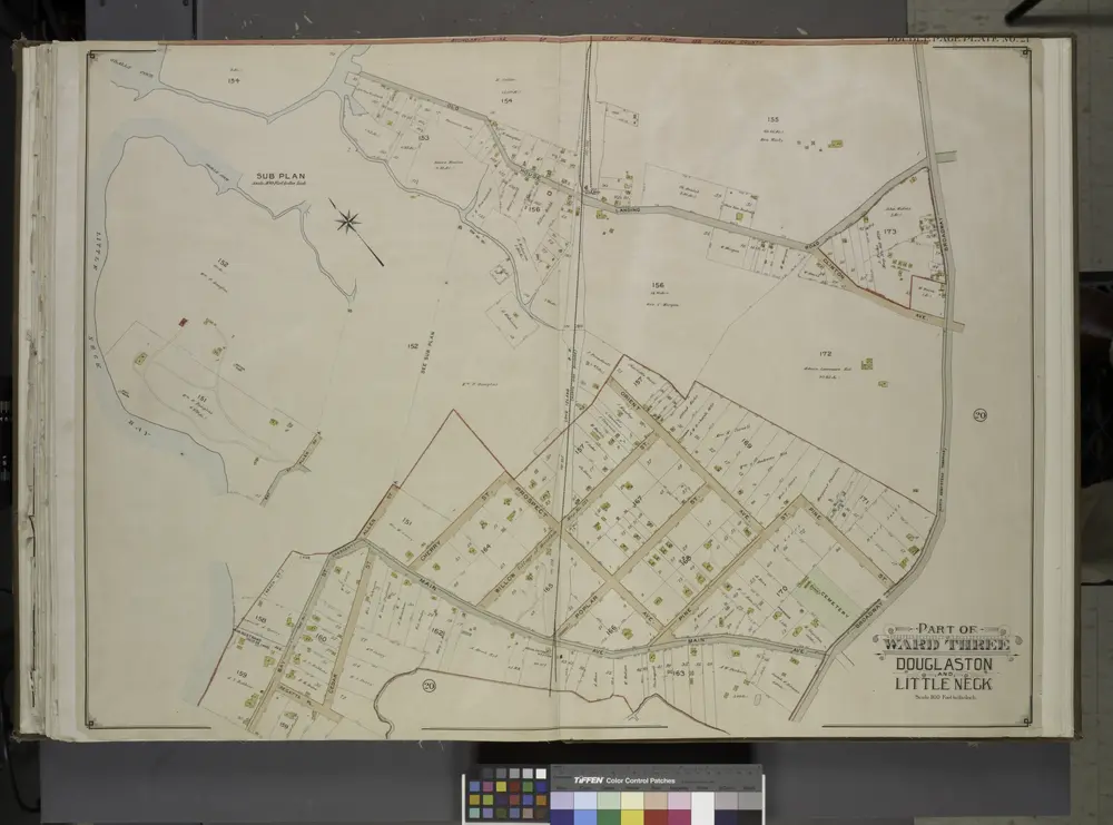
Queens, Vol. 3, Double Page Plate No. 21; Part of ward Three Sub Plan; [Map bounded by Little Neck Bay, Odalls Cove; Including Bay St., Allen St.]; Part of ward Three Douglaston and Little Neck; [Map bounded by Boundary Line of City of New York a
1913
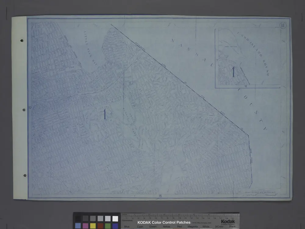
Height District Map Section No. 11; Height district map / City of New York, Board of Estimate and Apportionment.
1916
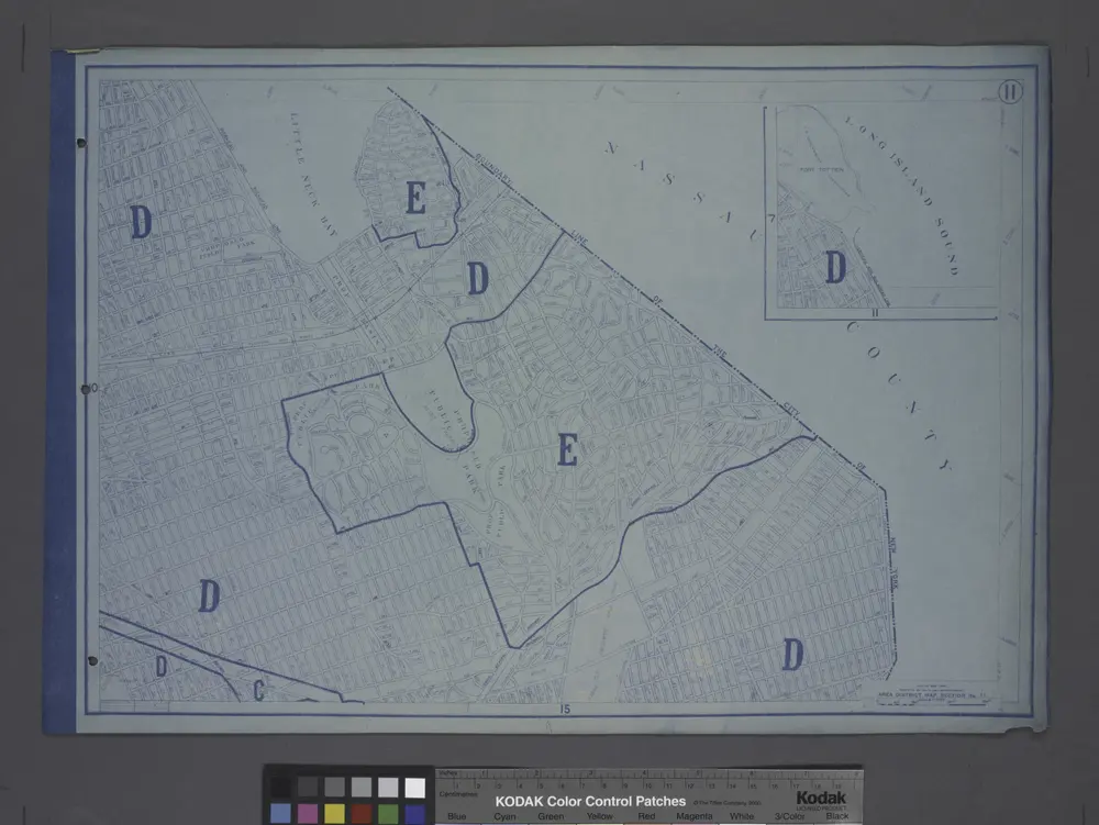
Area District Map Section No. 11; Area district map / City of New York, Board of Estimate and Apportionment.
1916
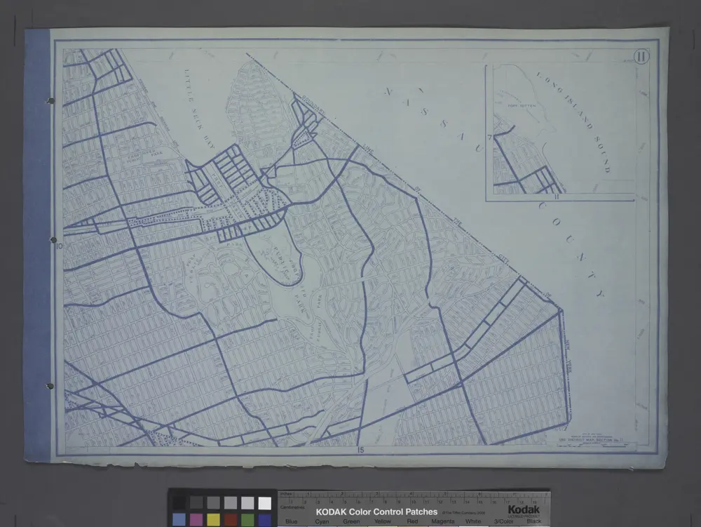
Use District Map Section No. 11; Use district map / City of New York, Board of Estimate and Apportionment.
1916
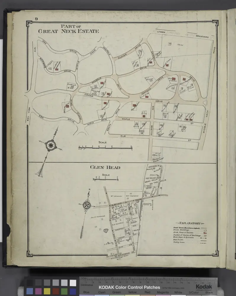
Part of Great Neck Estate; Glen Head
1914
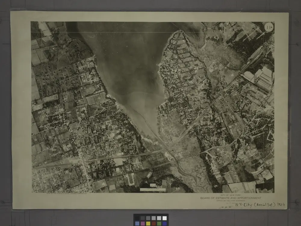
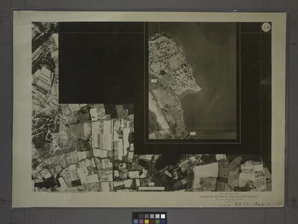
11A - N.Y. City (Aerial Set).
1924
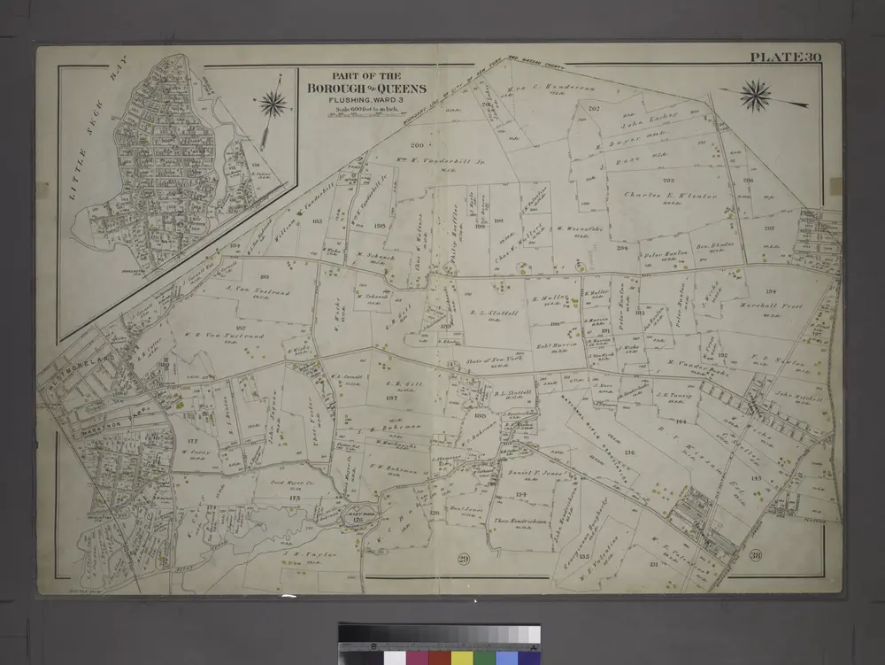
[Plate 30: Bounded by Nassau Road, Broadway, Clinton Avenue, East Alley Road, Little Neck Road, Jericho Turnpike, Rocky Hill Road, Alley Road and Broadway.]
1909
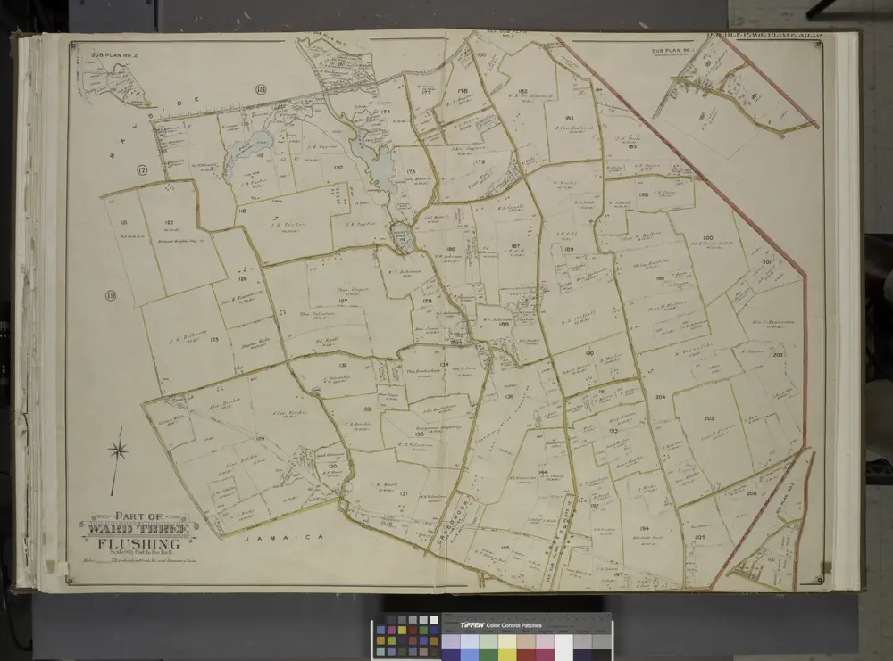
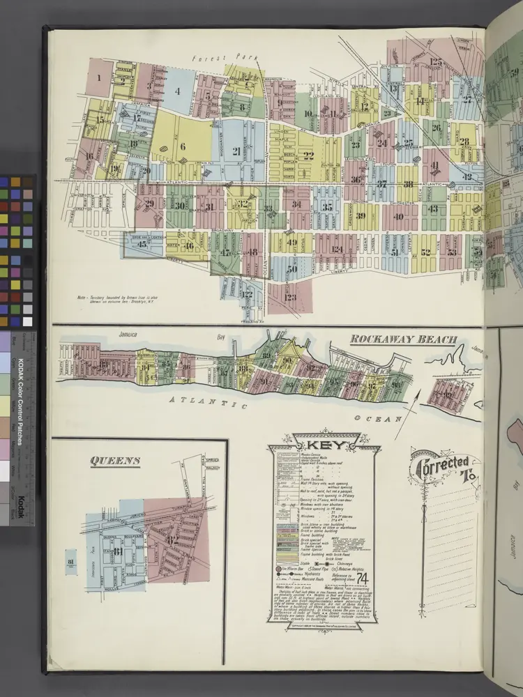
Queens, Vol. 3, Double Page Plate No. 20; Part of ward Three Sub Plan No. 1; [Map bounded by Broadway, Little Neck Road, West end Drive, Lakeville Road]; Part of ward Three Sub Plan No. 2; [Map bounded by Little Neck Bay]; Part of ward Thre
1913
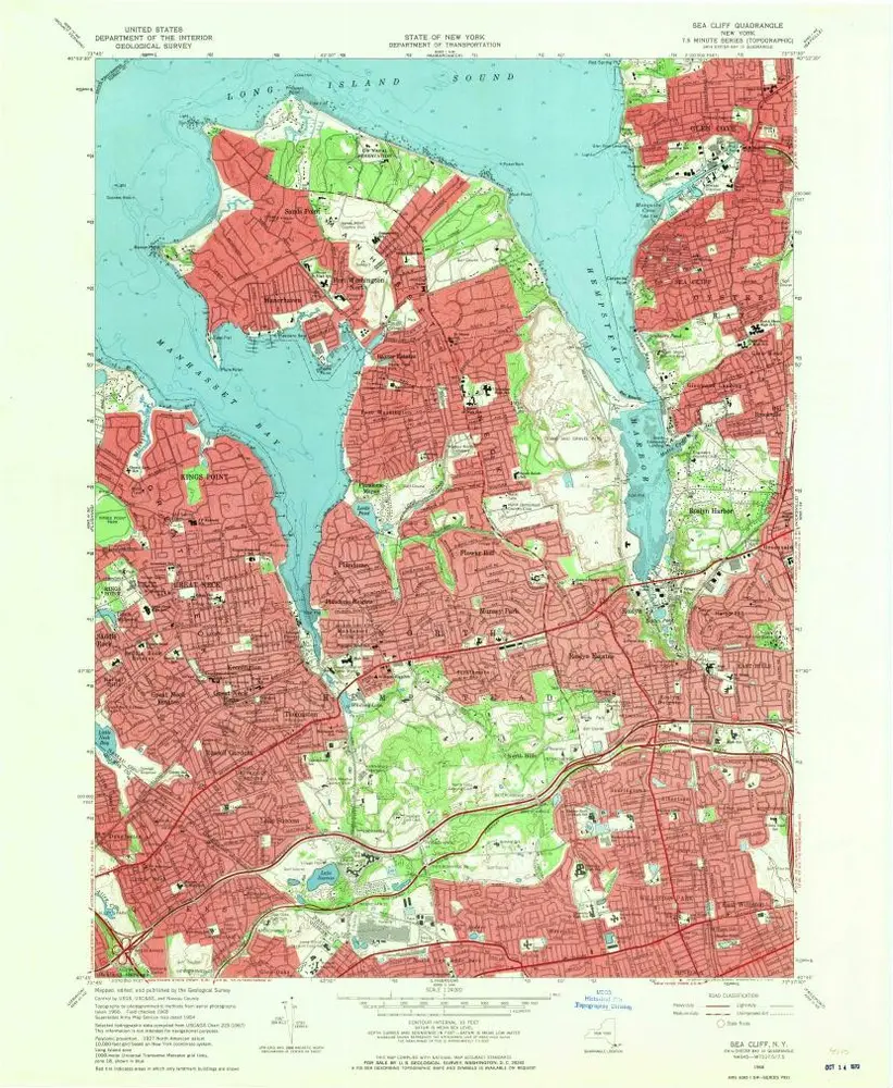
Sea Cliff
1968
1:24k
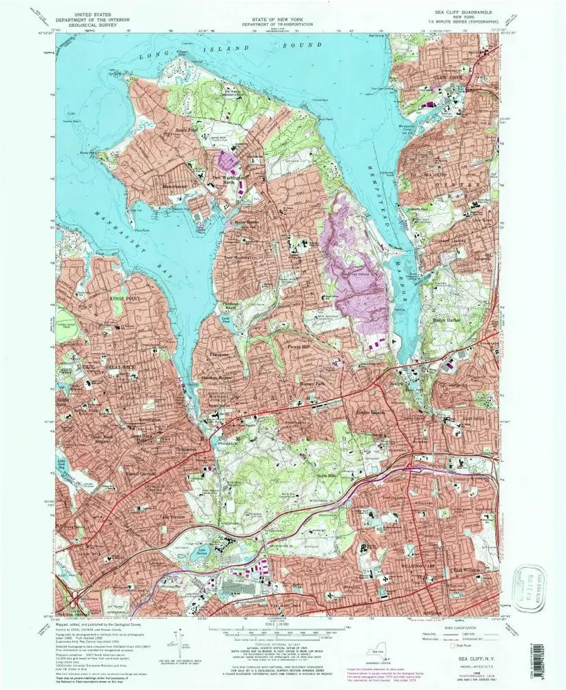
Sea Cliff
1968
1:24k
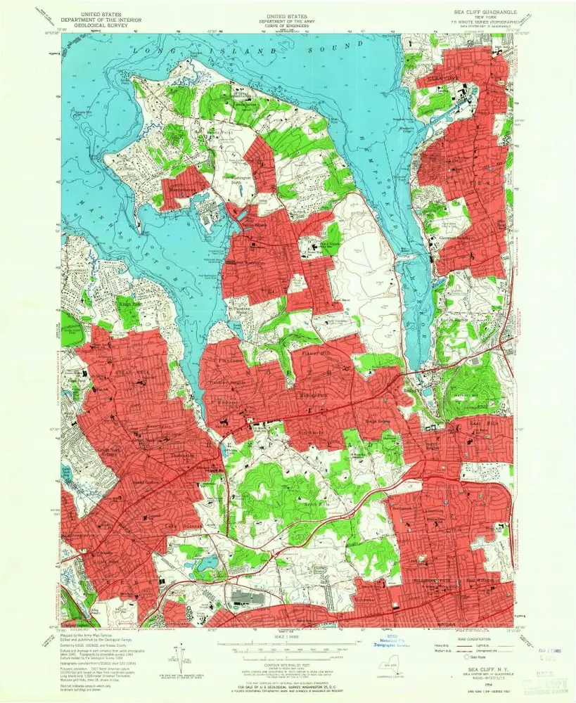
Sea Cliff
1954
1:24k
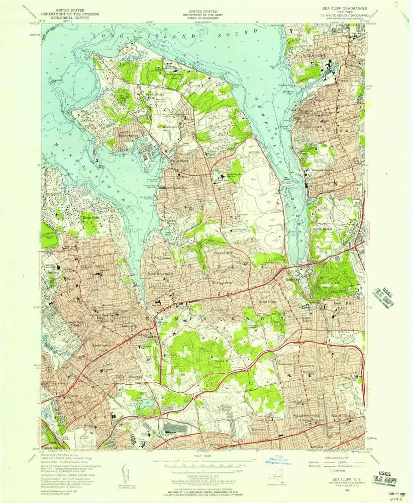
Sea Cliff
1954
1:24k
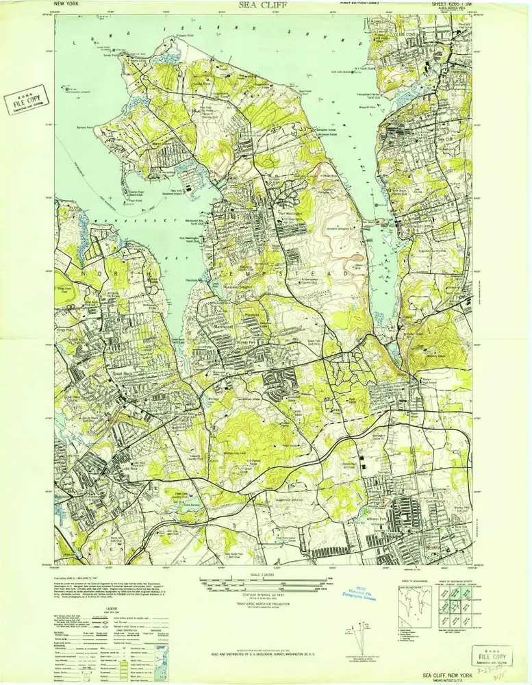
Sea Cliff
1947
1:24k