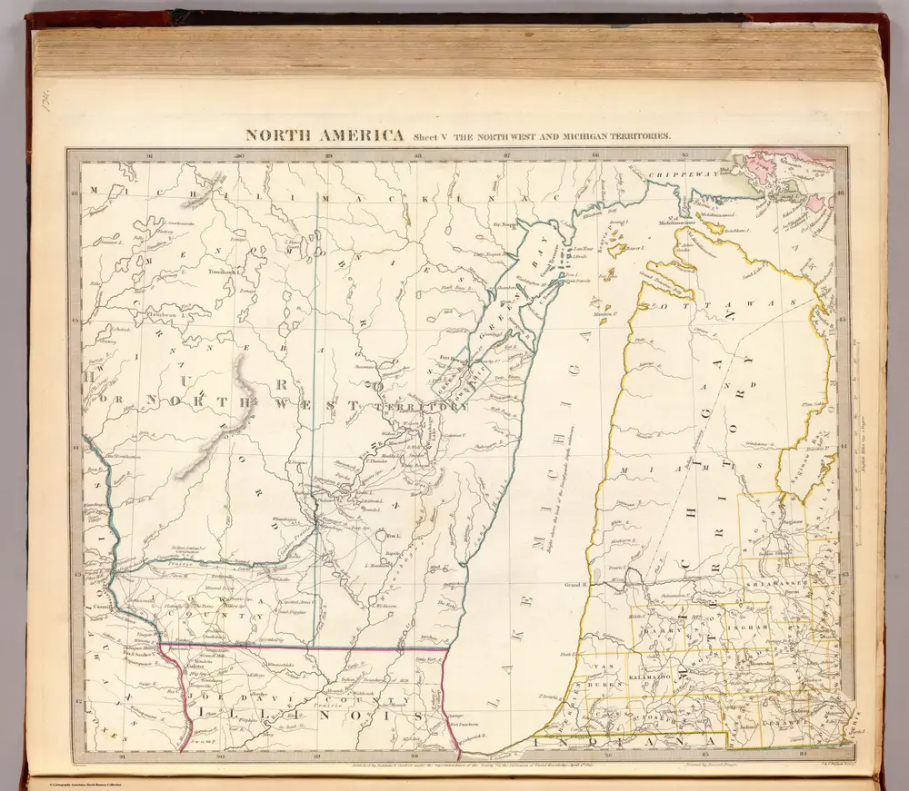
Anciennes cartes de Comté de Mason (Michigan)
Découvrez le passé de Comté de Mason (Michigan) sur des cartes historiques
Anciennes cartes de Comté de Mason (Michigan)
Découvrez le passé de Comté de Mason (Michigan) sur des cartes historiques
À la recherche d'un Alternative à l'API Google Maps?