Projet
Communauté
Actualités
Mon appli
Mes cartes
Cartes de Comté de Grant (Washington)
Recherche avancée
Tous
Privé
Favoris
The North-West Coast; or, three years' residence in Washington Territory. ... With ... illustrations
1857|SWAN, James Gilchrist.
Map of Public Surveys, Washington Territory, 1863
1863|U.S. General Land Office
Washington.
1874|Asher & Adams
1:1 267 200
Map of the Gold Regions of the Frazer River and the Washington Territory on the Western Coast of America. By J. Wyld
1858|London
Map of Public Surveys in the Territory of Washington,1862
1862|U.S. General Land Office
Oregon and Washington.
1874|Johnson, A.J.
1:2 550 000
Rocky Mountains to Puget Sound.
1861|Stevens, Isaac I.
1:1 200 000
1600
1650
1700
1750
1800
1850
1900
1950
2000
L'histoire
Anciennes cartes de Comté de Grant (Washington)
Découvrez le passé de Comté de Grant (Washington) sur des cartes historiques
Anciennes cartes de Comté de Grant (Washington)
Découvrez le passé de Comté de Grant (Washington) sur des cartes historiques
Explorer les cartes
Découvrir l'histoire
Région parente
Washington (État)
Lieux apparentés
Ville
Banks Lake South
Ville
Cascade Valley
Ville
Ephrata (Washington)
Ville
George (Washington)
Ville
Lakeview (Washington)
Ville
Moses Lake
Ville
Moses Lake North
Ville
Quincy (Washington)
Ville
Royal City (Washington)
Ville
Soap Lake (Washington)
Ville
Warden (Washington)
Ville
Coulee City (Washington)
Ville
Electric City (Washington)
Ville
Hartline (Washington)
Ville
Mattawa (Washington)
Ville
Wilson Creek (Washington)
© MapTiler
© OpenStreetMap
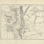 1857|SWAN, James Gilchrist.
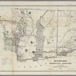 1863|U.S. General Land Office
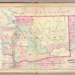 1874|Asher & Adams1:1 267 200
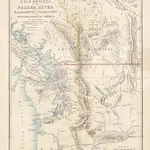 1858|London
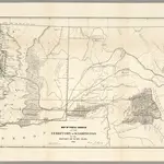 1862|U.S. General Land Office
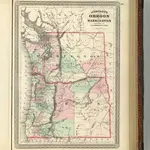 1874|Johnson, A.J.1:2 550 000
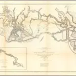 1861|Stevens, Isaac I.1:1 200 000