Cartes de Comté d'Emmet (Michigan)
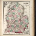 1873|Gray, O.W.1:1 320 000
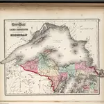 1873|Gray, O.W.1:1 600 000
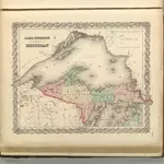 1857|Colton, G.W.1:1 600 000
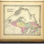 1856|Colton, G.W.1:1 625 000
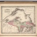 1866|Colton, G.W.1:1 500 000
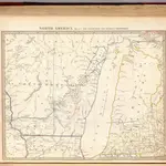 1833|Society for the Diffusion of Useful Knowledge (Great Britain)1:1 770 000
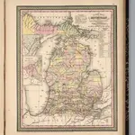 1853|Mitchell, Samuel Augustus1:2 000 000