We have modernised our Bounding Box tool and added new features!
The tool is freely available at https://boundingbox.klokantech.com and allows visual selection of geographic coordinates of an area on a map directly in a web browser.
It is a popular tool used regularly by many librarians all over the world - during the cataloguing of maps. It allows direct copy and paste of the selected area into a library system in various formats such as MARC, DublinCore, FGDC or ISO 19139. Thanks to this effort the maps can be discovered with a geographical search - for example, at OldMapsOnline.org.
It is practical also for GIS people - who can get the bounding box in GeoJSON, KML, or OGC WKT for use in PostGIS or SQL.
What is new?
The drawn rectangle can now be rotated for higher precision (by dragging the circle in the bottom-right corner) - this is often required for recording areas of maps which are not north-oriented - for example riverbed maps.
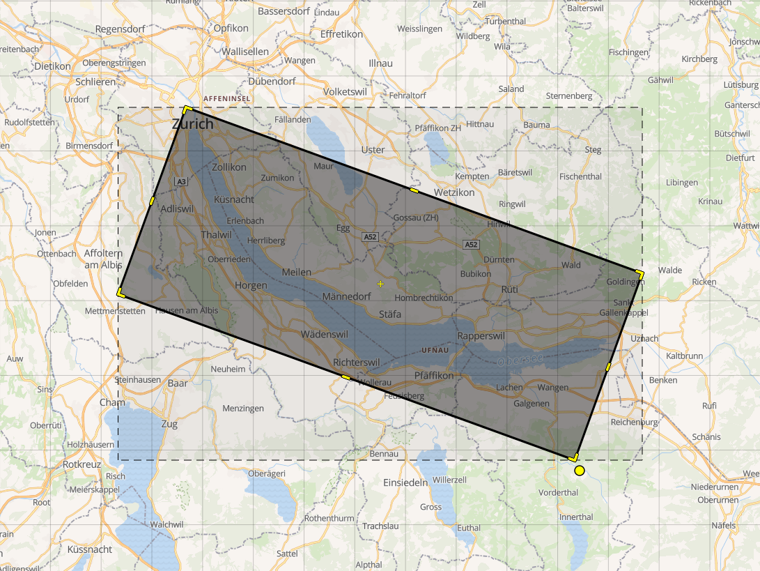
And there is also a completely new “Polygon tool” accessible by clicking the pentagon icon on the left side. This allows you to draw (and modify) any shape with high precision:
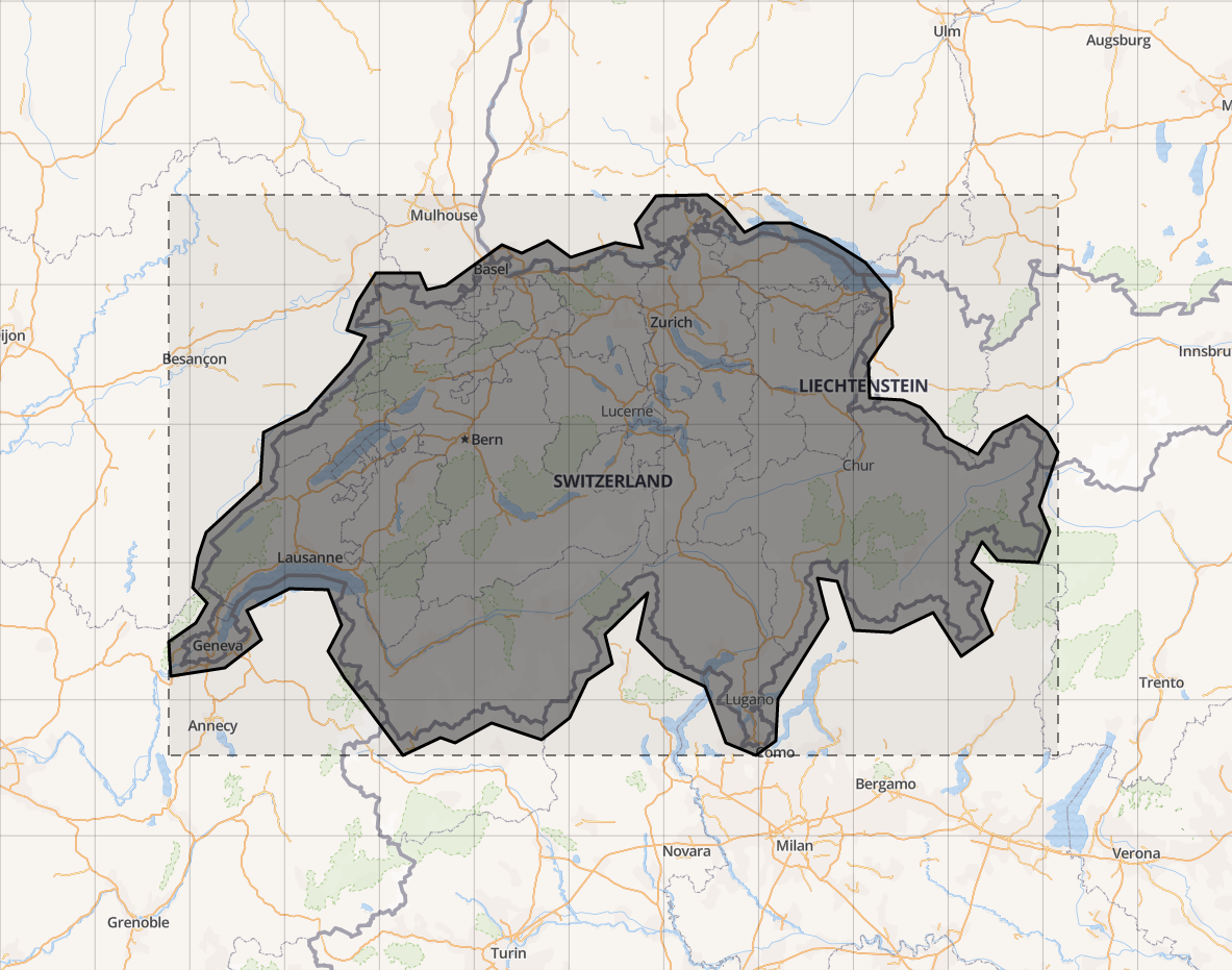
In both cases, the full geometry is formatted into the MARC format (fields 34 and 255). The wrapping bounds, automatically calculated and shown as the dashed rectangle on the map, can be included as well.
The tool has also been upgraded to the latest mapping library (OpenLayers), and we are now using as the default background layer the OpenStreetMap maps from the OpenMapTiles.org open-source project.
The development has been supported by the Swiss libraries as part of the Kartenportal.CH project.