Proyecto
Comunidad
Noticias
Mi aplicación
Mis mapas
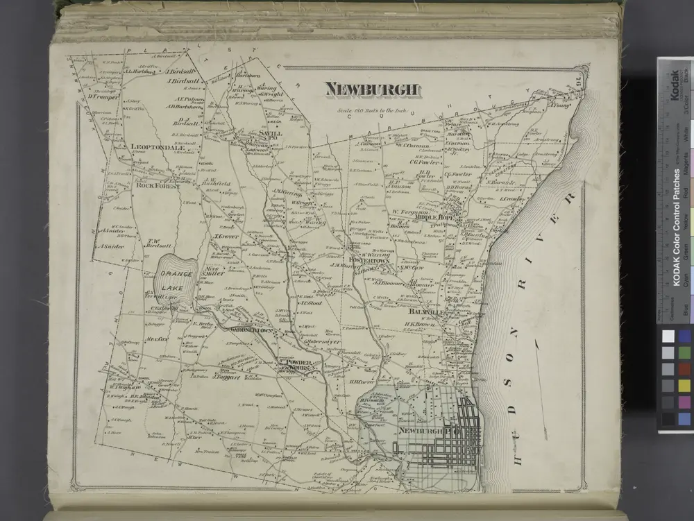
Newburgh [Township]
1875
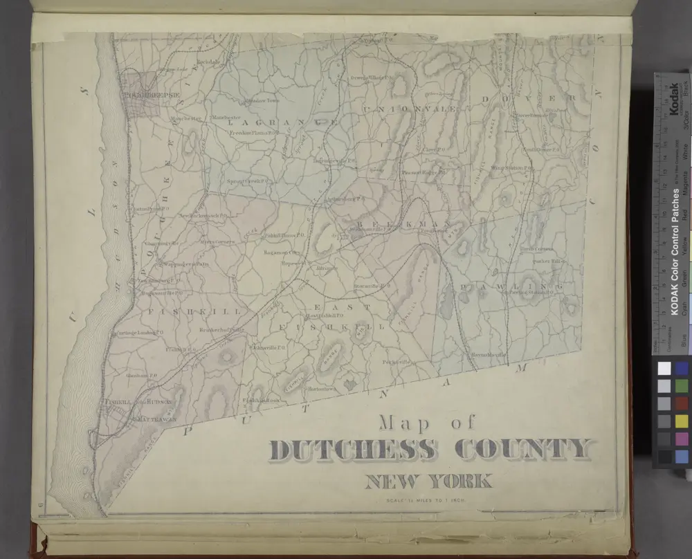
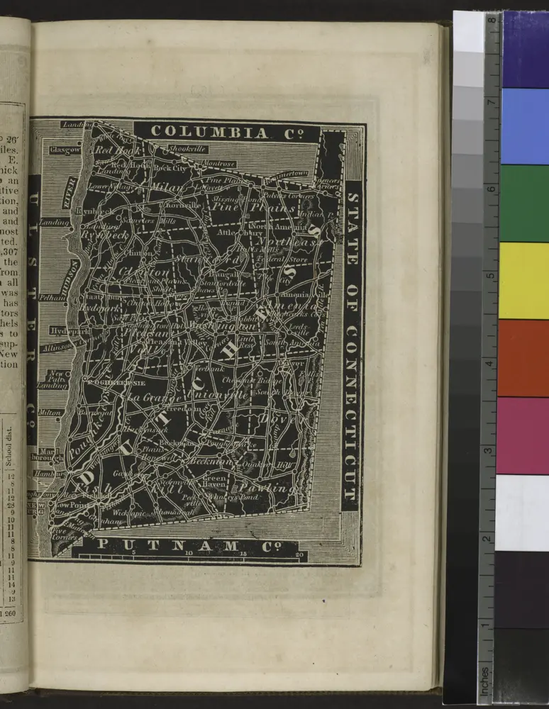
Map of Dutchess County New York
1876
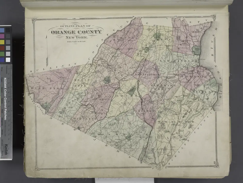
Outline Plan of Orange County New York.
1875
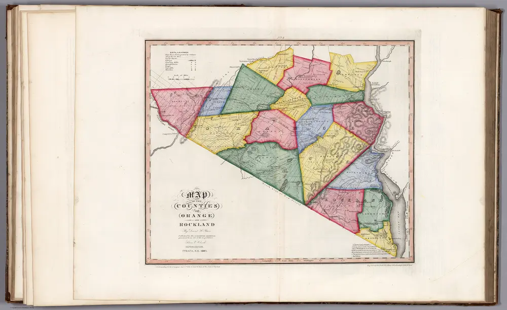
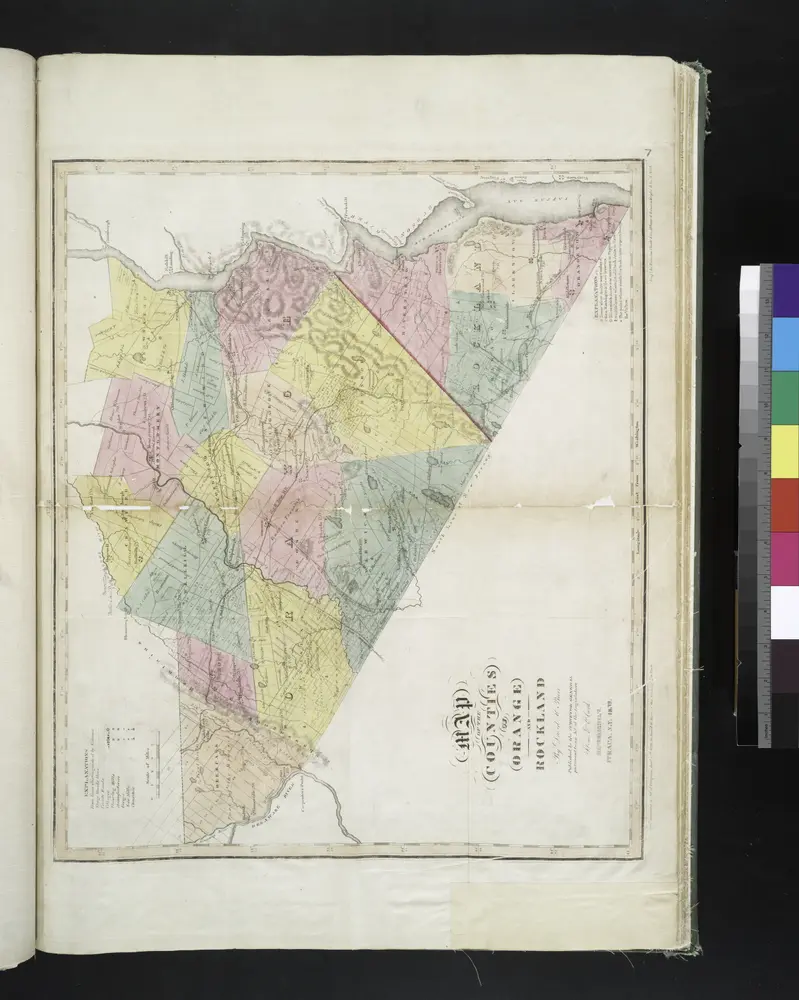
Map of the Counties of Orange and Rockland (New York).
1840
Burr, David H., 1803-1875
1:168k
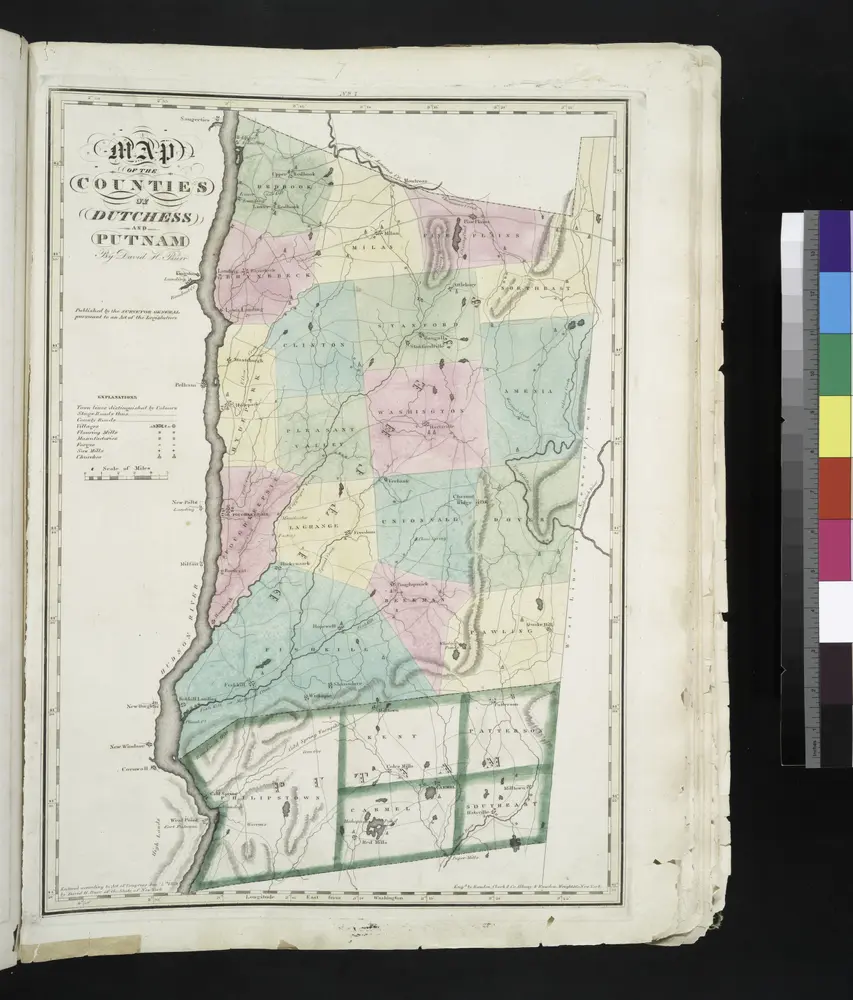
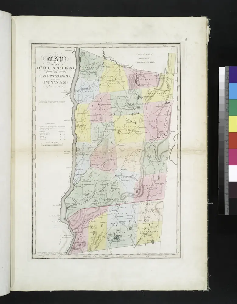
Map of the counties of Dutchess and Putnam / by David H. Burr ; engd. by Rawdon, Clark & Co., Albany, & Rawdon, Wright & Co., New York.
1829
[Dutchess County].
1838
Map of the county of Ulster / by David H. Burr ; engd. by Rawdon, Clark & Co., Albany, & Rawdon, Wright & Co., New York.
1829
Map of the counties of Dutchess and Putnam / by David H. Burr ; engd. by Rawdon, Clark & Co., Albany, & Rawdon, Wright & Co., New York.
1829
Map of the counties of Orange and Rockland / by David H. Burr ; engd. by Rawdon, Clark & Co., Albany, & Rawdon, Wright & Co., N. York.
1829
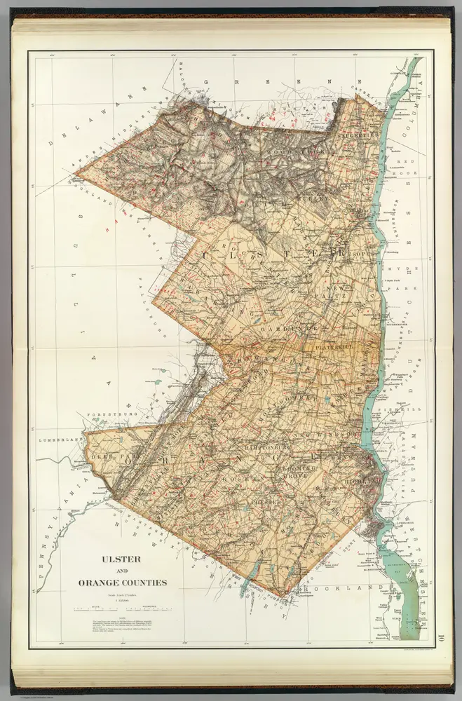
Ulster, Orange counties.
1895
Bien, Joseph Rudolf
1:158k
Geschiedenis
Mapas antiguos de Plattekill, New York
Descubra el pasado de Plattekill, New York en mapas históricos
Mapas antiguos de Plattekill, New York
Descubra el pasado de Plattekill, New York en mapas históricos
Explorar los mapas
Descubrir la historia
Región paterna
Condado de Ulster
Lugares relacionados