编目地图

Ravenden Springs
1966
1:24k
Ravenden Springs
1966
1:24k
Cherokee Village
1983
1:100k
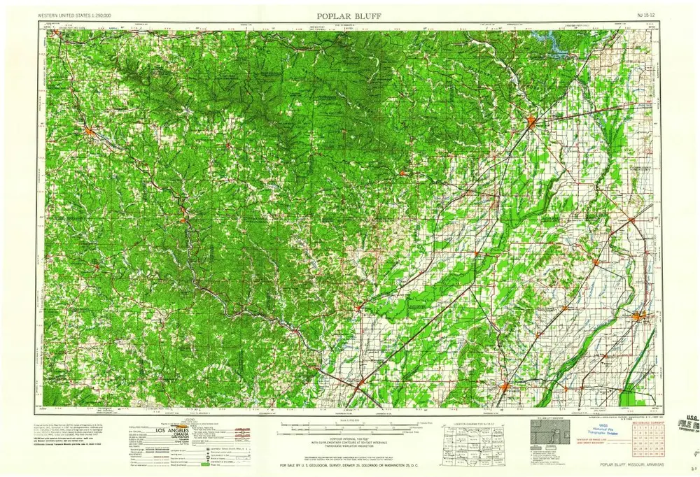
Poplar Bluff
1960
1:250k
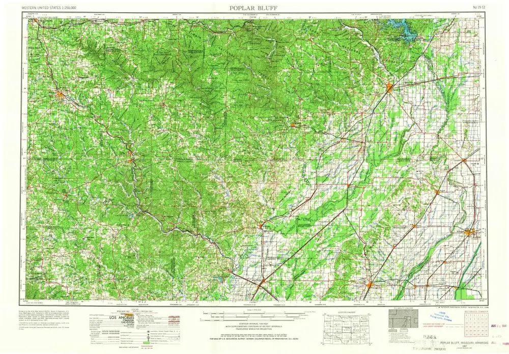
Poplar Bluff
1957
1:250k
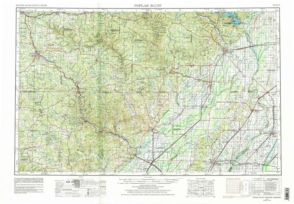
Poplar Bluff
1957
1:250k
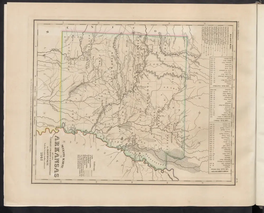
Neueste Karte von Arkansas mit seinen Canaelen Strassen & Entfernungen der Hauptpunkte
1860
Meyer, J.
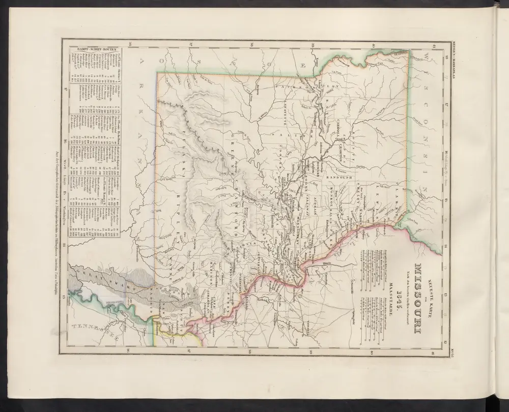
Neueste Karte von Missouri
1860
Meyer, J.
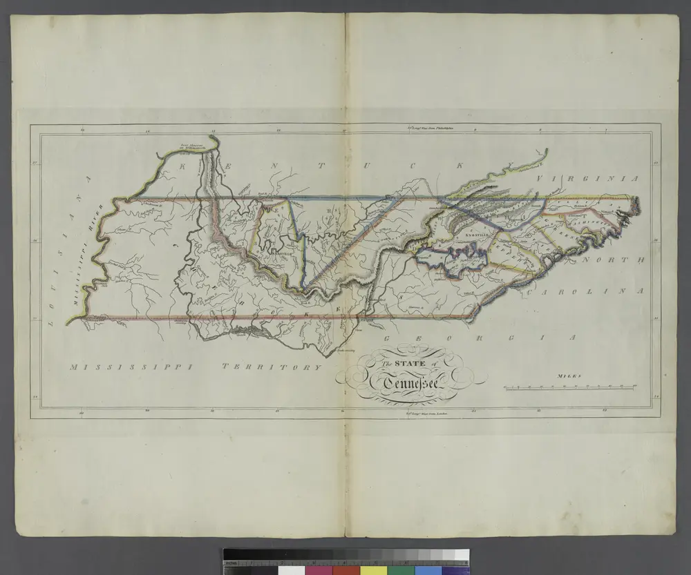
The State of Tennessee.
1814
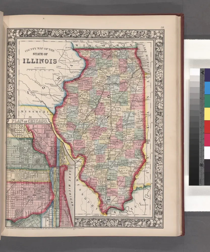
County map of the State of Illinois ; Plan of Chicago [inset].
1860