Cataloged map
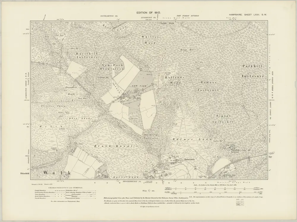
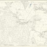
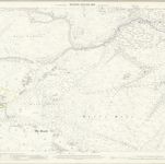
Hampshire & Isle of Wight LXXII.SW - OS Six-Inch Map

Institution:National Library of Scotland
Full title:Hampshire & Isle of Wight LXXII.SW - OS Six-Inch Map
Depicted:1907
Pubdate:1910
Publisher:Ordnance Survey
Map scale:1:10 560
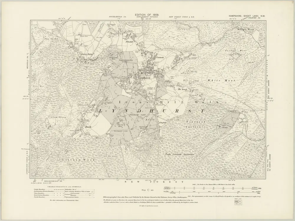
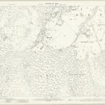
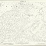
Hampshire & Isle of Wight LXXII.NW - OS Six-Inch Map
1907
Ordnance Survey
1:11k
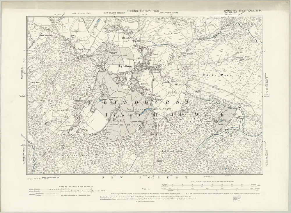
Hampshire & Isle of Wight LXXII.NW - OS Six-Inch Map
1895
Ordnance Survey
1:11k
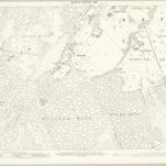
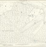
Hampshire and Isle of Wight LXXII.1 (includes: Lyndhurst; Minstead) - 25 Inch Map
1907
Ordnance Survey
1:3k
Hampshire and Isle of Wight LXXII.1 (includes: Lyndhurst; Minstead) - 25 Inch Map
1896
Ordnance Survey
1:3k
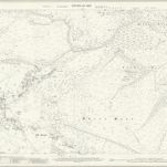
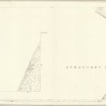
Hampshire and Isle of Wight LXXII.5 (includes: Brockenhurst; Lyndhurst; Minstead) - 25 Inch Map
1907
Ordnance Survey
1:3k
Hampshire and Isle of Wight LXXII.5 (includes: Brockenhurst; Lyndhurst; Minstead) - 25 Inch Map
1896
Ordnance Survey
1:3k
Hampshire and Isle of Wight LXXII.2 (includes: Denny Lodge; Lyndhurst) - 25 Inch Map
1907
Ordnance Survey
1:3k
Hampshire and Isle of Wight LXXII.2 (includes: Denny Lodge; Lyndhurst) - 25 Inch Map
1896
Ordnance Survey
1:3k
Hampshire and Isle of Wight LXXII.6 (with inset LXXII.2) (includes: Denny Lodge; Lyndhurst) - 25 Inch Map
1867
Ordnance Survey
1:3k
Hampshire and Isle of Wight LXXII.6 (includes: Denny Lodge; Lyndhurst) - 25 Inch Map
1907
Ordnance Survey
1:3k
Hampshire and Isle of Wight LXXII.6 (includes: Denny Lodge; Lyndhurst) - 25 Inch Map
1896
Ordnance Survey
1:3k
Hampshire and Isle of Wight LXXII.6 (with inset LXXII.2) (includes: Denny Lodge; Lyndhurst) - 25 Inch Map
1867
Ordnance Survey
1:3k