Cataloged map
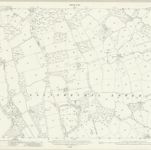
Monmouthshire XXIII.16 (includes: Llanfihangel Llantarnam; Llanfrechfa Lower; Llangybi Fawr) - 25 Inch Map

Full title:Monmouthshire XXIII.16 (includes: Llanfihangel Llantarnam; Llanfrechfa Lower; Llangybi Fawr) - 25 Inch Map
Depicted:1917
Pubdate:1921
Publisher:Ordnance Survey
Map scale:1:2 500