Project
Community
News
My App
My maps
Katalogisierte Karte
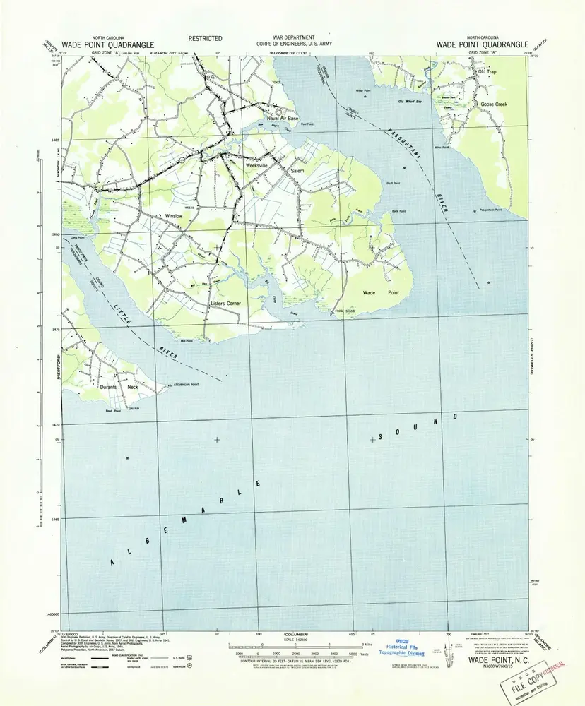
Wade Point
View on external website
View digitized
Einrichtung:
United States Geological Survey
Vollständiger Titel:
Wade Point
Jahr der Abbildung:
1943
Maßstab der Karte:
1:62 500
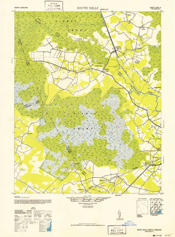
South Mills
1952
1:63k
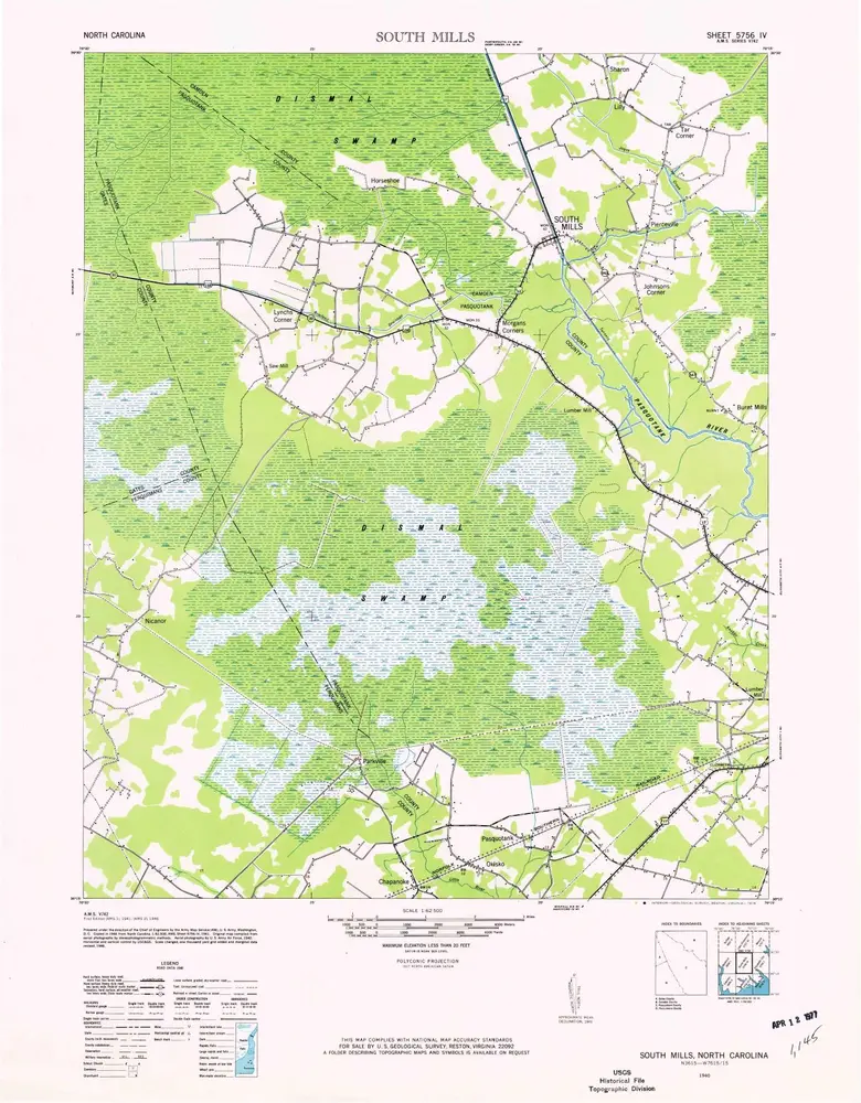
South Mills
1940
1:63k
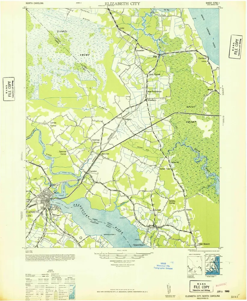
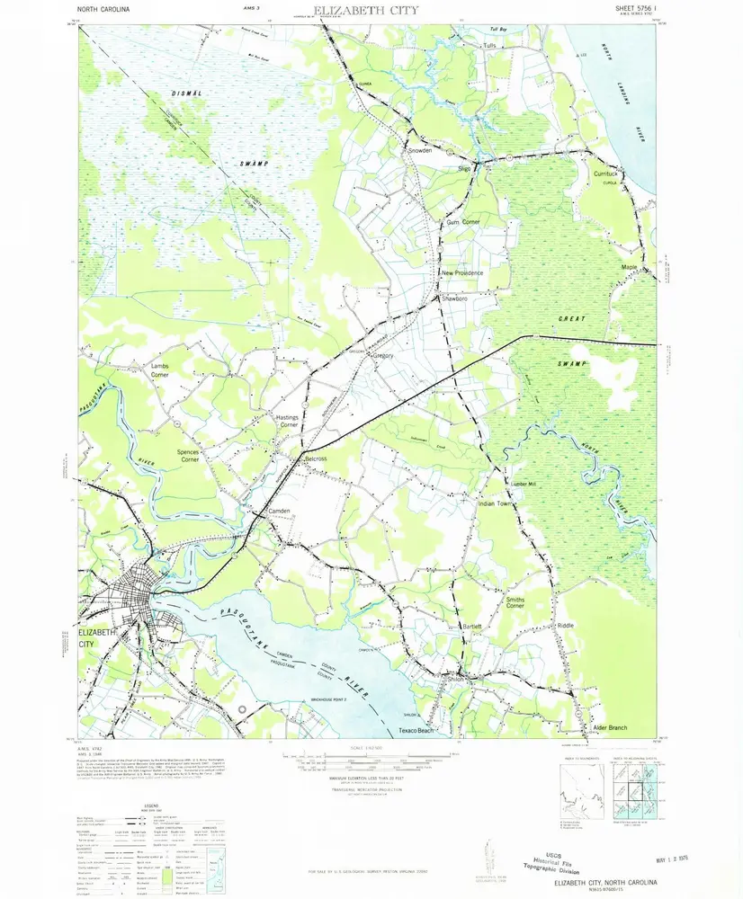
Elizabeth City
1948
1:63k
Elizabeth City
1948
1:63k
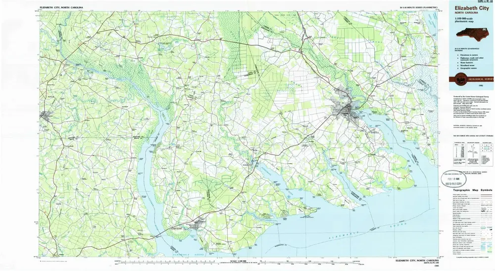
Elizabeth City
1985
1:100k
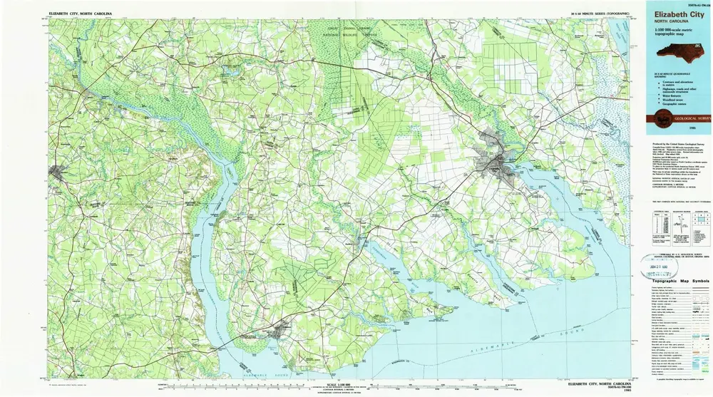
Elizabeth City
1985
1:100k
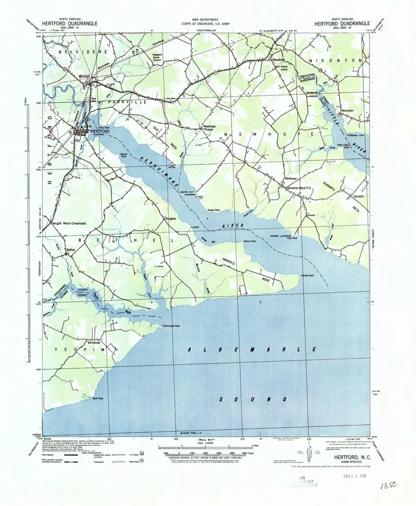
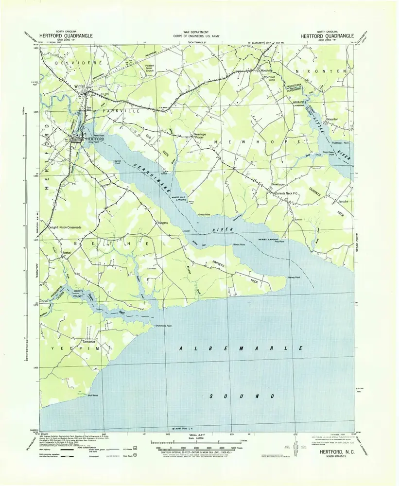
Hertford
1940
1:63k
Hertford
1940
1:63k
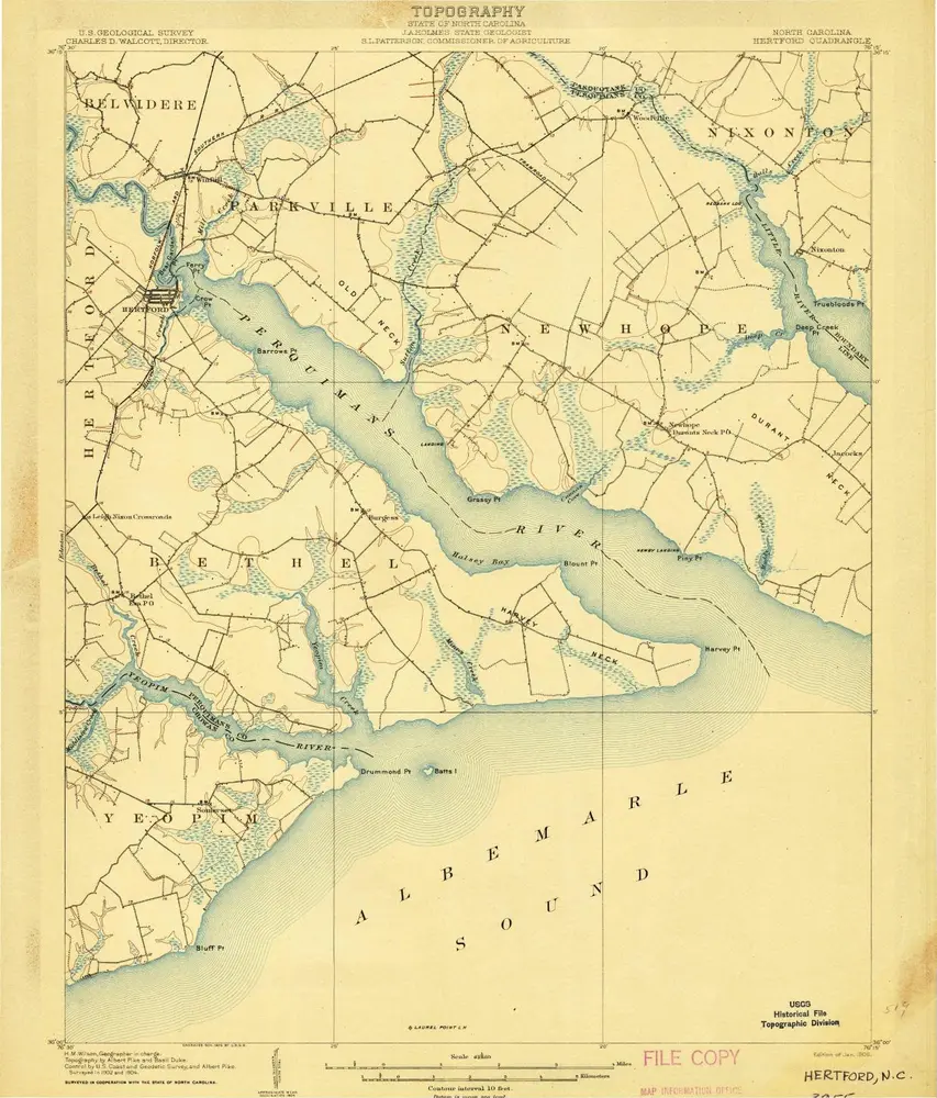
Hertford
1906
1:63k
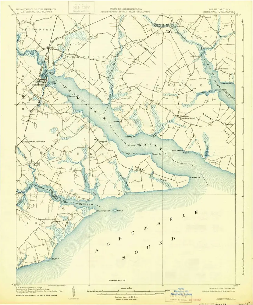
Hertford
1906
1:63k
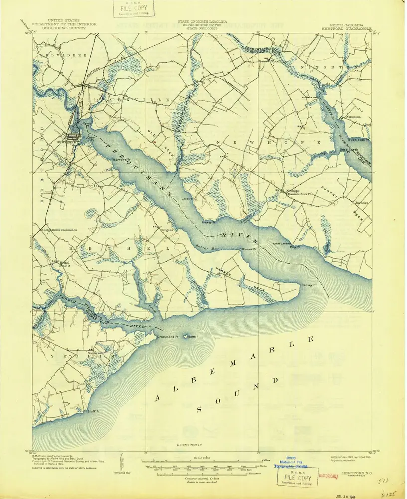
Hertford
1906
1:63k
Geschichte