
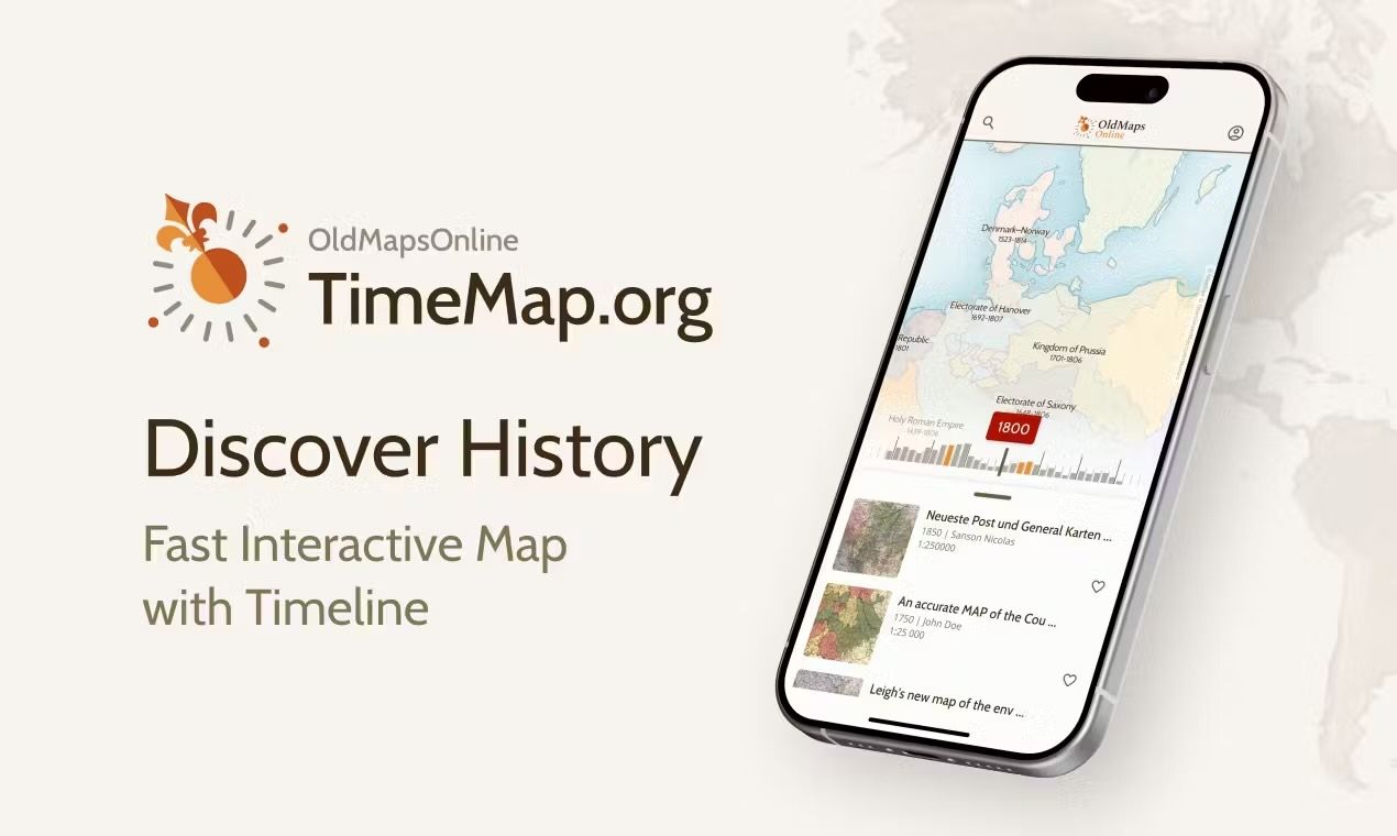
Explore Historical Places with TimeMapPublished: 17 mars 2026
TimeMap allows you to explore how the world has changed through history. Alongside historical regions and borders, the map now includes Places — cities and settlements that you can e...
TimeMap allows you to explore how the world has changed through history. Alongside historical regions and borders, the map now includes Places — cities and settlements that you can e...

History has a strange way of repeating itself…or at least reminding us what happened on this very day, tens or even hundreds of years ago.“ OldMapsOnline.org has introduced a brand-n...

A new and improved history search is now live on OldMapsOnline, making it easier and faster to find exactly what you’re looking for—whether that’s battles, rulers, notable people, or...

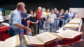
Zentralbibliothek Zürich is hosting a special event presenting its citizen-science campaign “Einzigartige Landkarten der ZB: Prunkvolles und Geheimes”. The initiative invites volunte...

Good news for all map lovers and history enthusiasts. You can now order a high-quality print of any map you find on OldMapsOnline, and it’s incredibly easy.🙌🏻 Just pick the map yo...

A brand-new way to explore old maps has just arrived! Jigsaw, the OldMapsOnline puzzle game. The goal is simple: rebuild a historical map as quickly as possible from scattered piece...

Got an idea that would make OldMapsOnline or TimeMap even better? Want to see what others are suggesting and help shape what gets built next? 🎉 The Feature Requests section is now ...
Hey OMO community! We’d love for you to help grow our map collection by uploading and tagging maps. Feel free to upload as many as you'd like, but the real magic happens when you tag...
We’re thrilled to share that Timemap was officially launched on Product Hunt, where it resonated deeply with the community and achieved an incredible milestone: 4th Product of the Da...
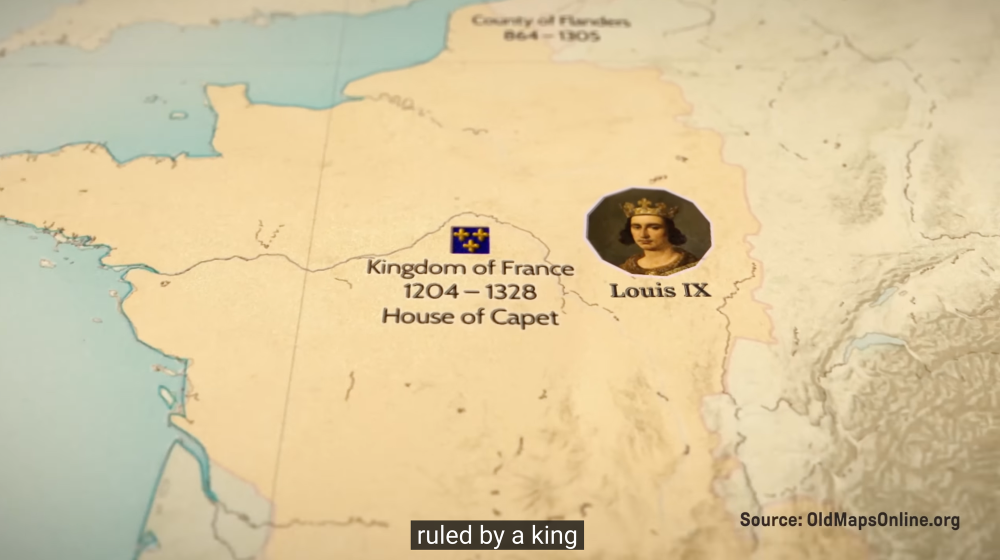
Johnny Harris is not your typical journalist. Based in Washington, DC, Harris has carved out a unique space in modern media as an Emmy-winning independent journalist and a contributo...
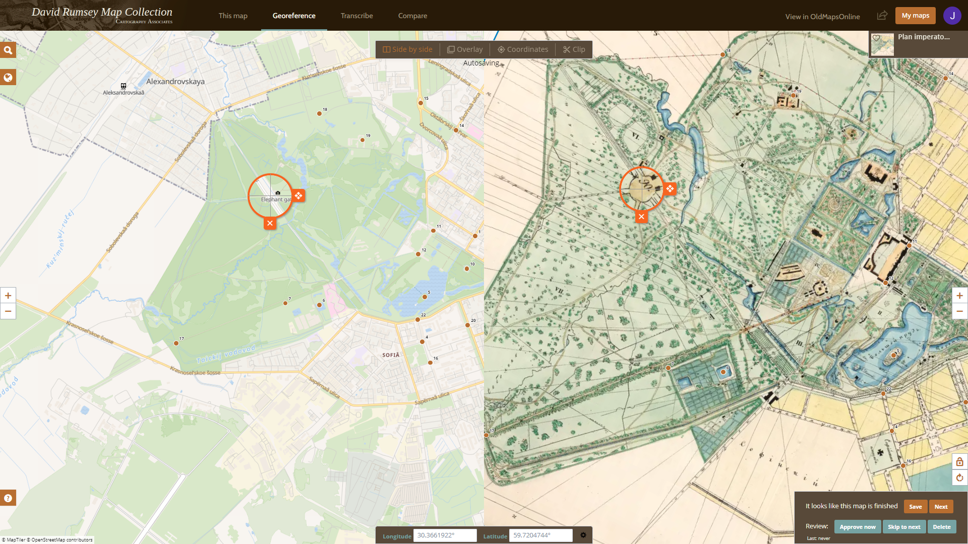
More than 8000 digitized maps from the David Rumsey Map Collection are now available for georeferencing. This vast archive, which spans centuries of cartographic history, offers an u...
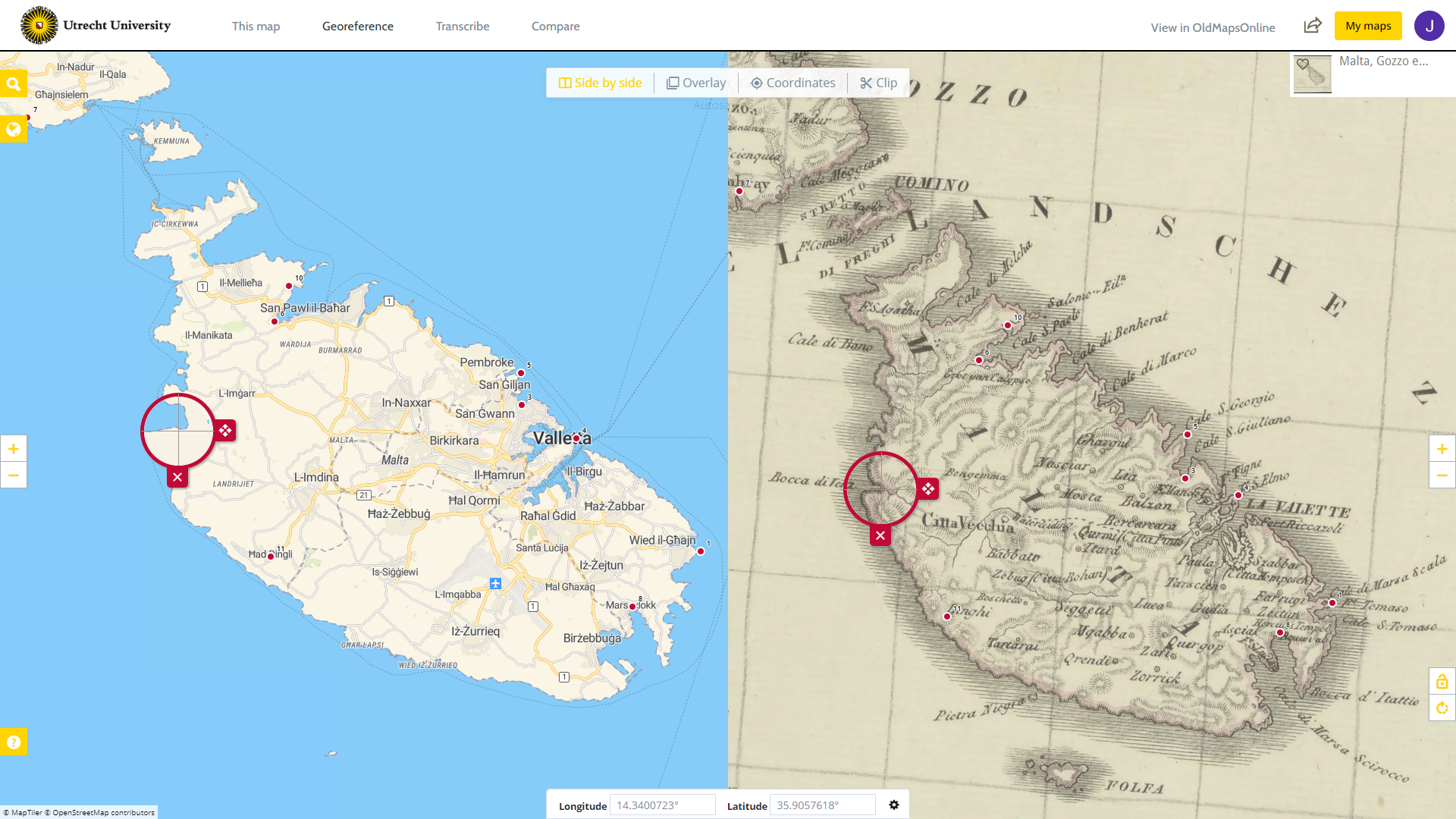
After the successful georeferencing project of Atlas Maior and Toonneel der Steden, where more than 800maps from the 17th century by publisher Blaeu were georeferenced, a new project...
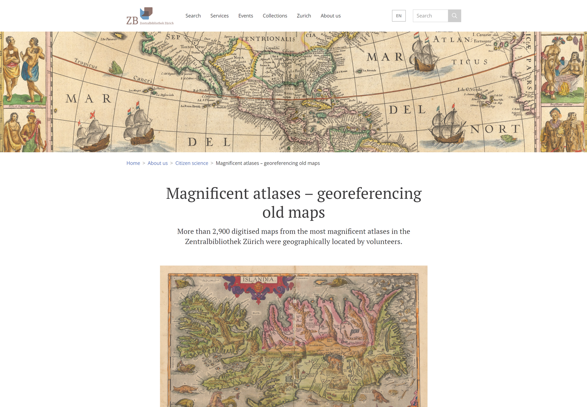
More than 2900 digitized maps from the most magnificent atlases of the Zentralbibliothek Zürich archives are waiting to be geographically located by those interested. Often ornately ...

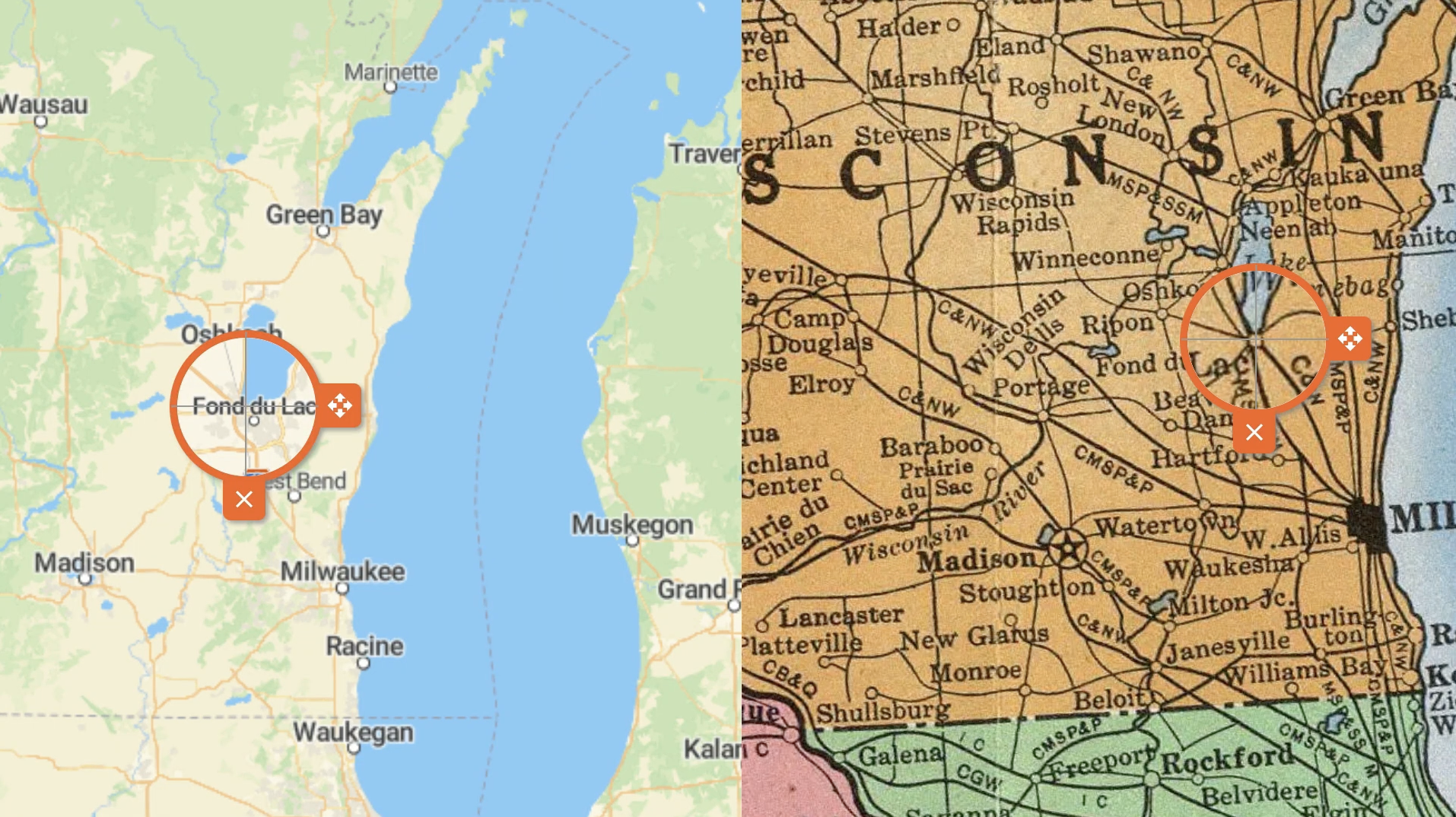
Compare and overlay maps with each other! In the new version released in December 2022, we integrated the Compare tool into the www.oldmapsonline.org search engine. Now you can easil...
A new crowdsourcing project of Utrecht University Library! A total of 847 maps from “Atlas Maior” and “Toonneel der Steden” by Joan Blaeu have been added to Georeferencer application...
After the Zentralbibliothek Zürich's "Durch Raum und Zeit" georeferencer project, maps from their collection have joined the OldMapsOnline portal. Dive into Switzerland's history fr...
The Moravian Library in Brno, Czech Republic, announces the results of the successful georeferencing contest, which was launched this year on the Staremapy.cz portal. The crowdsourc...

We are continuously and constantly enlarging the number of maps in our search engine database OldMapsOnline.org. We have recently added new historical maps and you can now search and...
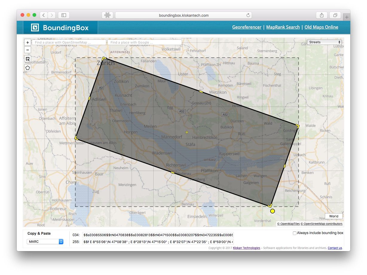
We have modernised our Bounding Box tool and added new features! The tool is freely available at http://boundingbox.klokantech.com and allows visual selection of geographic coordina...
Some of the historical maps are unfortunately not north-oriented. To turn the map while georeferencing will save time and help to find the depicted places. In the new user interface...
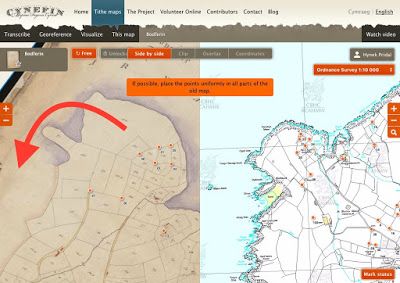
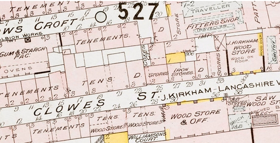
Tithe Maps are interesting source of historical information from 19th century in the United Kingdom. During our project, we came to a new challenge: Each map was accompanied by a sc...
Over 400 historical maps have been released by Technical University Darmstadt in a new Georeferencer pilot. The map collection of ULB has around 37.000 sheets from 16th to 20th centu...
Map lovers will find hours and hours worth of cartographic joys on this site that draws sources from the U.S. Geological Society, the National Library of Scotland, the Land Survey Of...
At Leiden University, over 300 hand-drawn manuscript maps from the collection of Van Keulen have been georeferenced in the new pilot. The maps were drawn between 1704-1755. After mo...
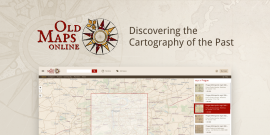
OldMapsOnline is a search engine for maps that allows visitors to explore and discover the beauty of historical maps depicting a past geographical place of interest. In the new vers...
We would like to give advanced notice to all our users that the infrastructure that our sites and services run on is being upgraded. This is essential maintenance and whilst it is h...
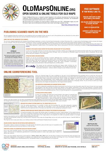
Available on our website is a complex overview of how to publish large images, such as scans or maps. The text was prepared for cultural heritage institutions, which often struggle ...
A new application of Georeferencer was announced on 7 November 2014 in New York. This time, another 40,000 maps have been published by David Rumsey and are available for online geor...
Petr from Klokan Technologies took part in the meeting and workshop in the New York Public Library. The aim of this meeting was to unify the processes of digitization of Old maps and...

Online scans of culture heritage documents, such as old maps, books, photographs, etc. are being published by the galleries, libraries, archives and museums. Until now there was no o...
In these days you have the unique opportunity to get involved and help the British Library to georeference new digitized maps, which were selected for scanning and online publishing ...

At the occasion of 120th anniversary celebration of the opening the building, the Battersea Arts Centre (BAC) in London together with Klokan Technologies GmbH have launched the digit...
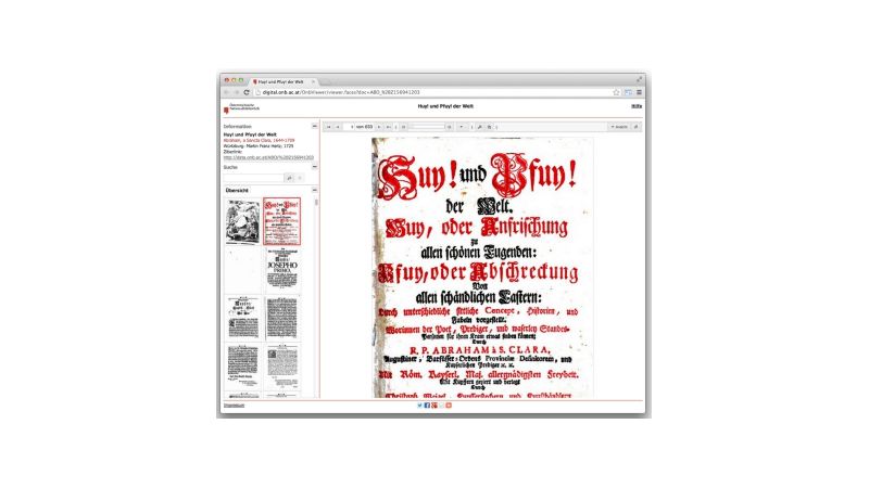
The Austrian National Library scanned first 100.000 complete historical books from the beginning of 16th century until the second half of the 19th century within the project Google B...
His Majesty King Willem-Alexander opens today the exhibition of Atlas Neederlanden. The MapTiler software has been used to produce the interactive online presentation of the histori...

OSGeo's Global Conference for Open Source Geospatial Software that brings together developers of map applications from all around the world. This year the conference took place in No...
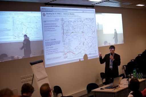
Yesterday we held our second conference on Working Digitally with Historical Maps. The first was held at the New York Public Library in February, and saw the original launch of the O...
Last Monday the project attended the AHRC-moot on Digital Transformations, held at the Mermaid Conference Centre in London. Humphrey Southall represented Old Maps Online and present...
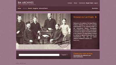
New website BMArchives.org has been launched. The site provides world-wide unique selection of digitised visual and cartographic historical material (over 30,000 images and almost 70...
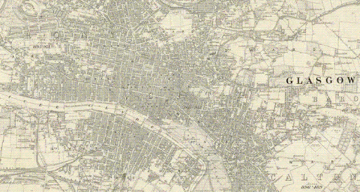
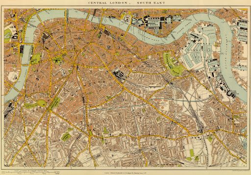
The next in our series of more in-depth posts about particular collections is focused on the National Library of Scotland's map collection. The first thing to note about this library...
JISC, who funded Old Maps Online, have requested that we review the success of our project, and how it can be sustained. Here we explore the ways our project has added value. First ...
The Joint Information Systems Committee (JISC) have awarded a grant of £139,900 as part of their JISC Content Programme for 2011-13 for a new project called Old Maps Online: Finding ...

Klokan Technologies, as a co-developer of a Culture Globe is proud to announce, that this project has become a winner of Europeana Hackaton competition. Feel free to try the project...
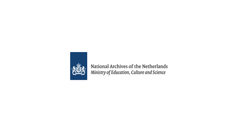
Klokan Technologies prepared Georeferencer application for Nationaal Archief (NA) in the Hague in May 2011. Thanks to Georeferencer, 650 maps were scanned and made available online i...
Petr Pridal from Klokan Technologies was on 6th International Workshop of Digital Approaches in Cartographic Heritage in Hague, 2011. Progress of OldMapsOnline project done for Mora...
Various historical maps from the collection of National Library of Scotland were digitized thanks to our tool Georeferencer. You can find more information about this project as well...
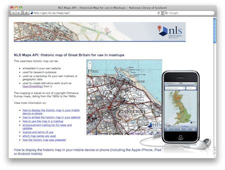
With the help of the software developed in our project OldMapsOnline.org has prepared a very interesting historical mapping application, allowing anyone to include selected historica...
The ICA Commission on Digital Technologies in Cartographic Heritage and Vienna University of Technology are organising the 5th International Workshop on Digital Approaches in Cartog...

Moravian Library and the OldMapsOnline.org project are proud to announce the release of a new version of the open-source IIPImage server software (http://help.oldmapsonline.org/jpeg2...
OldMapsOnline.org workflow was presented during a Workshop organized by The Map Curators' Group of the British Cartographic Society. The title of the workshop was "From paper to scre...
ICHC 2009 - International Conference on the History of Cartography was this year in Copenhagen, Denmark - July 12th - 17th. Historians and librarians, map curators and people from a...
At the European Library Automation Group (ELAG) conference we discussed the comprehensive workflow which we recommend for rare maps publishing in libraries. The final summarizing pre...
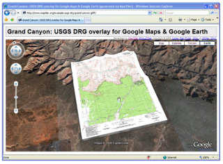
We actively contributed to the development of the MapTiler application, which is an excellent tool for fast and easy to use publishing of any existing raster maps, which are already ...
We have proposed to organize a workshop as a part of the ELAG 2009: New Tools of the Trade conference, which will be held on 22-24 April 2009 in Bratislava, Slovakia. We have just b...
Old maps publishing is an important part of the workflow which is being developed by our project. We would like to simplify this process as much as possible and that is why OldMapsOn...
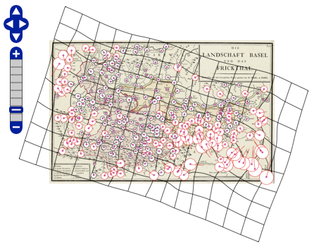
MapAnalyst is a software for the accurate analysis of old maps. Its main purpose is to compute distortion grids and other types of visualizations that illustrate the geometrical accu...
An article describing open-source tools for publishing scanned old maps and also prototypes and planned tools of our grant was published in the latest issue of e-Perimetron - the int...
How should the search interface produced by our project look like ? Let's have a look first at existing implementations of such search... One of the best map search interfaces is n...