Project
Community
News
My App
My maps
Maps of Municipality of Rače-Fram
Advanced search
All
Private
Favorites
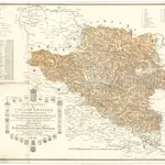
Neueste special Karte des Cillier Kreises im Herzogthume Steyermark
1836|Jos. Fr. Kaiser
1:220 000
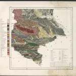
Geologische Uebersichtskarte des Herzogthumes Steiermark
1865|Schneider, Theodor
1:295 000
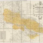
Spezial Karte des Marburger Kreises im Herzogthum Steyermark
1841|Jos. Fr. Kaiser
1:220 000
Neueste special Karte des Cillier Kreises im Herzogthume Steyermark
1840|Jos. Fr. Kaiser
1:210 000
Special Karte des Marburger Kreises im Herzogthume Steyermark
1836|Jos. Fr. Kaiser
1:200 000
Routen von und nach dem Badeorte Töplitz
1870|C. Albrecht
Spezial Karte des Marburger Kreises im Herzogthum Steyermark
1836|Jos. Fr. Kaiser
1:220 000
1600
1650
1700
1750
1800
1850
1900
1950
2000
History
Old maps of Municipality of Rače-Fram
Discover the past of Municipality of Rače-Fram on historical maps
Old maps of Municipality of Rače-Fram
Discover the past of Municipality of Rače-Fram on historical maps
Explore Maps
Discover History
Parent places
Slovenia
Related places
© MapTiler
© OpenStreetMap
 1836|Jos. Fr. Kaiser1:220 000
 1865|Schneider, Theodor1:295 000
 1841|Jos. Fr. Kaiser1:220 000
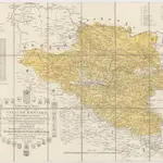 1840|Jos. Fr. Kaiser1:210 000
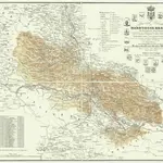 1836|Jos. Fr. Kaiser1:200 000
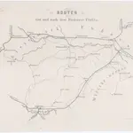 1870|C. Albrecht
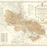 1836|Jos. Fr. Kaiser1:220 000