Project
Community
News
My App
My maps
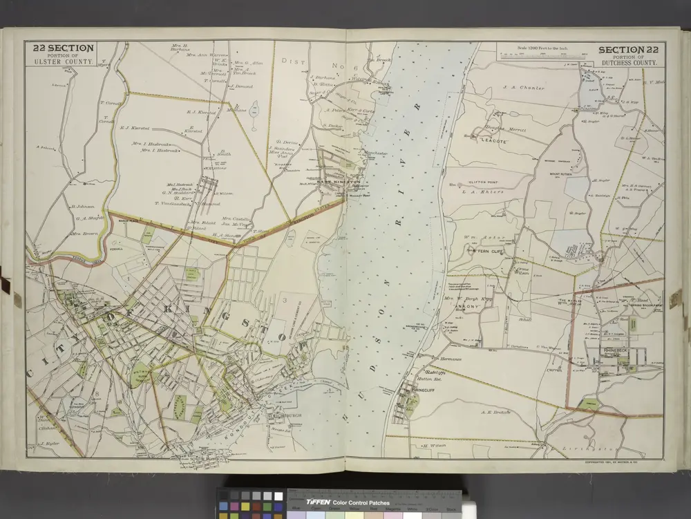
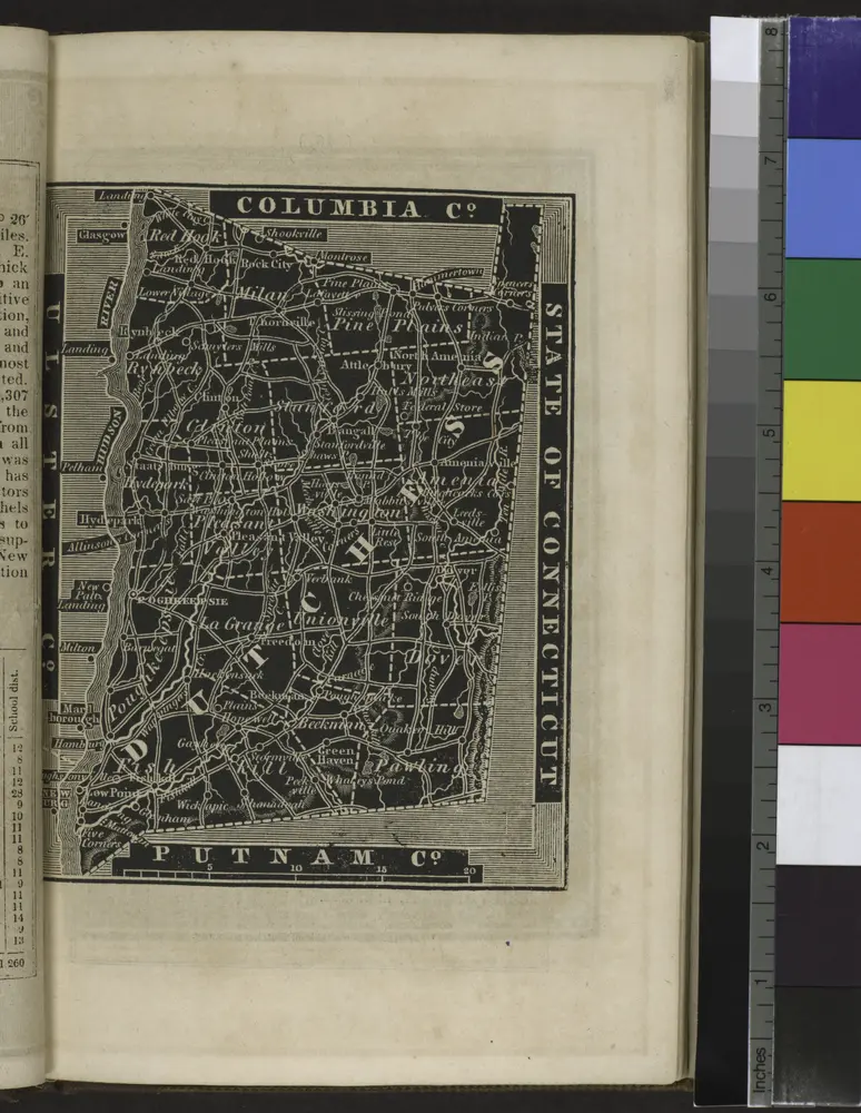
Portion of Ulster County. ; Portion of Dutchess County.
1891
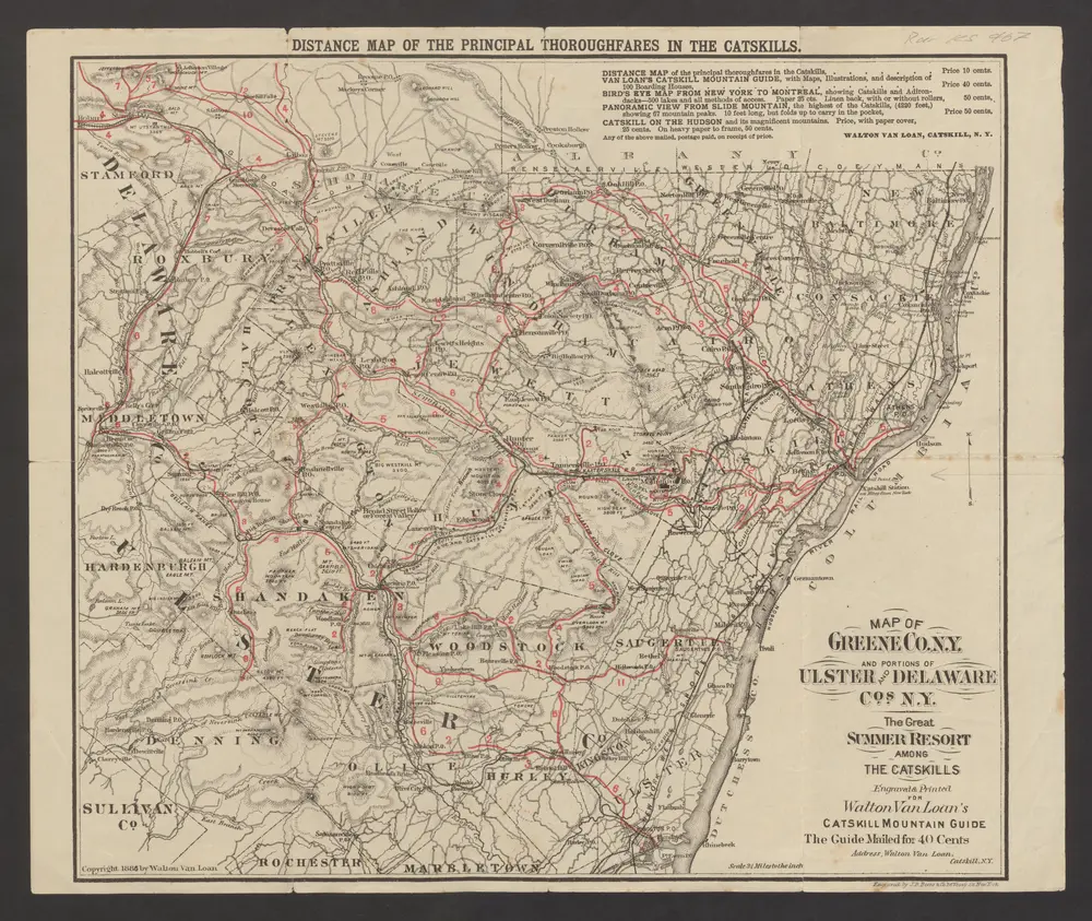
Distance map of the principal thoroughfares in the Catskills : Map of Greene co. N. Y. and portions of Ulster and Delaware cos. N.Y.
1886
Catskill : Walton van Loan Walton van Loan
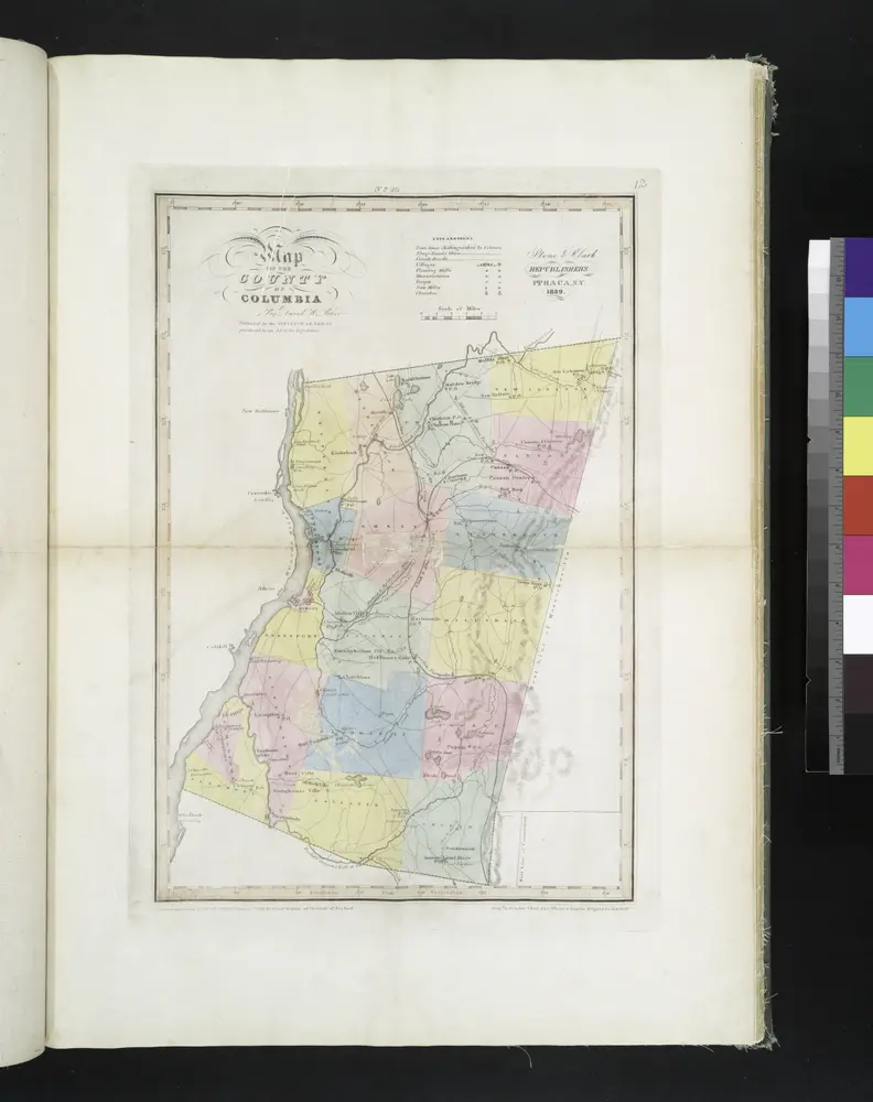
Map of the county of Columbia / by David H. Burr ; engd. by Rawdon, Clark & Co., Albany, & Rawdon, Wright & Co., New York.
1829
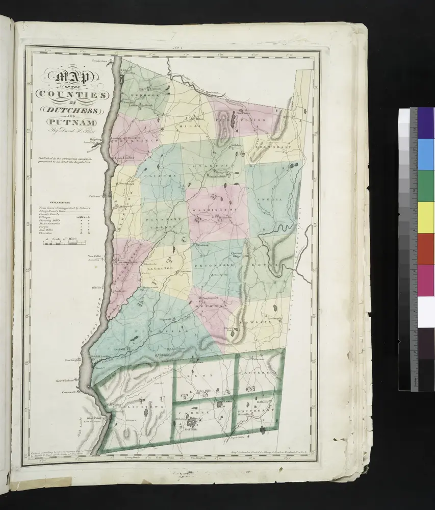
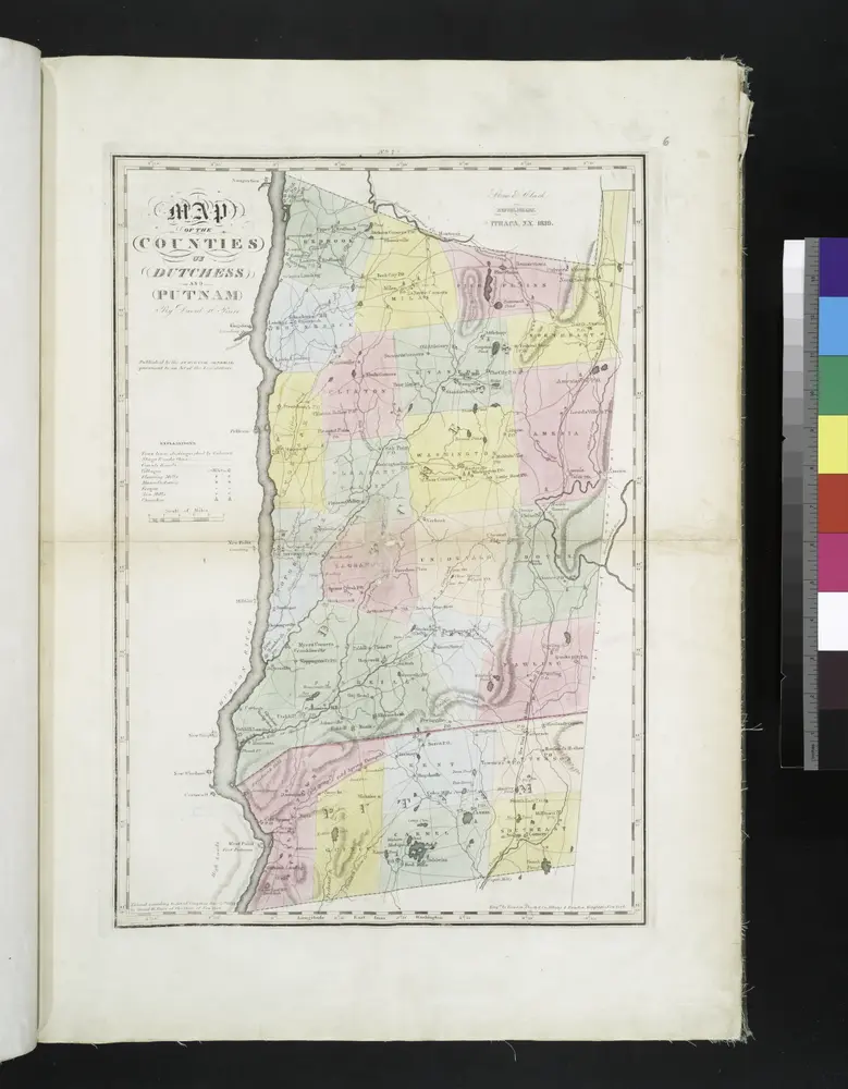
Map of the counties of Dutchess and Putnam / by David H. Burr ; engd. by Rawdon, Clark & Co., Albany, & Rawdon, Wright & Co., New York.
1829
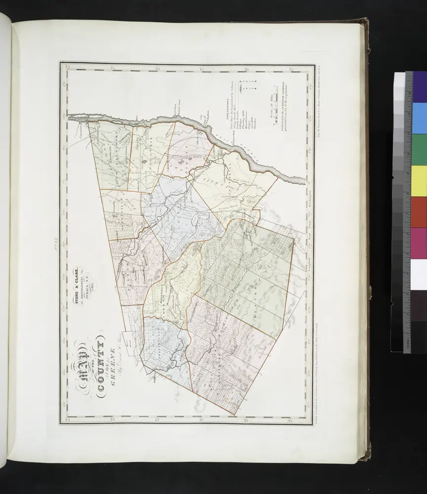
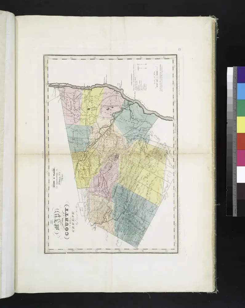
Map of the county of Greene / by David H. Burr ; engd. by Rawdon, Clark & Co., Albany, & Rawdon, Wright & Co., New York.
1841
[Dutchess County].
1838
Map of the county of Greene / by David H. Burr ; engd. by Rawdon, Clark & Co., Albany, & Rawdon, Wright & Co., New York.
1829
Map of the county of Ulster / by David H. Burr ; engd. by Rawdon, Clark & Co., Albany, & Rawdon, Wright & Co., New York.
1829
Map of the counties of Dutchess and Putnam / by David H. Burr ; engd. by Rawdon, Clark & Co., Albany, & Rawdon, Wright & Co., New York.
1829
Map of the county of Columbia / by David H. Burr ; engd. by Rawdon, Clark & Co., Albany, & Rawdon, Wright & Co., New York.
1829
Geschiedenis
Old maps of Hurley, New York
Discover the past of Hurley, New York on historical maps
Old maps of Hurley, New York
Discover the past of Hurley, New York on historical maps
Explore Maps
Discover History
Parent places
Ulster County, New York
Related places