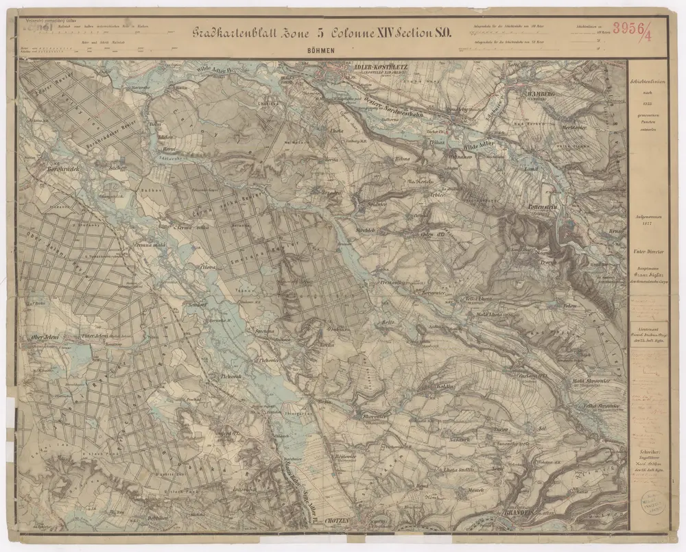
1877
1:25k
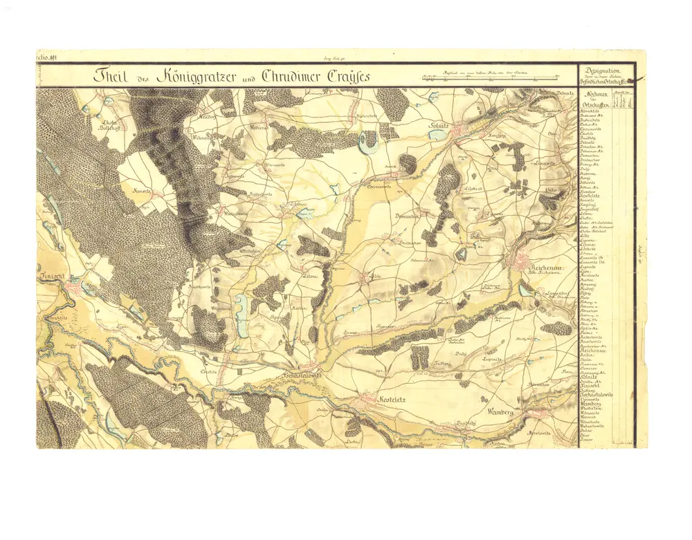
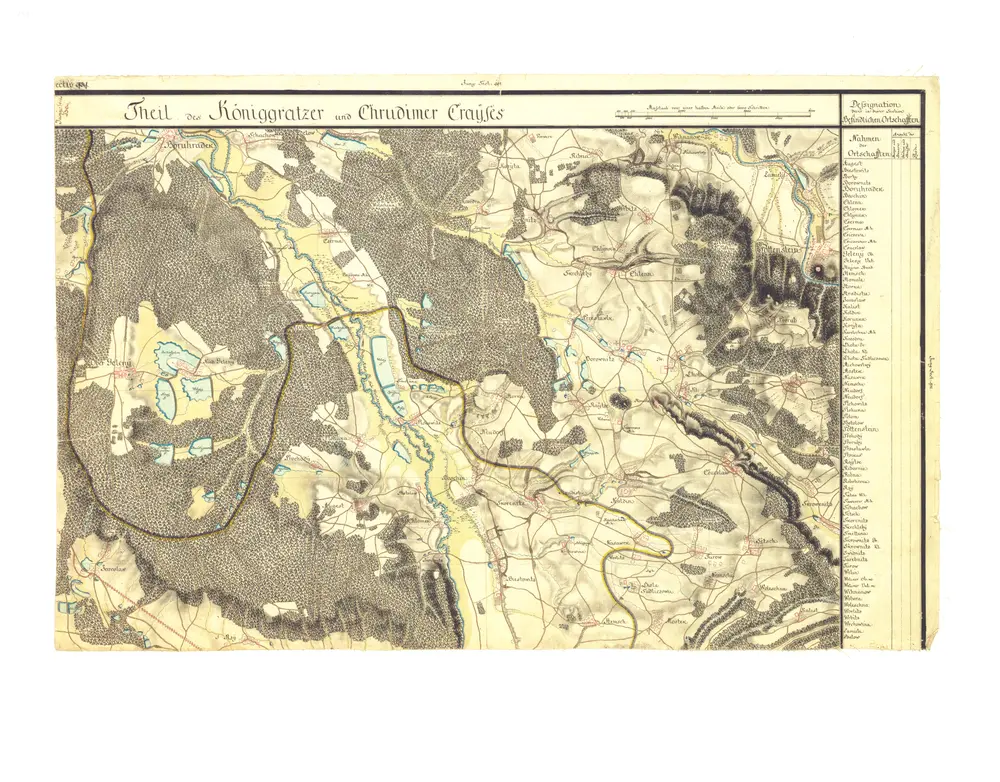
1783
1:29k
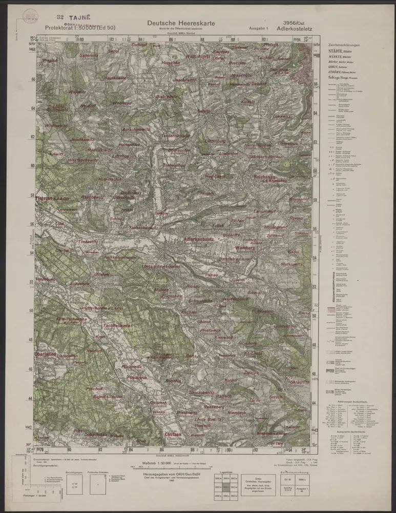
1945
Herausgegeben vom OKH / Gen St d H
1:50k
1929
Vojenský zeměpisný ústav
1:75k
1928
1938
Vojenský zeměpisný ústav,
1902
K. u. k. militär-geographisches Institut