Project
Community
News
My App
My maps
Maps of Coral Hills, Maryland
Advanced search
All
Private
Favorites
Maps of the Eastern, Middle and Southern States: Washington
1861|L. Prang & Co.
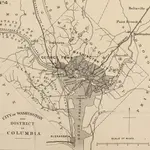
Strategic War Points of the United States no.4: city of Washington and District of Columbia
1861|J. Wyld
(District of) Columbia.
1828|Hassel, Georg, 1770-1829
Strategic War Points of the United States no.4: city of Washington and District of Columbia
1861|J. Wyld
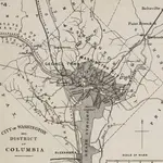
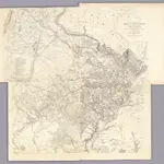
Washington & its vicinity
1861|J.H. Bufford's Lith.
1:18 100
Map Of N. Eastern Virginia And Vicinity Of Washington
1862|U.S. War Department, Topographical Engineers
1:63 360
Map of the Battle Ground, showing 5 mile distances from Washington
1861|L. Prang & Co.
1600
1650
1700
1750
1800
1850
1900
1950
2000
History
Old maps of Coral Hills, Maryland
Discover the past of Coral Hills, Maryland on historical maps
Old maps of Coral Hills, Maryland
Discover the past of Coral Hills, Maryland on historical maps
Explore Maps
Discover History
Parent places
Prince George's County, Maryland
Related places
© MapTiler
© OpenStreetMap
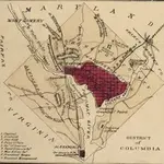 1861|L. Prang & Co.
 1861|J. Wyld
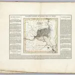 1828|Hassel, Georg, 1770-1829
 1861|J. Wyld
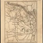 1861|J.H. Bufford's Lith.1:18 100
 1862|U.S. War Department, Topographical Engineers1:63 360
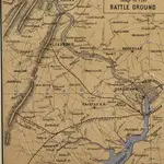 1861|L. Prang & Co.