Projekt
Gemeinschaft
Nachrichten
Meine App
Meine Karten
Skatalogowana mapa
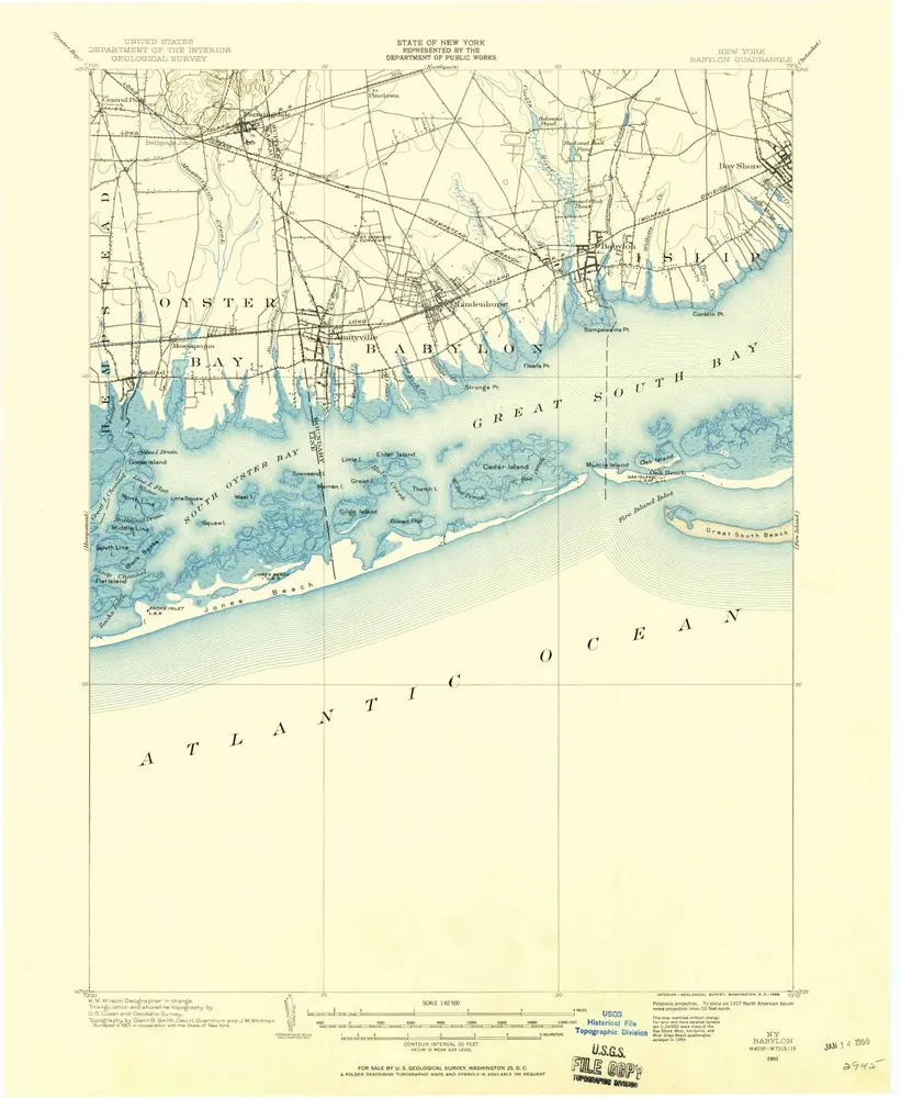
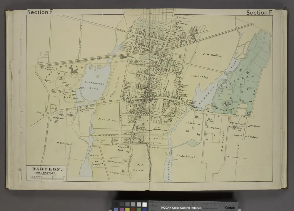
Babylon
Ansicht auf externer Website
Digitalisierte Bilder ansehen
Instytucja:
United States Geological Survey
Pełny tytuł:
Babylon
Rok ilustracji:
1901
Data publikacji:
1958
Skala mapy:
1:62 500
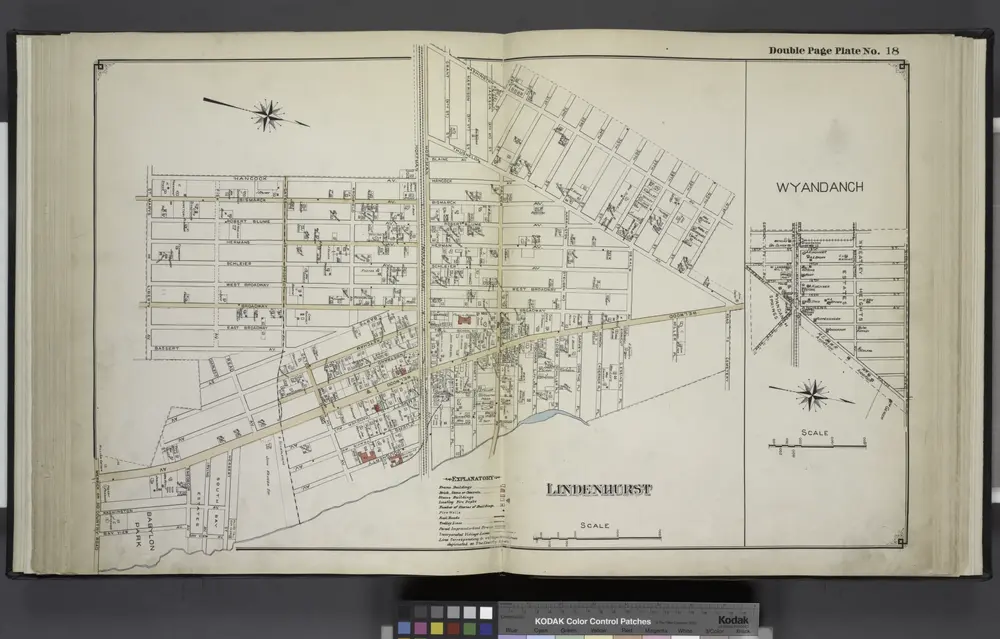
Lindenhurst; Wyandanch
1915
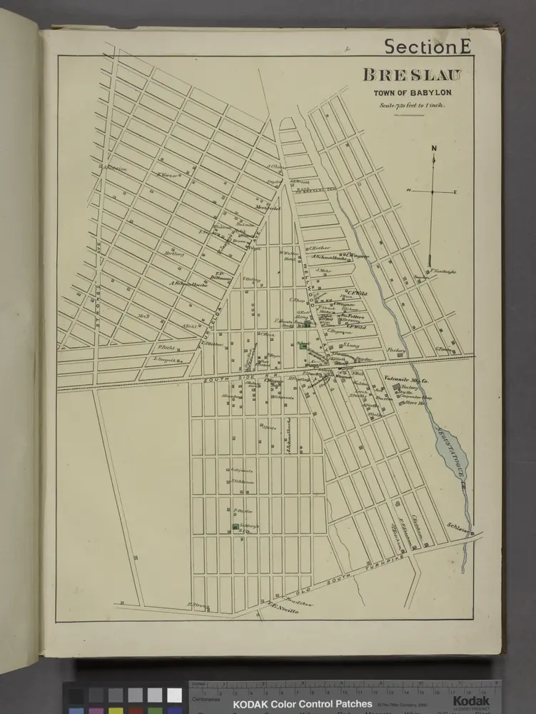
Breslau. [Village]
1888
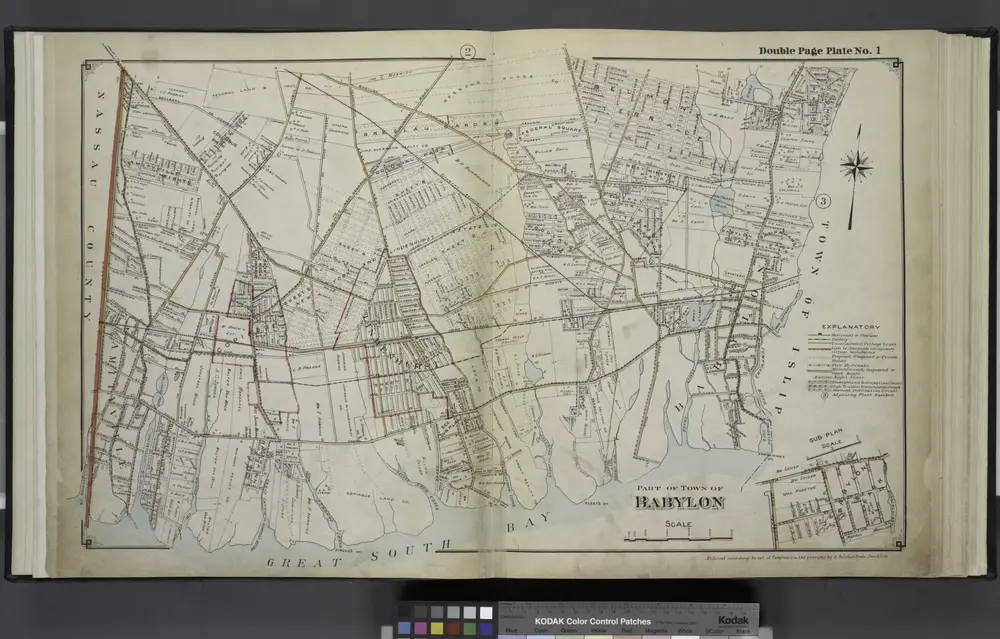
Part of Town Babylon
1915
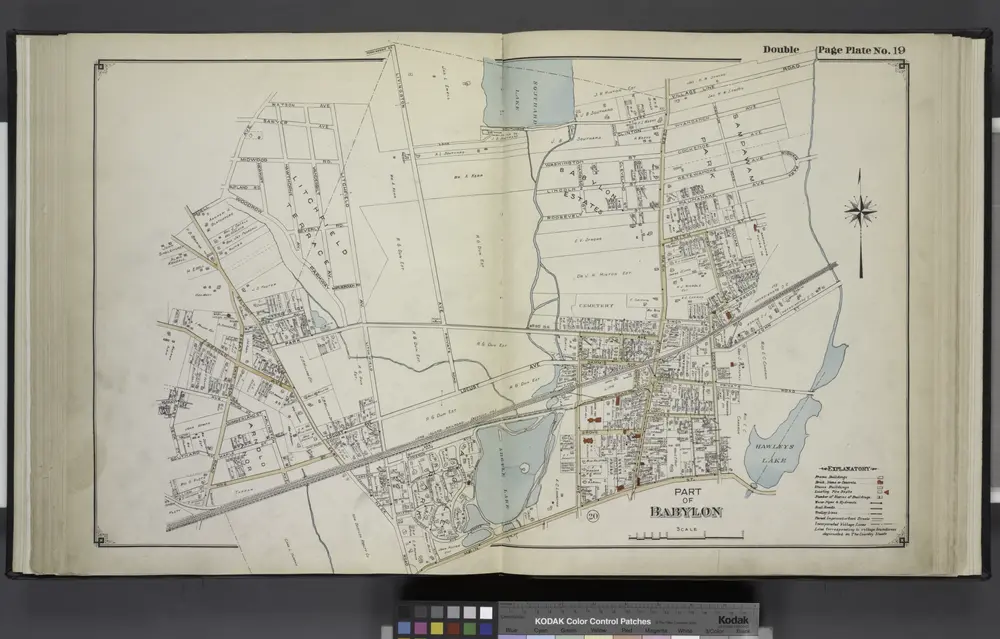
Part of Babylon
1915
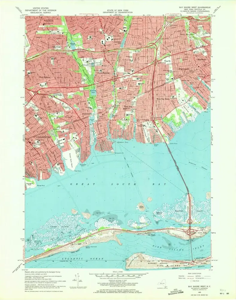
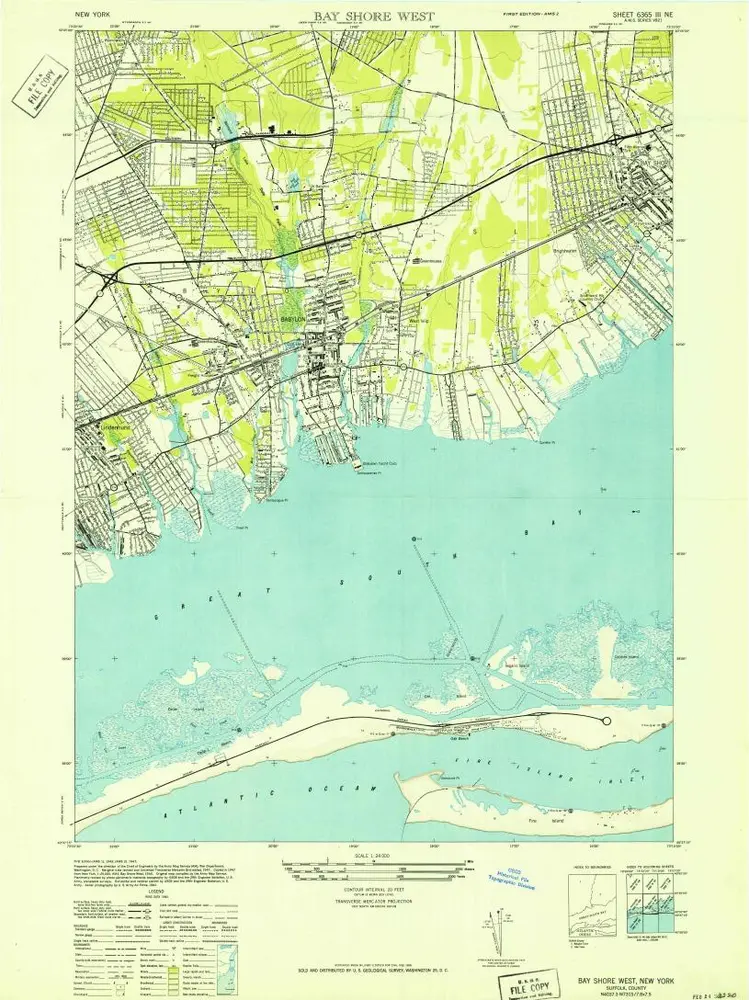
Bay Shore West
1969
1:24k
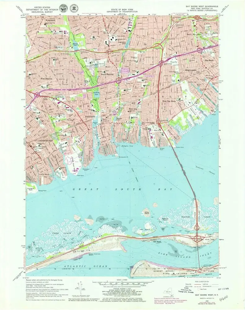
Bay Shore West
1969
1:24k
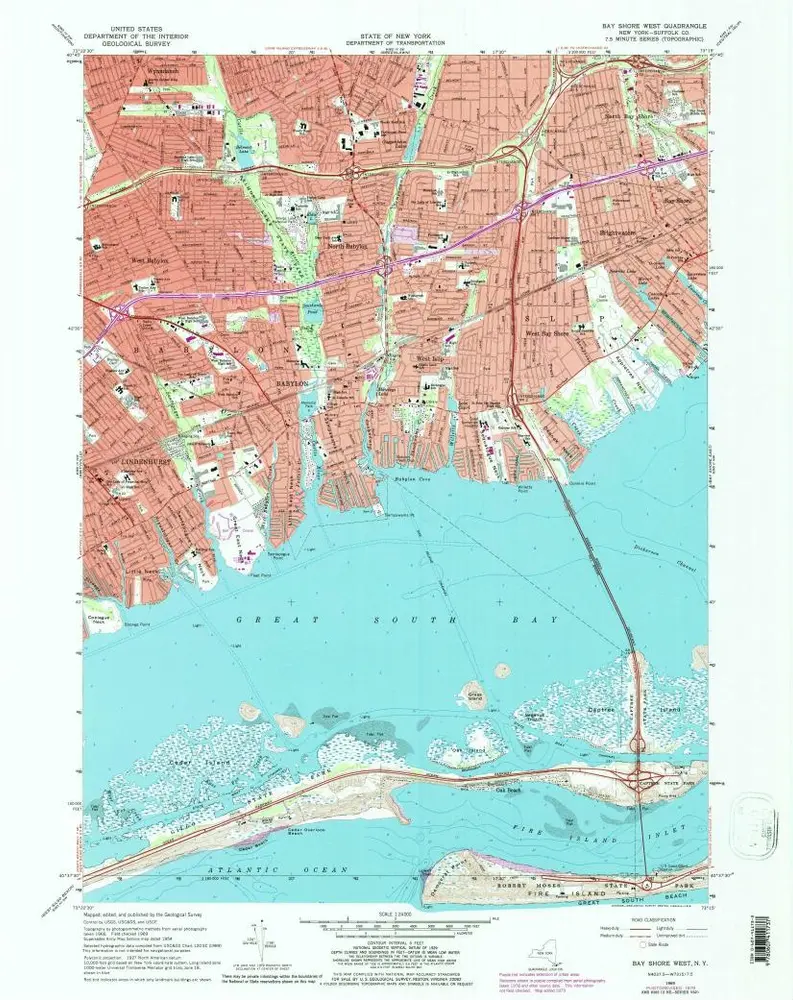
Bay Shore West
1969
1:24k
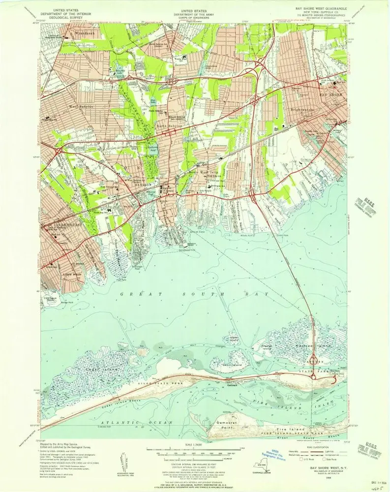
Bay Shore West
1954
1:24k
Bay Shore West
1941
1:24k
Babylon. [Village]
1888
Historia