Katalogisierte Karte
Ludlow - OS One-Inch Map

Einrichtung:National Library of Scotland
Vollständiger Titel:Ludlow - OS One-Inch Map
Jahr der Abbildung:1949
Veröffentlichungsdatum:1952
Herausgeber:Ordnance Survey
Maßstab der Karte:1:63 360
An accurate map of Hereford Shire
1755
Bowen; Tinney
Herefordia comitatvs
1646
Blaeu
n/a
1742
Hereford - OS One-Inch Map
1944
Ordnance Survey
1:63k
New map of the county of Hereford, 1
1754
s.n.
New map of the county of Hereford, 2
1754
s.n.
New map of the county of Hereford, 4
1754
s.n.
New map of the county of Hereford, 3
1754
s.n.
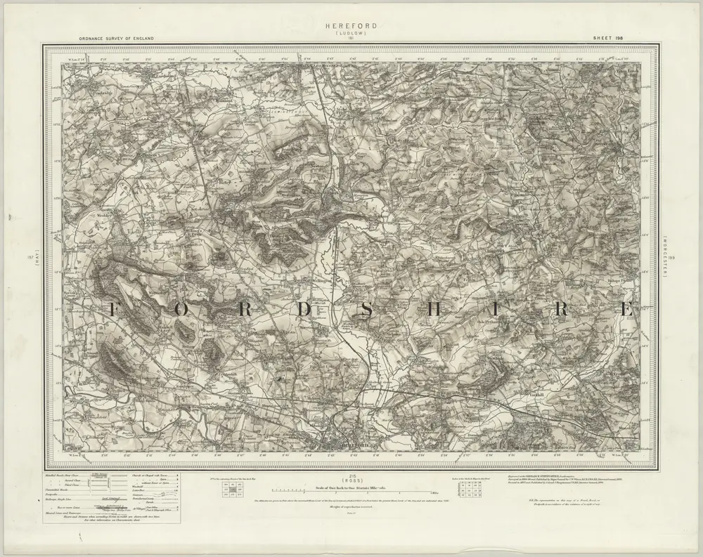
Hereford (Hills) - OS One-Inch Revised New Series
1897
Ordnance Survey
1:63k
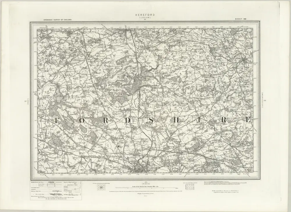
Hereford (Outline) - OS One-Inch Revised New Series
1897
Ordnance Survey
1:63k