Projekt
Komunita
Novinky
Moje aplikace
Moje mapy
Katalogisierte Karte
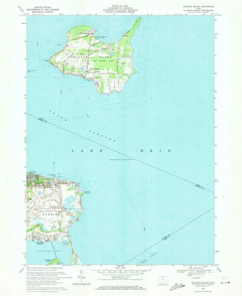
Kelleys Island
Zobrazit na externích webových stránkách
Zobrazit digitalizované
Einrichtung:
United States Geological Survey
Vollständiger Titel:
Kelleys Island
Jahr der Abbildung:
1969
Veröffentlichungsdatum:
1971
Maßstab der Karte:
1:24 000
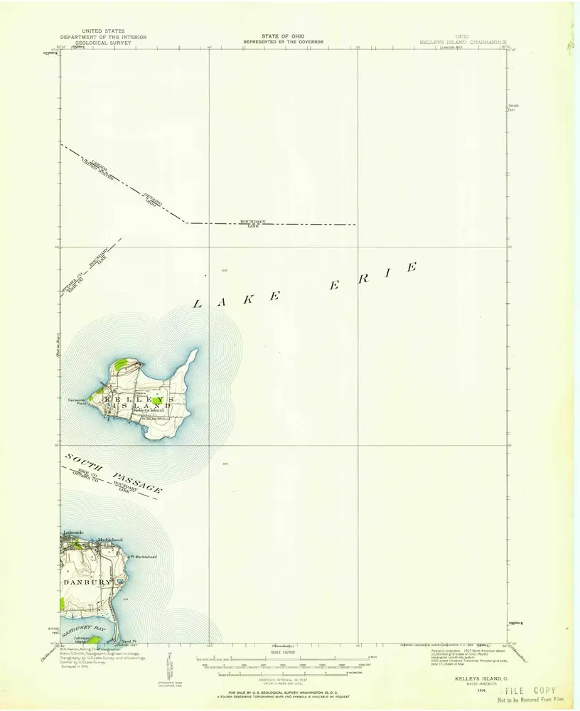
Kelleys Island
1919
1:63k
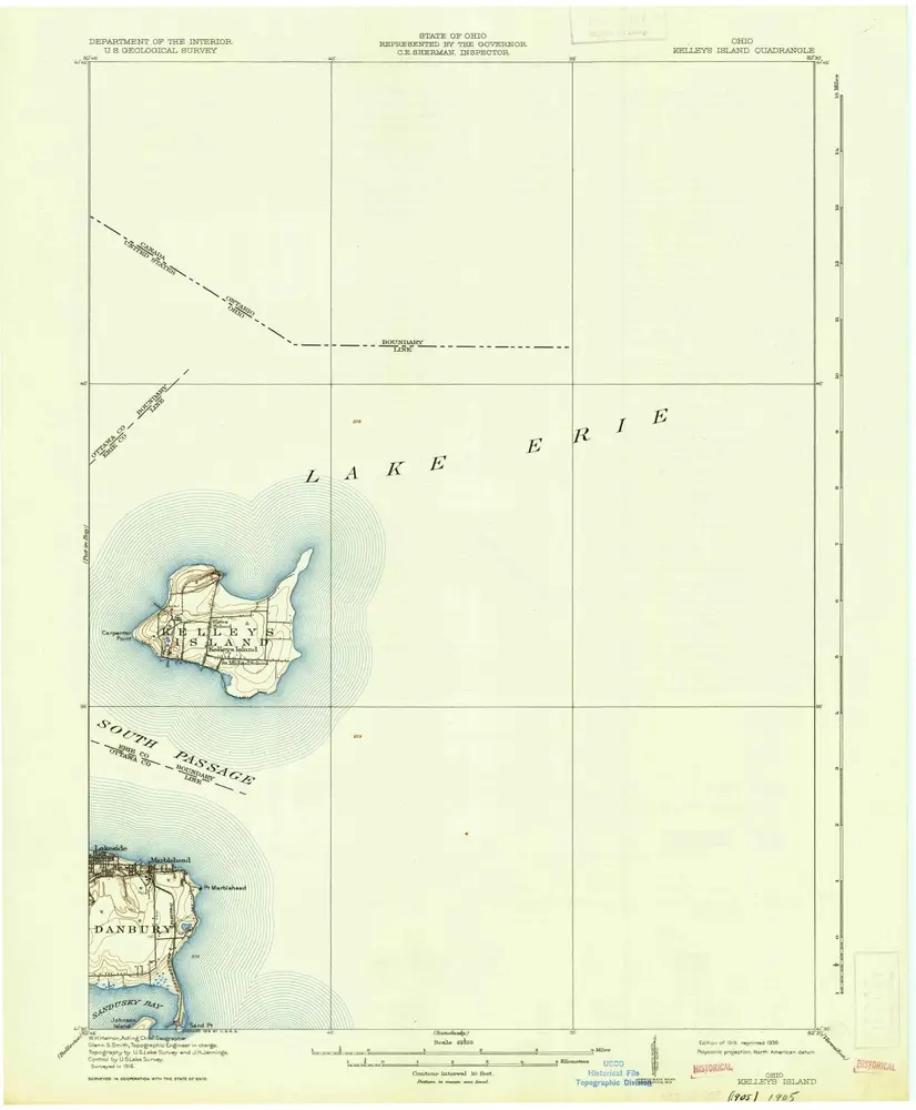
Kelleys Island
1916
1:63k
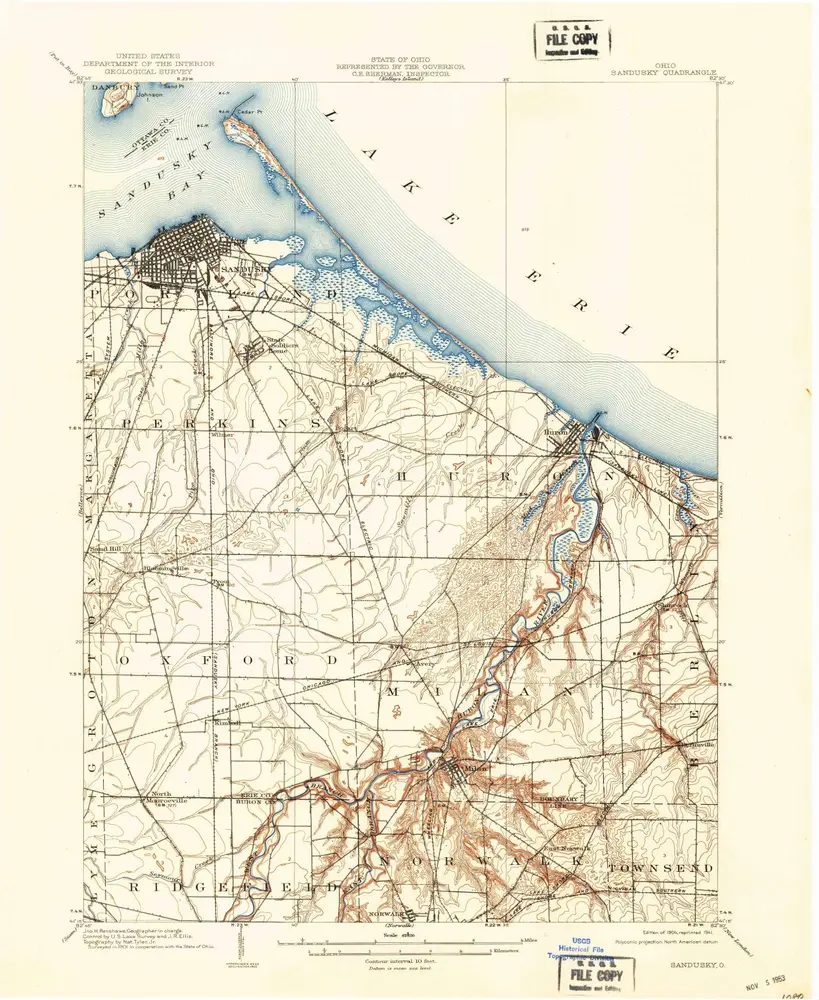
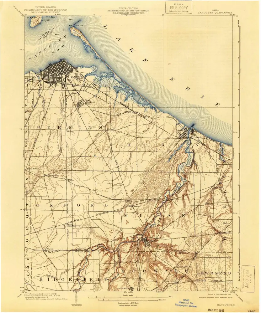
Sandusky
1904
1:63k
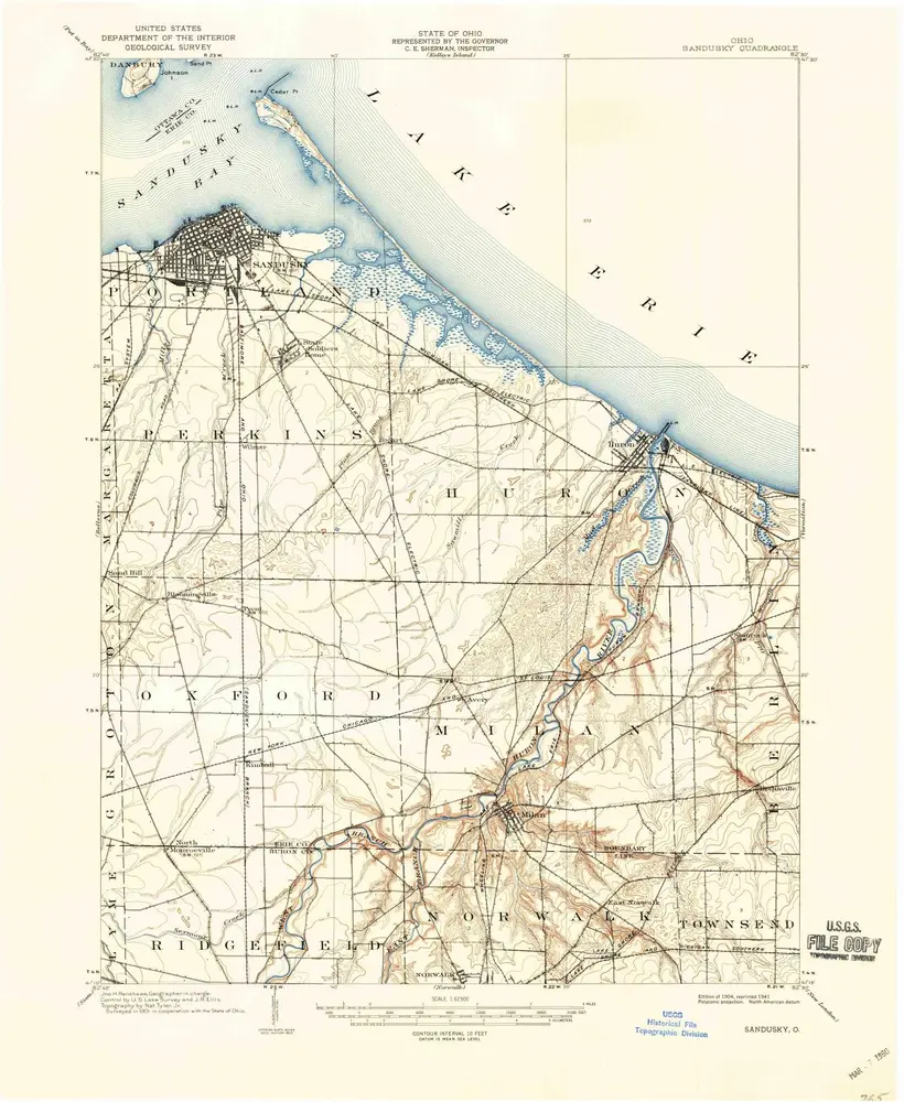
Sandusky
1904
1:63k
Sandusky
1904
1:63k
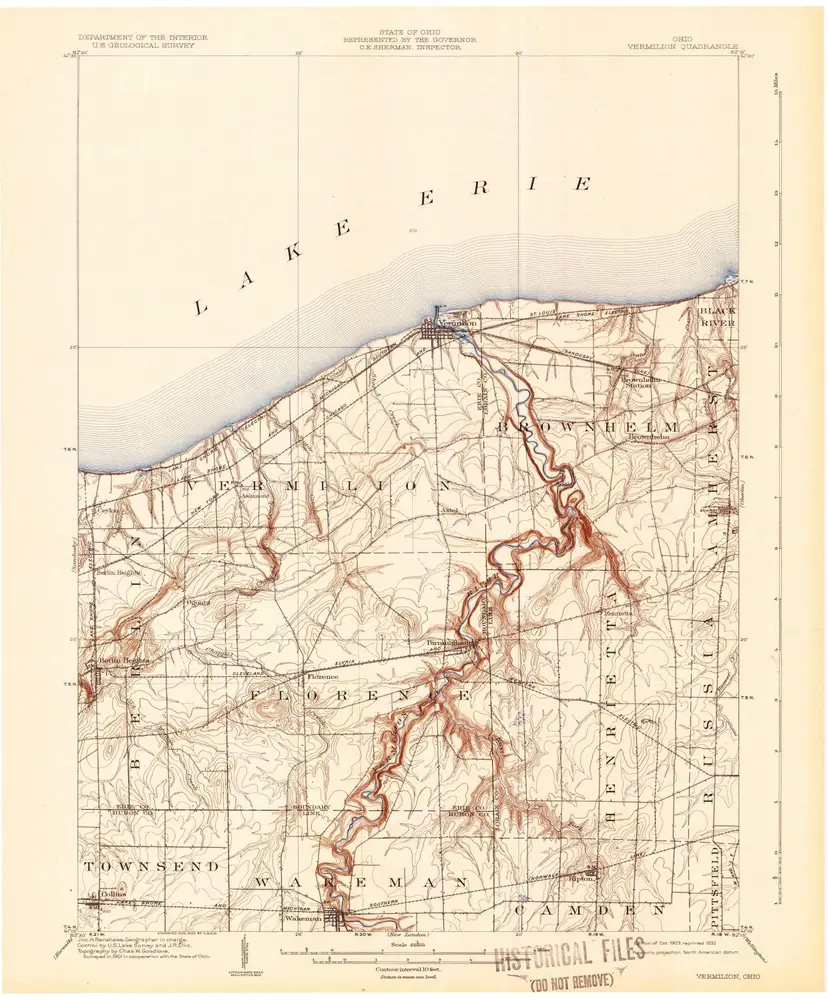
Vermilion
1903
1:63k
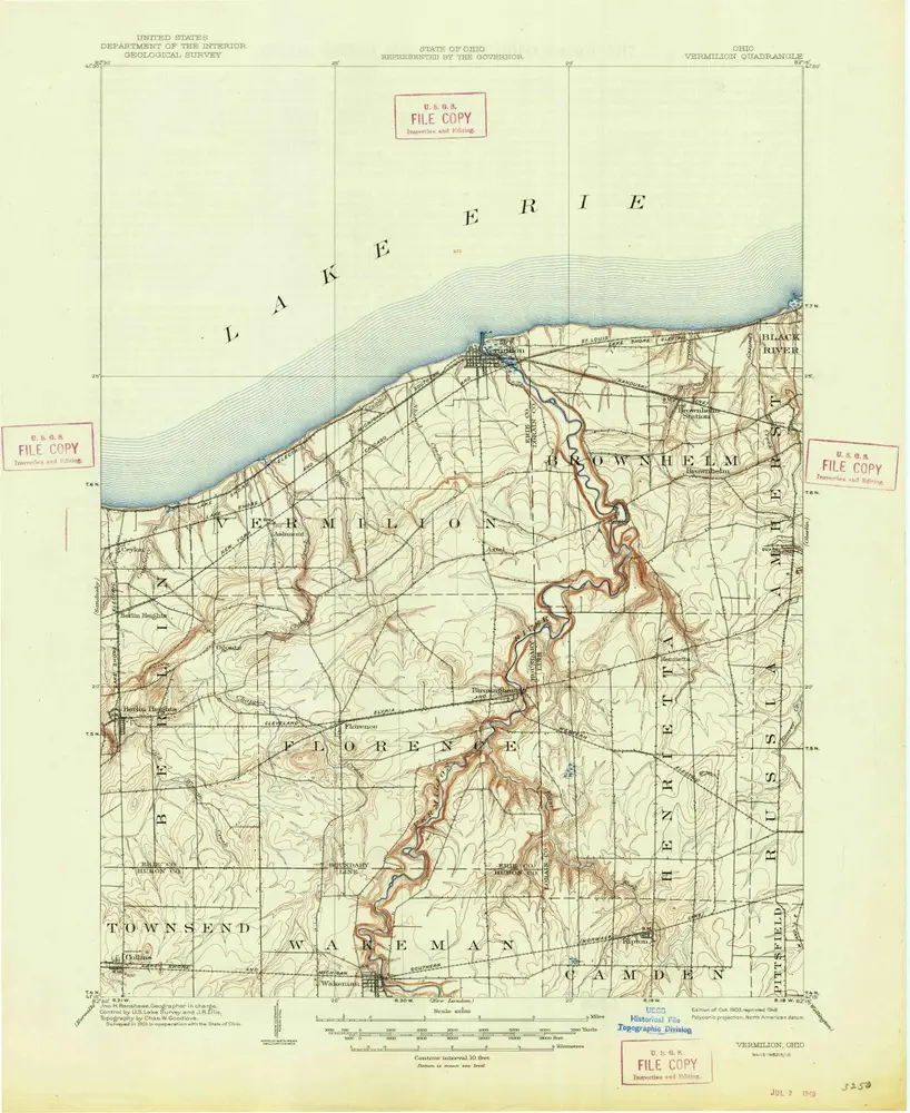
Vermilion
1903
1:63k
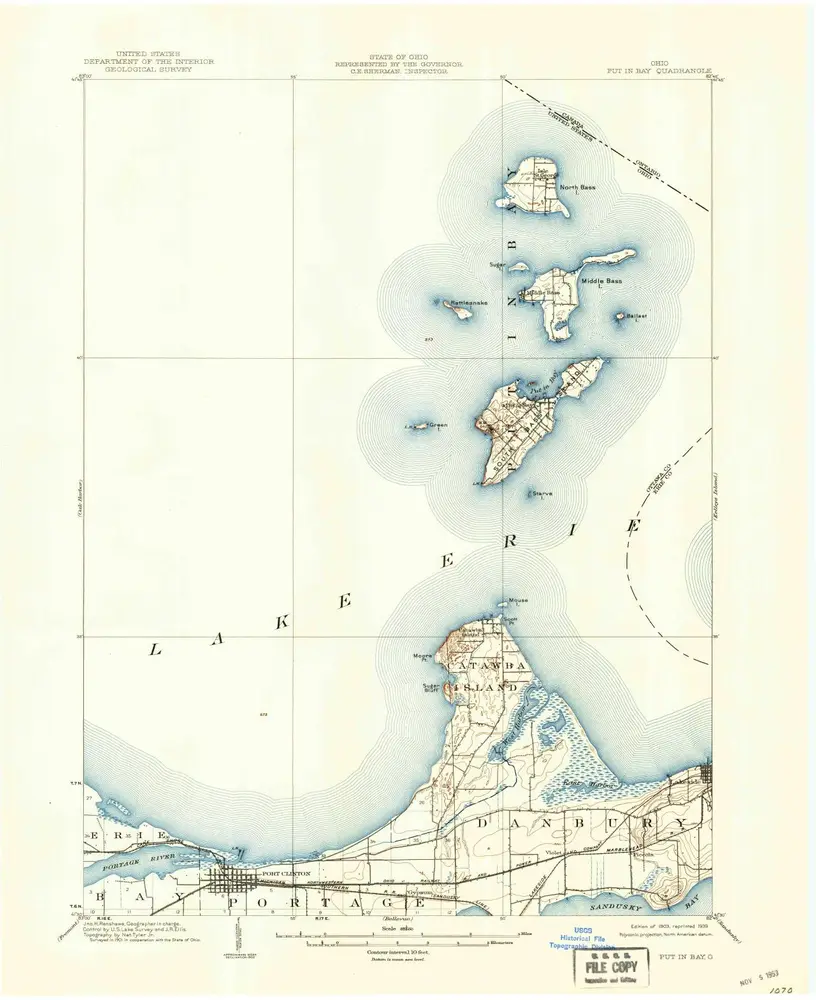
Put In Bay
1903
1:63k
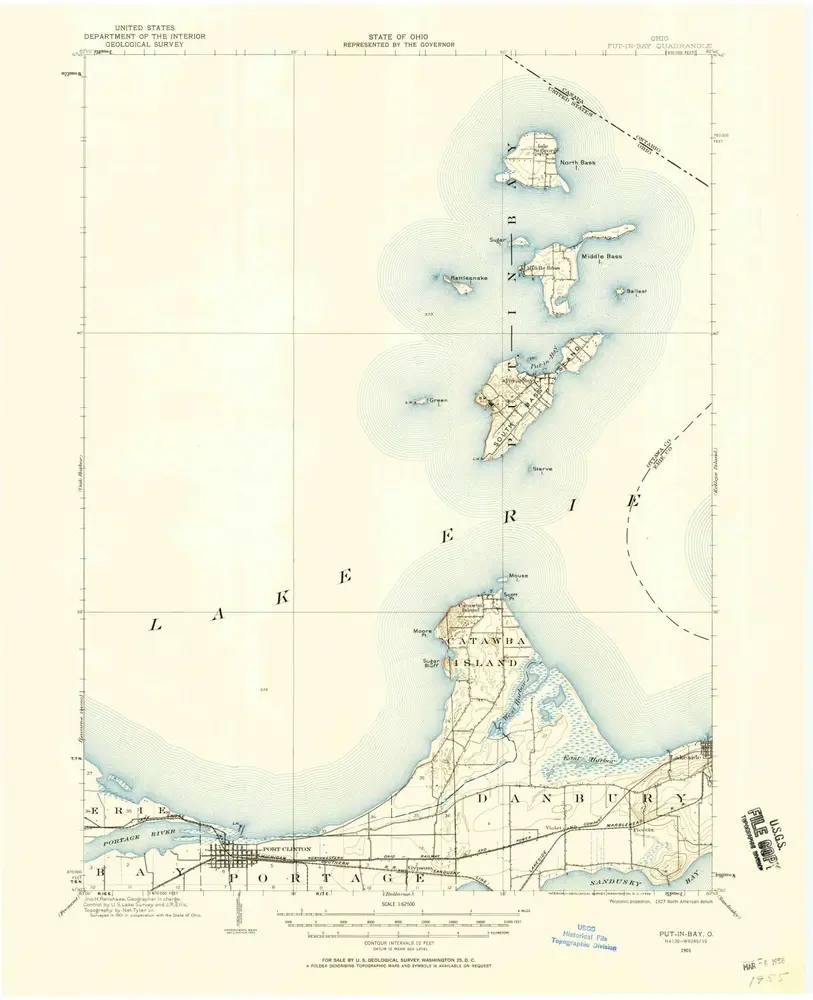
Put-In-Bay
1901
1:63k
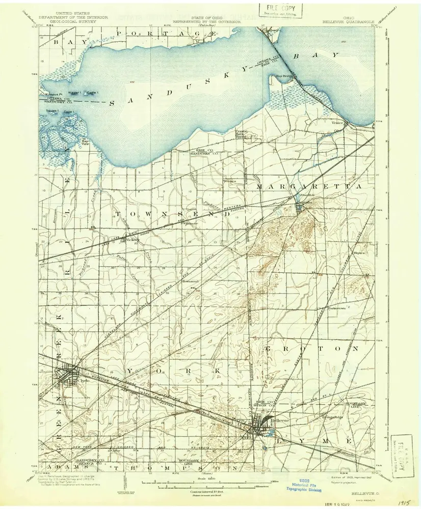
Bellevue
1903
1:63k
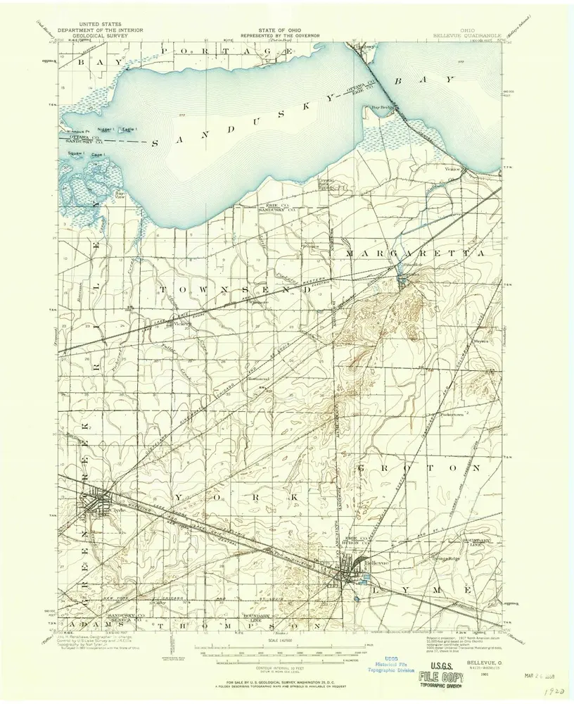
Bellevue
1901
1:63k
Geschichte