A complete History of the great American Rebellion, embracing its causes, events and consequences. With biographical sketches and portraits of its principal actors, and scenes and incidents of the War. Illustrated with maps, plans, etc
1865|STORKE, Elliot G. and BROCKETT (L. P.)
A Chronological History of the Civil War in America, illustrated with A. I. Johnson's and I. H. Colton's Steelplate Maps and Plans of the Southern States and Harbors
1863|FISHER, Richard Swainson.
[Neueste Karte von Süd Carolina mit seinen Canaelen, Strassen, Dampfschiff Routen und Entfernungen der Hauptpunkte]
1860|Meyer, J.
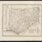
Georgia.
1842|Colby, Charles A.1:1 650 000
Neueste Karte von Georgia mit seinen Strassen, Eisenbahnen und Entfernungen
1860|Meyer, J.
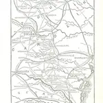
Caroline du Nord.
1825|Buchon, J. A. C.; Carey, H. C.; Lea, I.1:1 650 000
 1865|STORKE, Elliot G. and BROCKETT (L. P.)
 1863|FISHER, Richard Swainson.
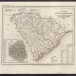 1860|Meyer, J.
 1842|Colby, Charles A.1:1 650 000
 1860|Meyer, J.
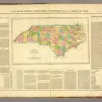 1825|Buchon, J. A. C.; Carey, H. C.; Lea, I.1:1 650 000
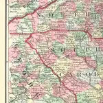
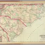 1874|Asher & Adams1:1 267 200