المشروع
المجتمع
الأخبار
تطبيقي
خرائطي
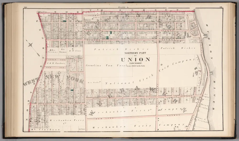
Northern Part of the Union Township - Plate A.
1873
Hopkins, G.M.
1:3k
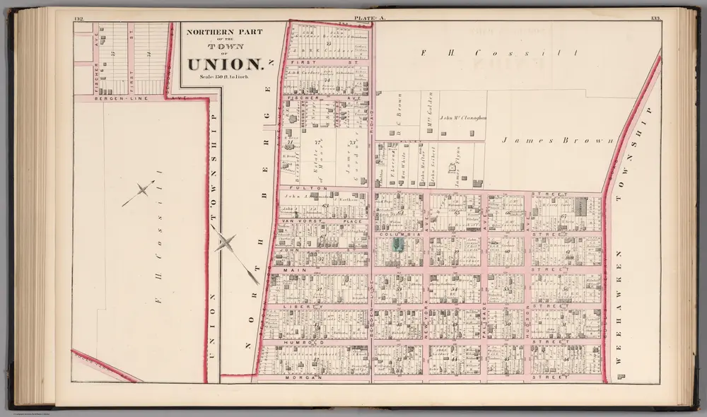
Northern Part of the Town of Union - Plate A.
1873
Hopkins, G.M.
1:2k
8A - N.Y. City (Aerial Set).
1924
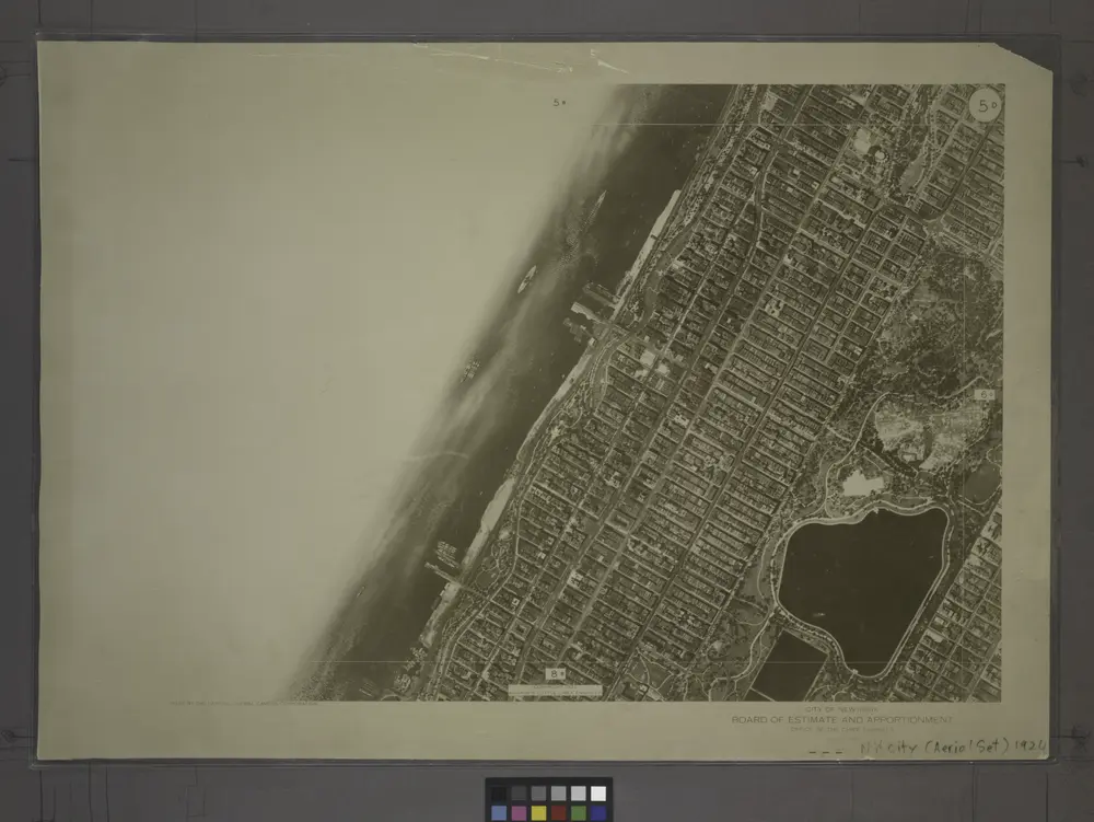
5D - N.Y. City (Aerial Set).
1924
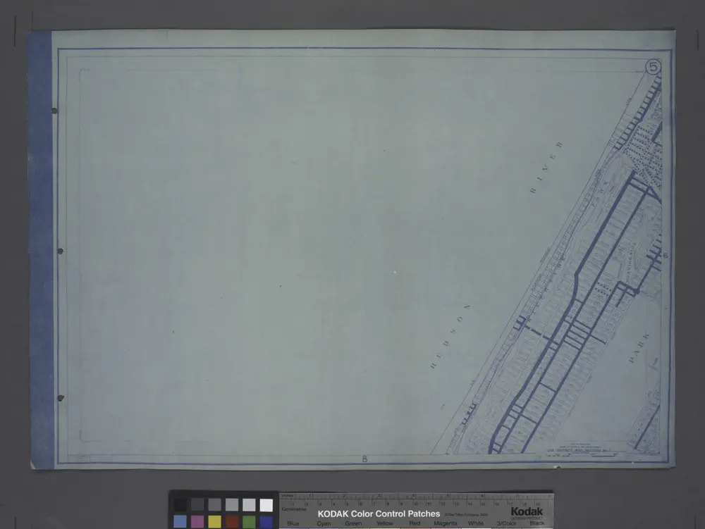
Use District Map Section No. 5
1916
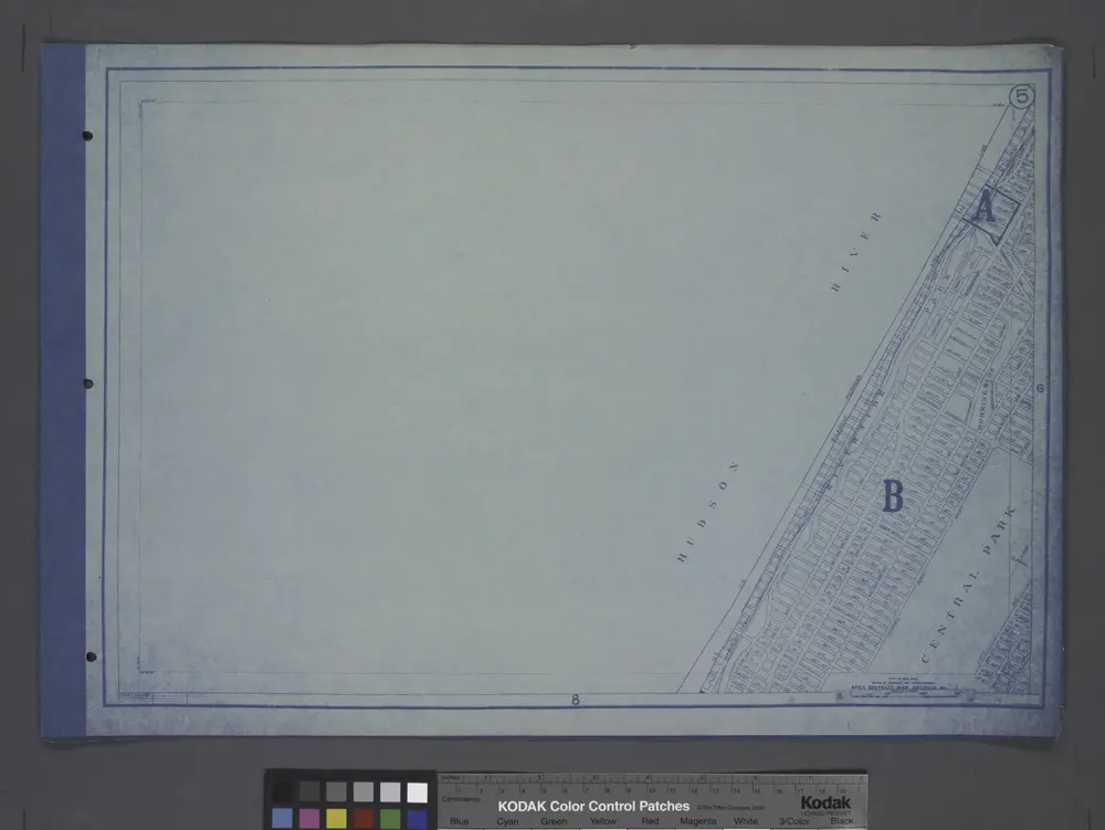
Area District Map Section No. 5
1916
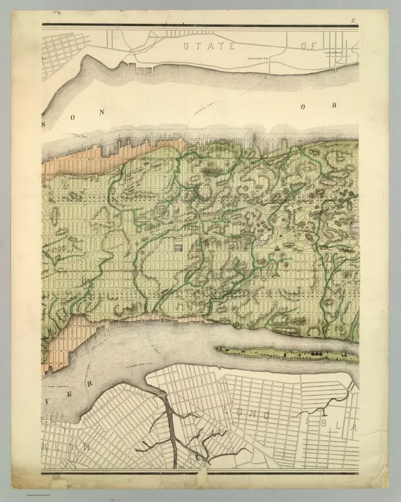
Topographical Atlas Of The City Of New York
1874
Viele, Egbert L.
1:12k
Manhattan, V. 6, Double Page Plate [Map of Hudson River Piers along 12th Ave.]
1892
Topographical map of New York City, County and vicinity: showing old farm lines &c. / based on Randells and other official surveys, drawings and modern surveys by J.F. Harrison & T. Magrane; printed by C. Wadlow.
1854
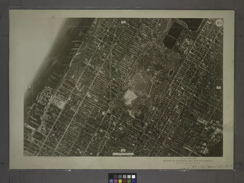
8B - N.Y. City (Aerial Set).
1924
History
الخرائط القديمة لـ West New York, New Jersey
اكتشف ماضي West New York, New Jersey على الخرائط التاريخية
الخرائط القديمة لـ West New York, New Jersey
اكتشف ماضي West New York, New Jersey على الخرائط التاريخية
استكشاف الخرائط
اكتشف التاريخ
المنطقة الأم
مقاطعة هدسون (نيو جيرسي)
الأماكن ذات الصلة