المشروع
المجتمع
الأخبار
تطبيقي
خرائطي
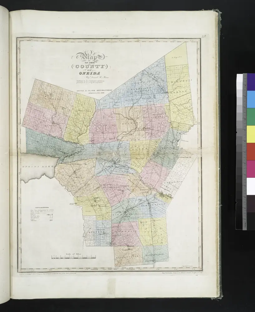
Map of the county of Oneida / by David H. Burr; engd. by Rawdon, Clark & Co., Albany, & Rawdon, Wright & Co., N.Y.; An atlas of the state of New York, designed for the use of engineers, containing a map of the state and of the several counties. / Projected and drawn ... under the superintendence and direction of Simeon de Witt.
1839
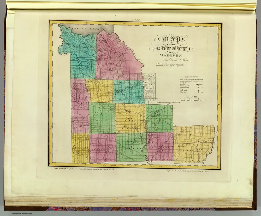
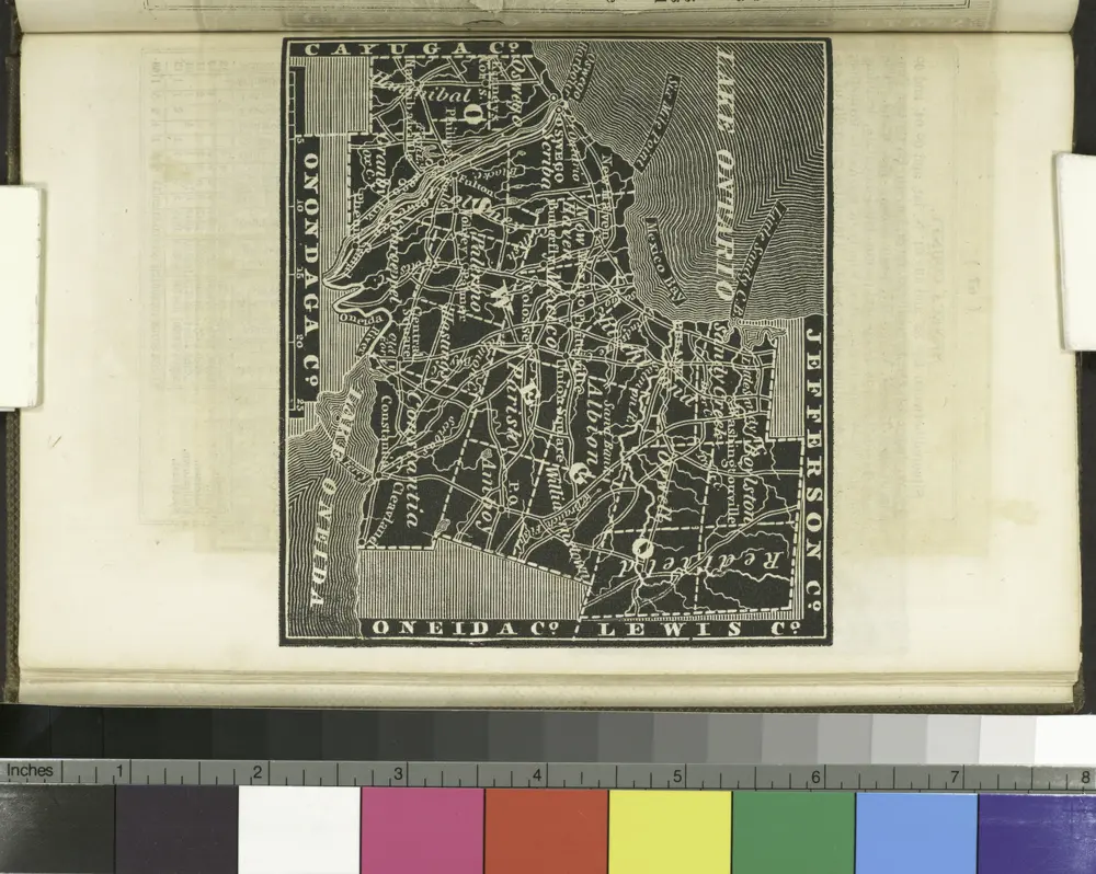
Madison County.
1829
Burr, David H., 1803-1875
1:151k
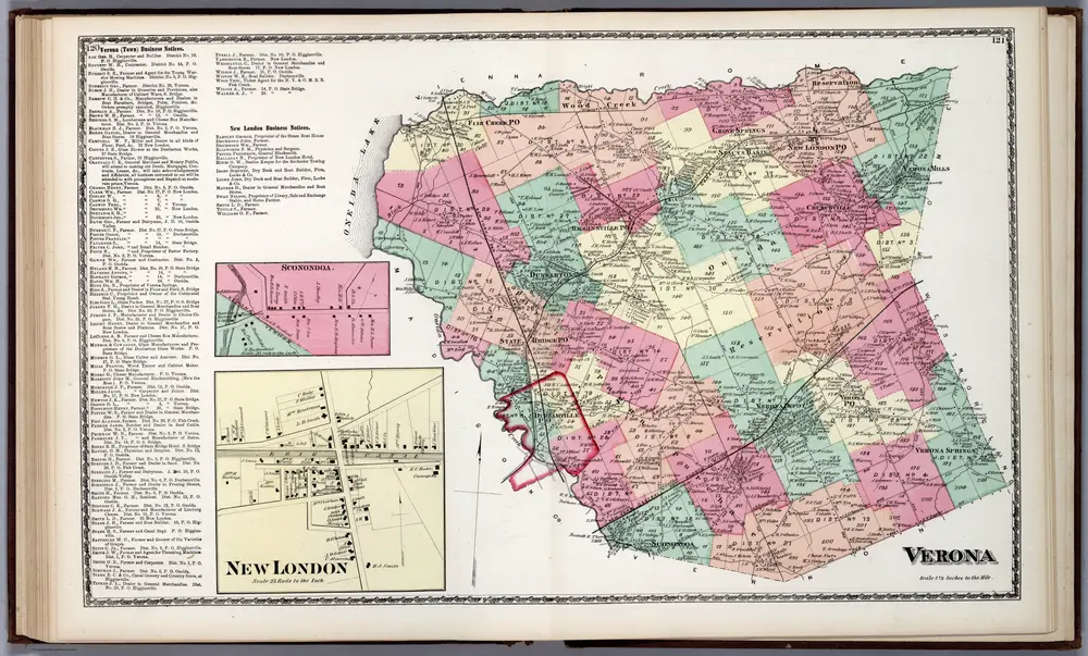
Verona, Oneida County, New York. Sconondoa. New London.
1874
Beers, D.G.
1:42k
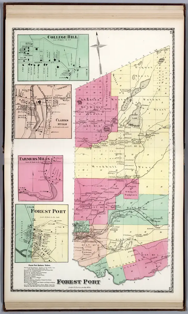
Forest Port, Oneida County, New York. College Hill. Clarks Mills. Farmers Mills. Forest Port.
1874
Beers, D.G.
1:42k
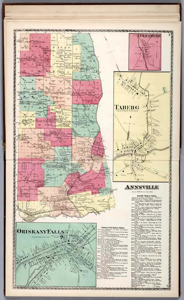
Annsville, Oneida County, New York. Glenmore. Taberg. Oriskany Falls.
1874
Beers, D.G.
1:42k
Oswego County.
1838
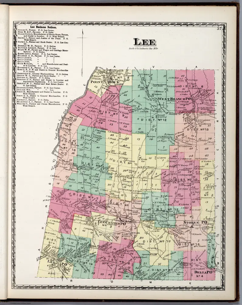
Lee, Oneida County, New York.
1874
Beers, D.G.
1:42k
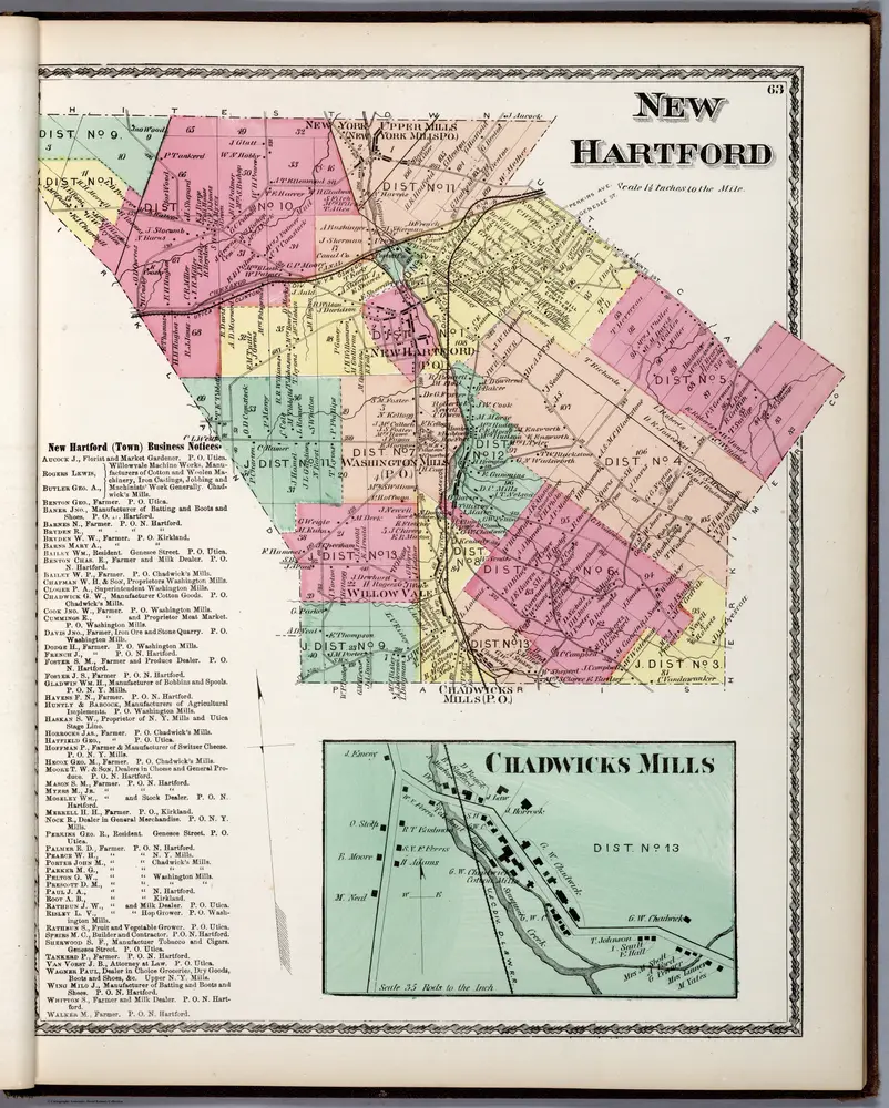
New Hartford, Oneida County, New York. Chadwicks Mills.
1874
Beers, D.G.
1:42k
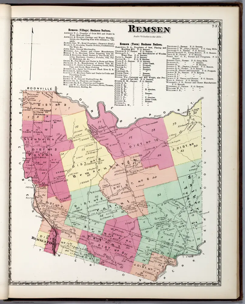
Remsen, Oneida County, New York.
1874
Beers, D.G.
1:42k
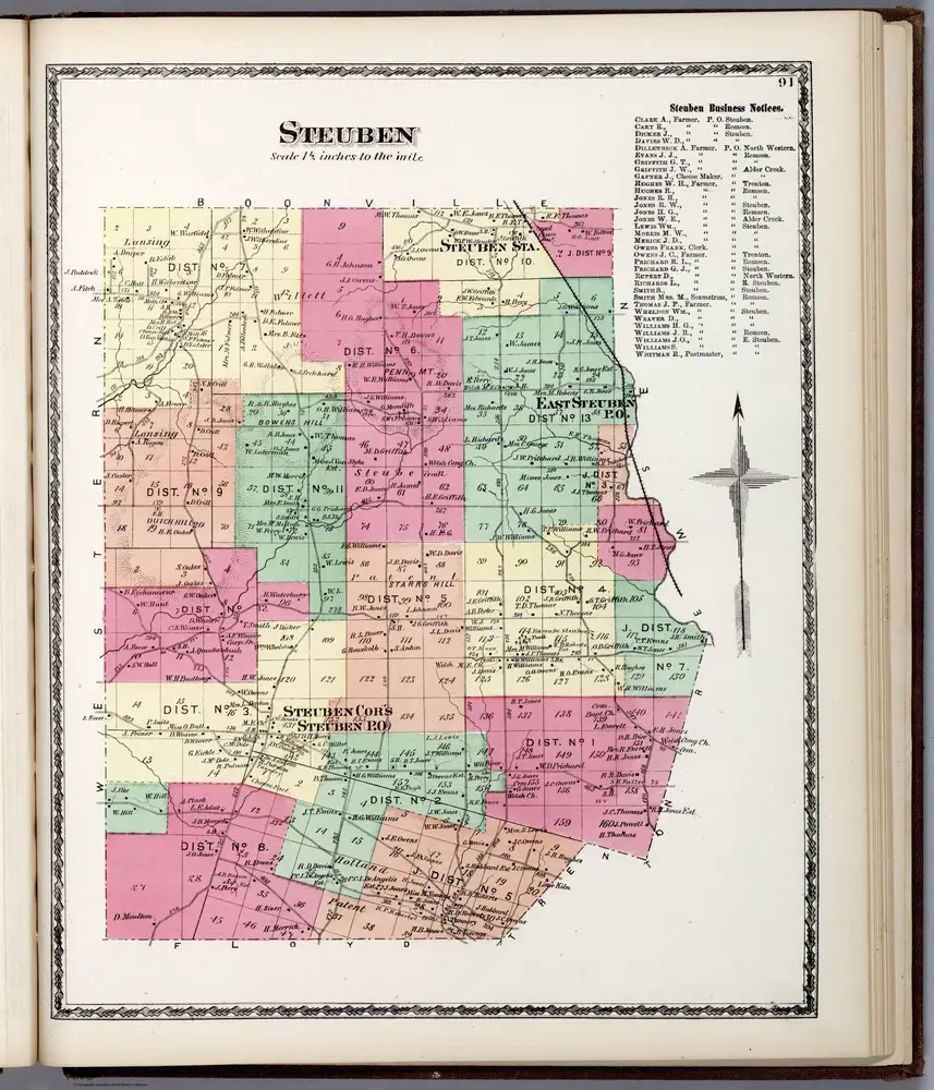
Steuben, Oneida County, New York.
1874
Beers, D.G.
1:42k
Historia
الخرائط القديمة لـ Oneida County, New York
اكتشف ماضي Oneida County, New York على الخرائط التاريخية
الخرائط القديمة لـ Oneida County, New York
اكتشف ماضي Oneida County, New York على الخرائط التاريخية
استكشاف الخرائط
اكتشف التاريخ
المنطقة الأم
الأماكن ذات الصلة
المدينة
أوتيكا (نيويورك)
المدينة
كلارك ميلس (نيويورك)
المقاطعة
مارشال (نيويورك)