المشروع
المجتمع
الأخبار
تطبيقي
خرائطي
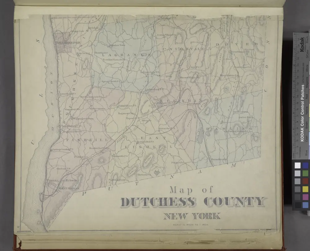
Map of Dutchess County New York
1876
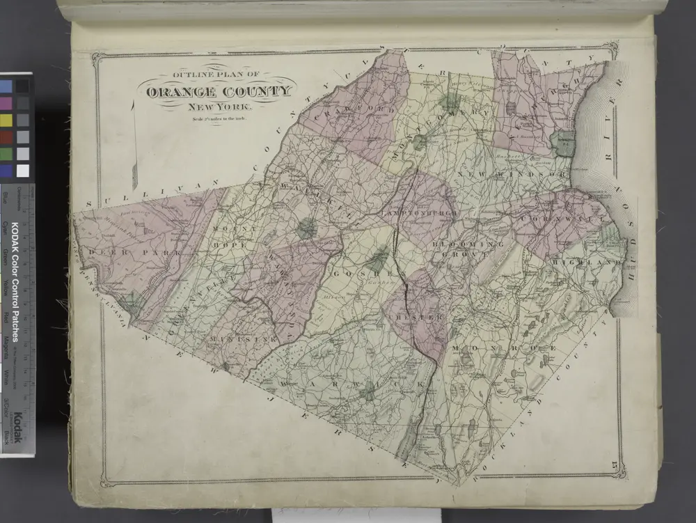
Outline Plan of Orange County New York.
1875
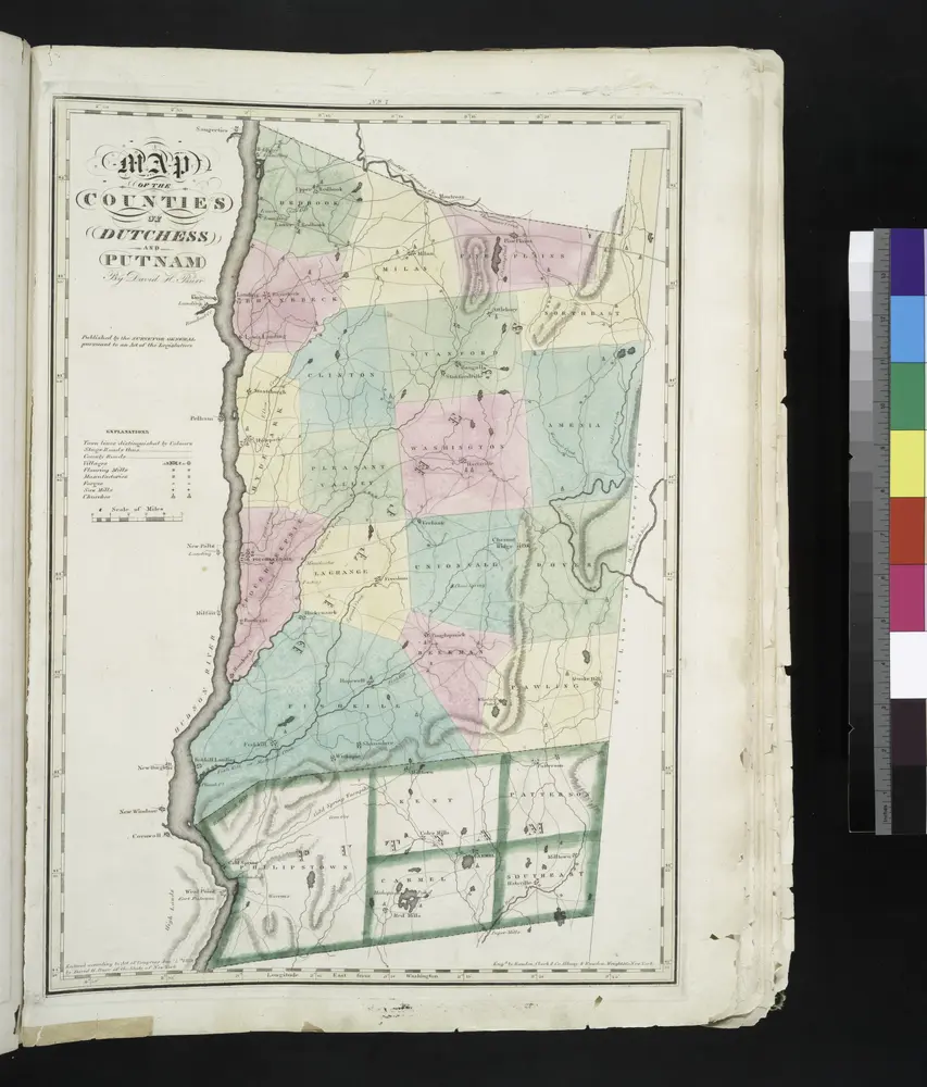
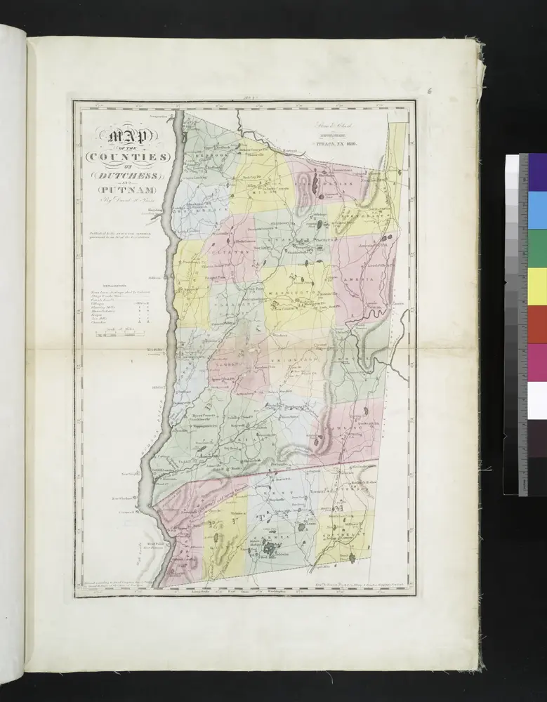
Map of the counties of Dutchess and Putnam / by David H. Burr ; engd. by Rawdon, Clark & Co., Albany, & Rawdon, Wright & Co., New York.
1829
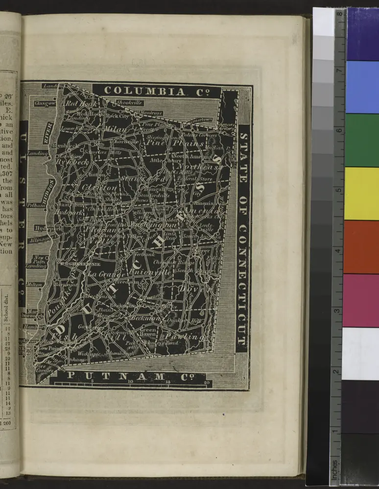
[Dutchess County].
1838
Map of the county of Ulster / by David H. Burr ; engd. by Rawdon, Clark & Co., Albany, & Rawdon, Wright & Co., New York.
1829
Map of the counties of Dutchess and Putnam / by David H. Burr ; engd. by Rawdon, Clark & Co., Albany, & Rawdon, Wright & Co., New York.
1829
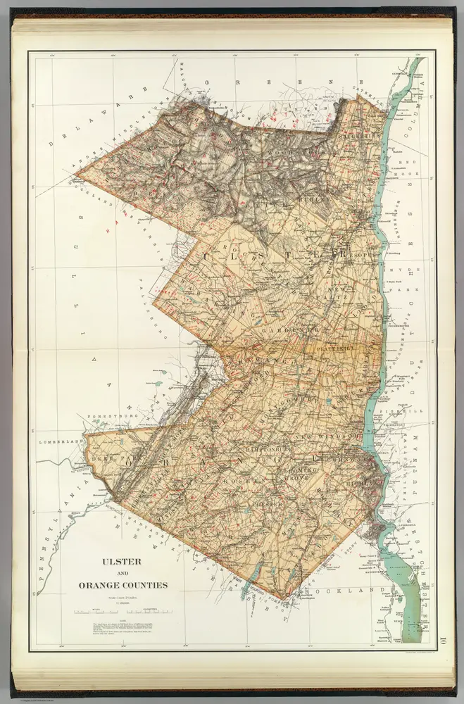
Ulster, Orange counties.
1895
Bien, Joseph Rudolf
1:158k
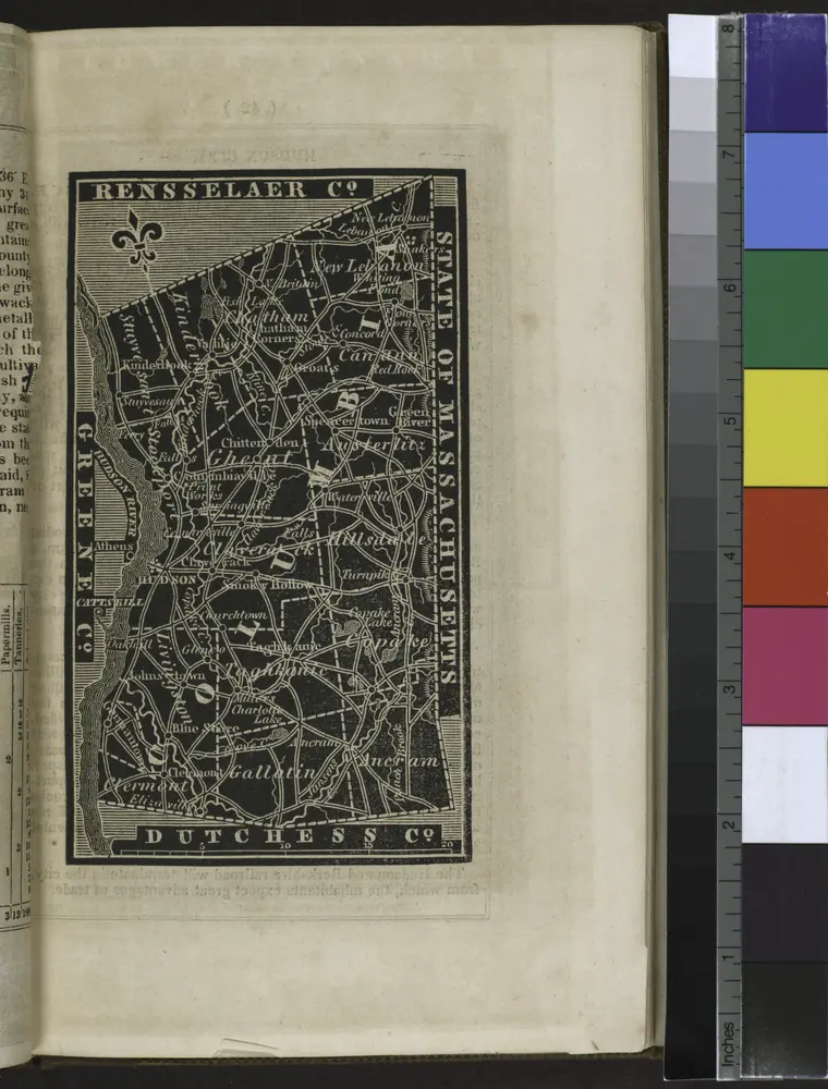
[Columbia County].
1838
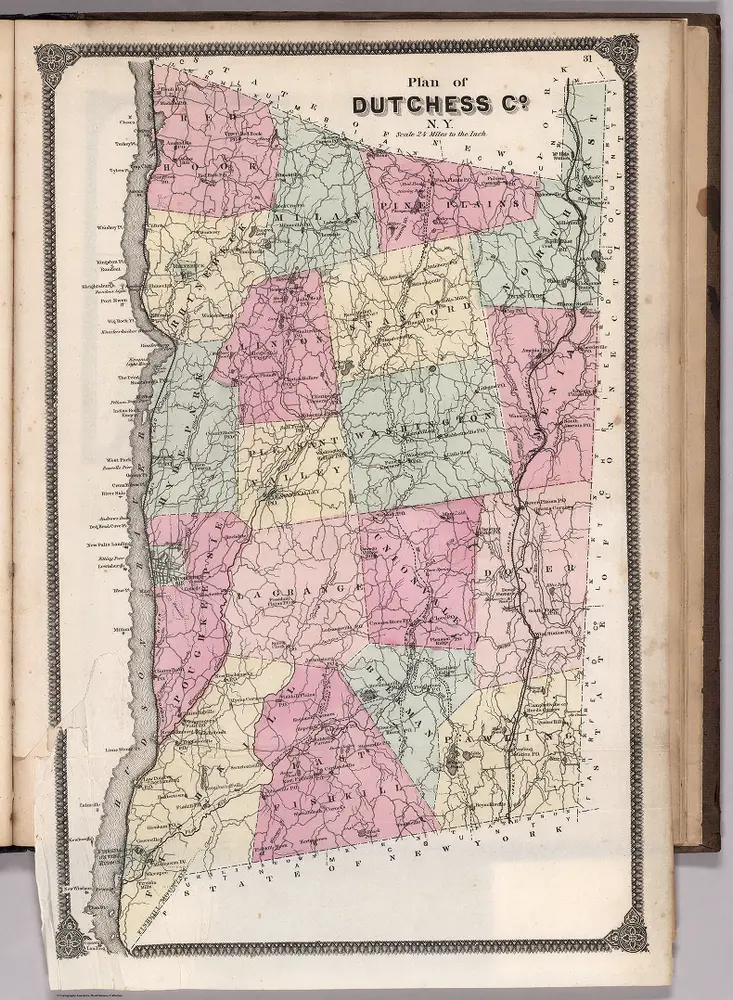
Plan of Dutchess County, New York.
1867
Beers, Frederick W.
1:135k
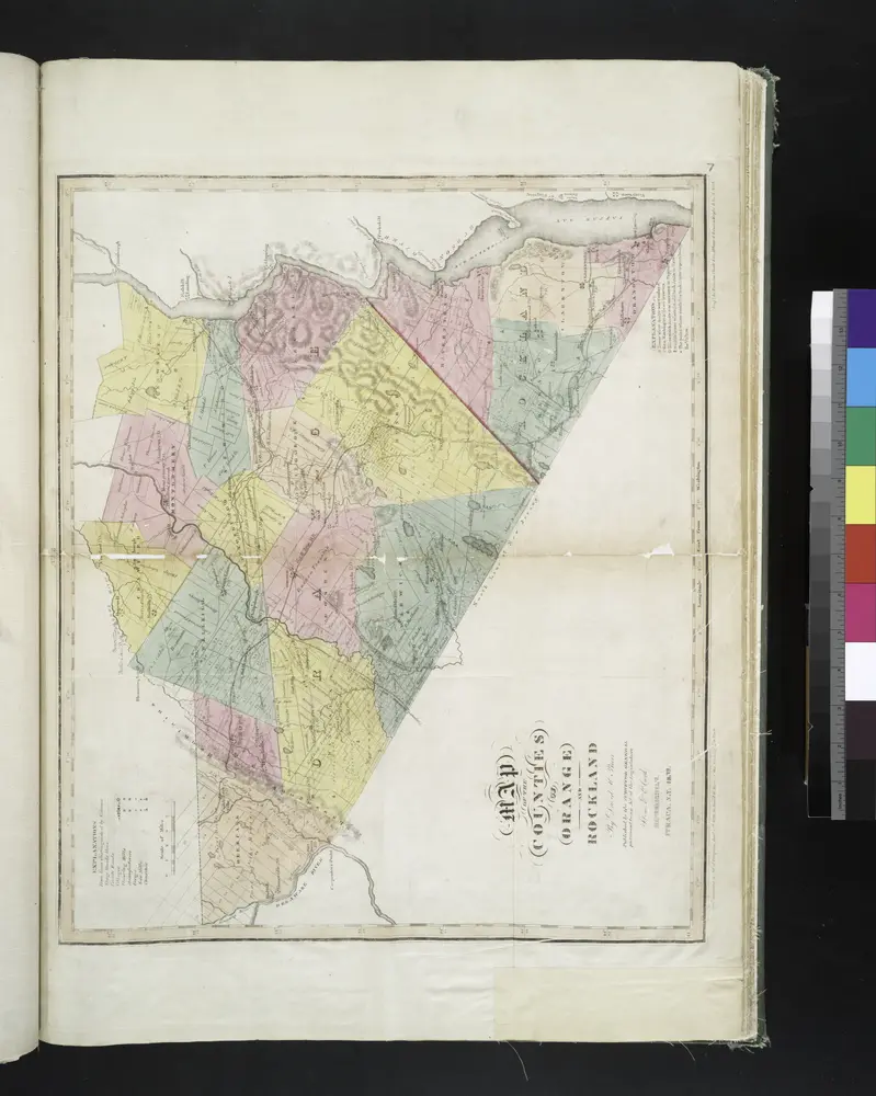
Map of the counties of Orange and Rockland / by David H. Burr ; engd. by Rawdon, Clark & Co., Albany, & Rawdon, Wright & Co., N. York.
1829
Geschiedenis
الخرائط القديمة لـ Clintondale, New York
اكتشف ماضي Clintondale, New York على الخرائط التاريخية
الخرائط القديمة لـ Clintondale, New York
اكتشف ماضي Clintondale, New York على الخرائط التاريخية
استكشاف الخرائط
اكتشف التاريخ
المنطقة الأم
مقاطعة أولستر (نيويورك)
الأماكن ذات الصلة